displaying 3263 results

Speakers at the upcoming Geodesign Summit will tackle questions such as how geodesign can solve the 21st century's most pressing problems.

Electronic navigation charts (ENCs) created using ArcGIS guide a growing number of commercial vessels up and down the Changjiang River in China.

Snowplow operations are much more efficient thanks to an automatic vehicle location (AVL) system that uses Esri ArcGIS...
Read how some major organizations, that presented at the Esri User Conference, use GIS in a big way.

Beaufort County School District is located south of Charleston, SC, and serves all students within the county, an area that encompasses over 900…
Whether you are an ArcGIS Online subscriber or an ArcGIS Hub user, you can launch an open data site.
Taylor Shellfish Farms of Shelton, Washington, takes The Science of Where to the tidal flats of Puget Sound to sustainably produce...
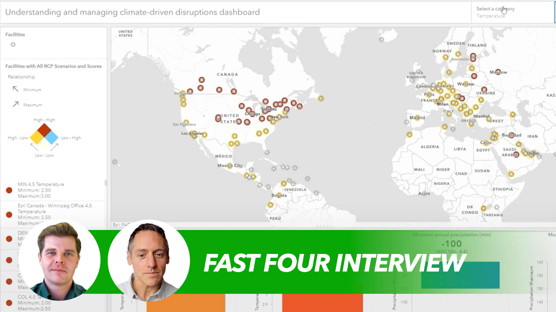
Resilience is an expanding imperative in the climate era—leading companies are embracing the new paradigm and seizing opportunities.
As a GIS manager, you must figure out how to prepare your team to leverage new tools and capabilities as the technology evolves. Helping your pe…

GCOOS uses GIS technology to manage on-demand, accurate, and reliable data essential for environmental monitoring and disaster response.

A GIS team created the Integrated Spatial Information System of the Palestine Ministry of Local Government to manage urban development.

Geospatial technologies—especially GIS—are critical to rapidly documenting and formalizing land rights in Angola/