displaying 4854 results

The City of Austin, Texas, developed a comprehensive plan to migrate to ArcGIS Pro.

The United States Border Patrol is using GIS to improve its search and rescue (SAR) operations for migrants in distress.

Ensuring women have the right to own land could lift millions of people out of hunger and reduce rural poverty,

National Geospatial Data Assets (NGDA) and Infutor geocoding now available in ArcGIS to improve geographic knowledge.
Esri joined Digital Twin Consortium, Esri certified SAP HANA Cloud, Esri committed to accessibility standards;
The world has run up against the hard truth that the world is a very interconnected place. Table of contents for this issue.
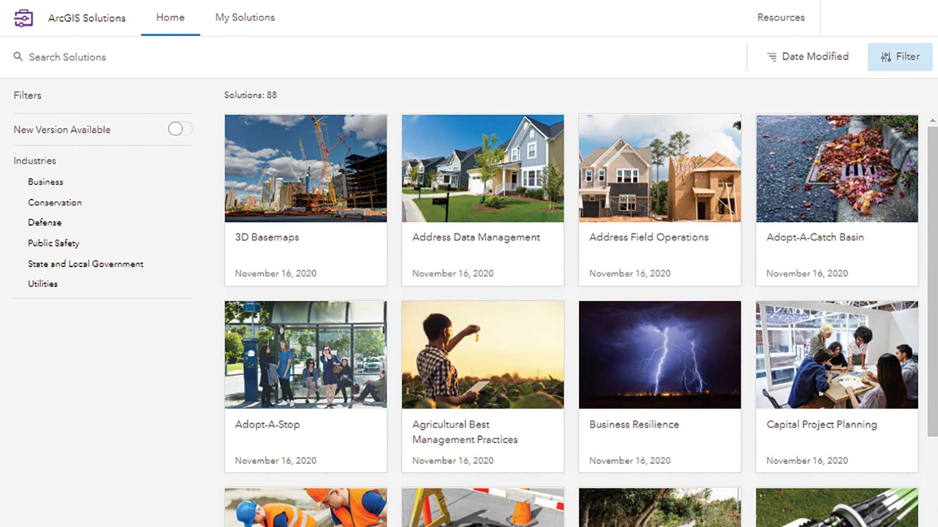
Esri added a new way to quickly deploy ArcGIS Solutions to your organization—the ArcGIS Solutions app.
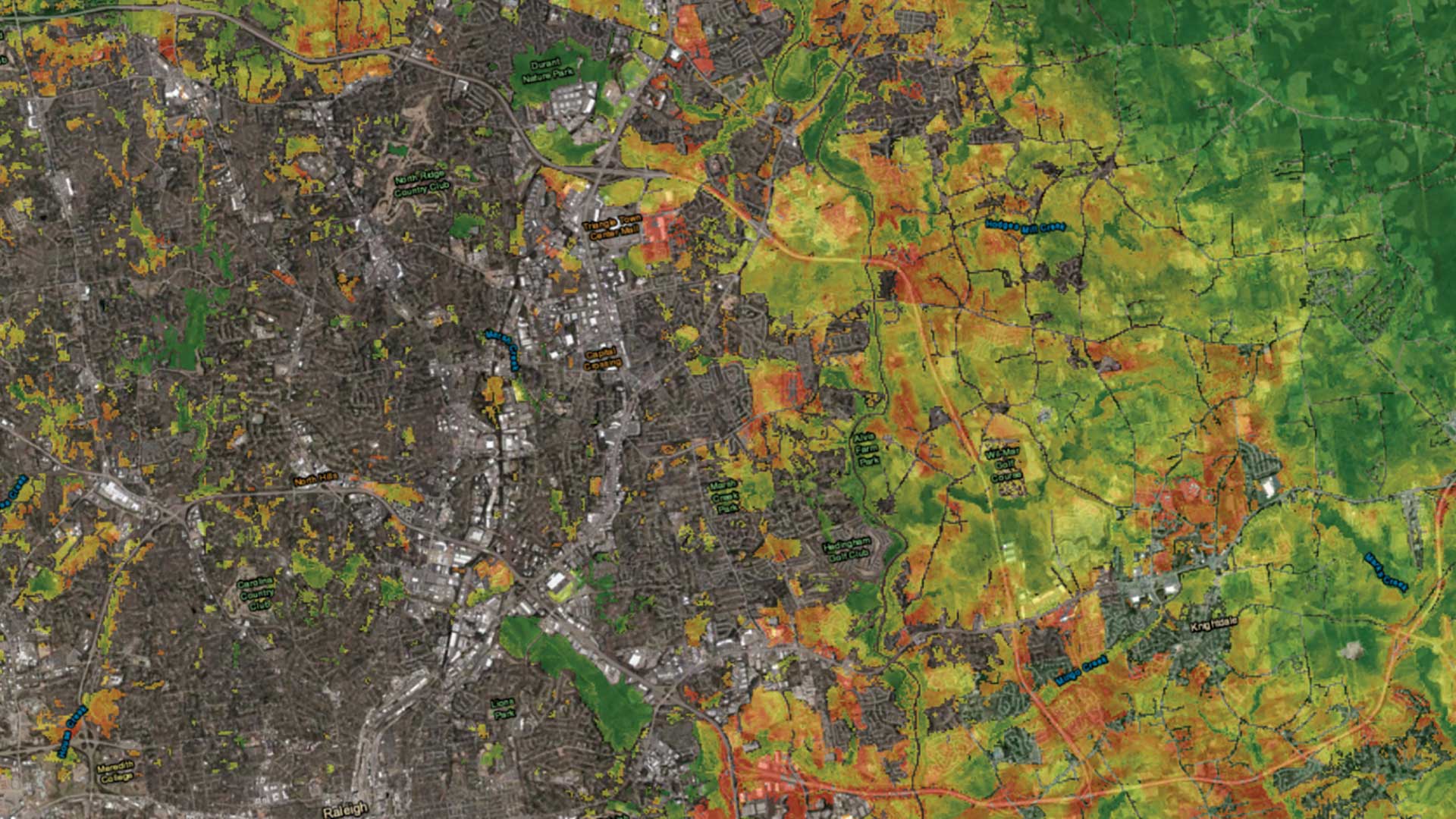
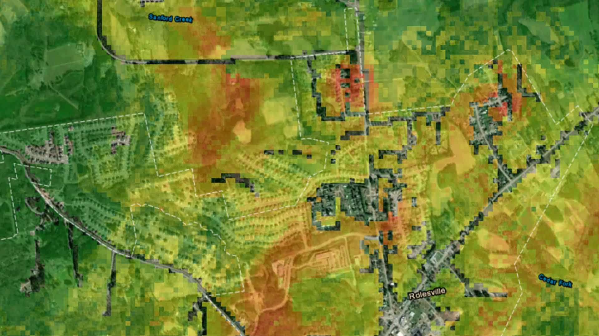
An urban growth prediction model empowers city planners and other to make informed urban policy decisions.

Geospatial infrastructure empowers everyone to be an intrapreneur.

The real-time data sharing, analysis, visualization, and planning capabilities will be key to equitable and speedy vaccine distribution.

A Wisconsin county used GIS to identify and educate citizens to recycle correctly.

ArcGIS Runtime SDKs 100.7 expands capabilities for utilities, defense, and public safety.