displaying 4700 results

New content was just added to the World Topographic Map, which is seen by more than one million viewers daily.

States are set to receive funds to repair aging infrastructure, and Virginia is ready with a detailed list of priority projects.

The Trust for Public Land partners with cities nationwide to transform vacant land into parks, always factoring in equity.

The HMI is designed to reflect overall builder confidence in the housing market, and can be used to plan with geography in mind.
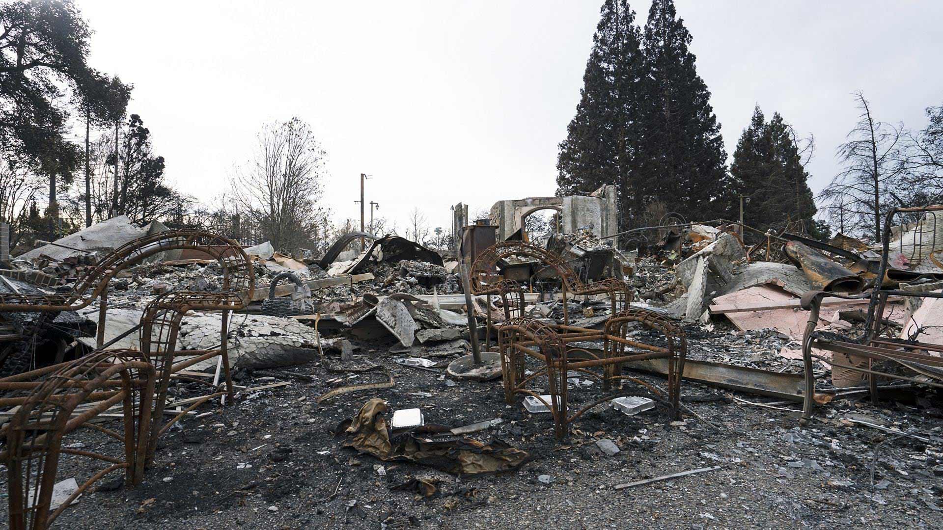
These GeoAI models available in ArcGIS Living Atlas of the World are designed for damage assessment during disaster events.


The technology for applying the geographic approach—GIS—is expanding our world.
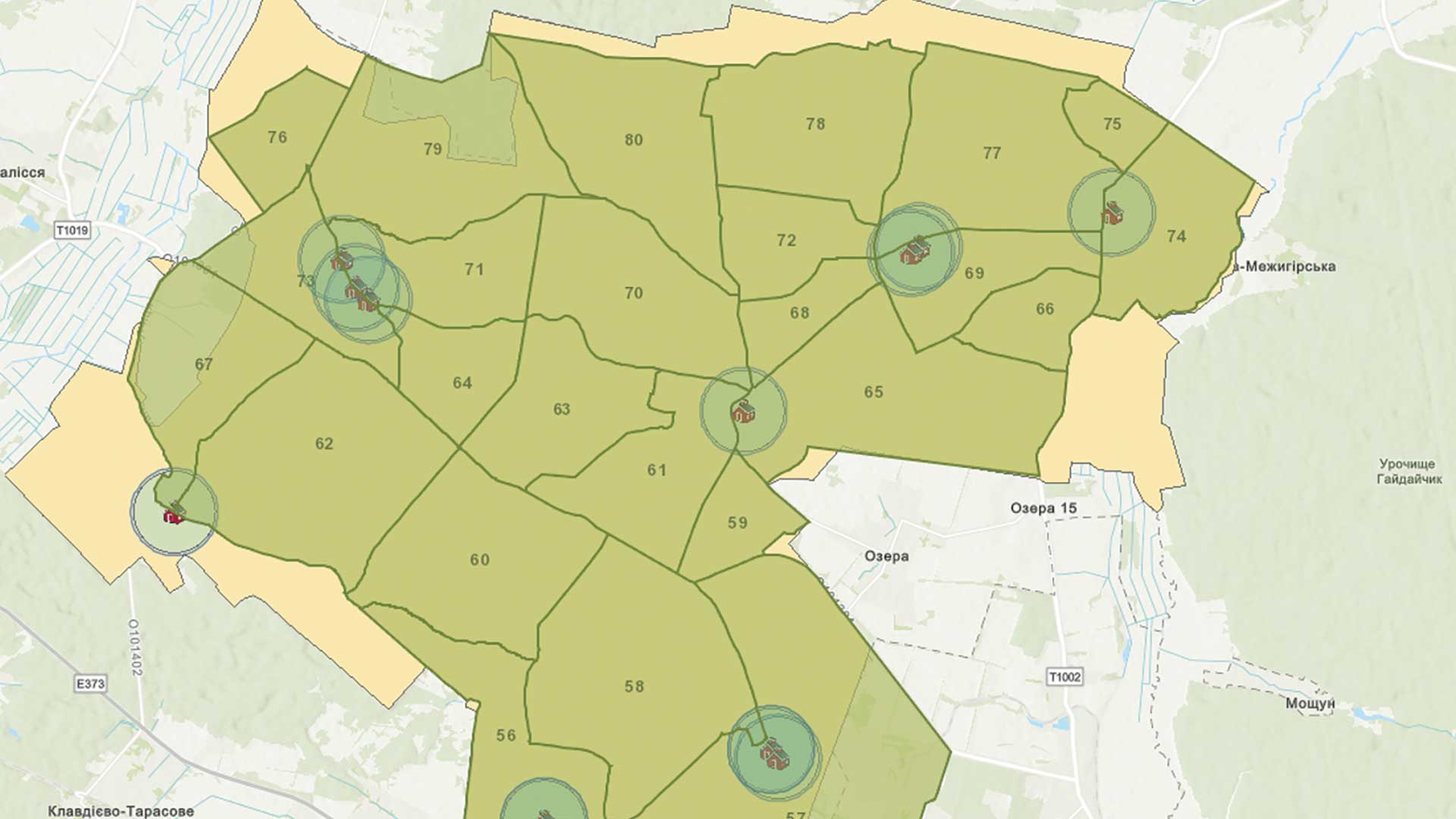
GIS is being used to meet the tremendous challenge of rebuilding Ukrainian infrastructure.

Orange County, California, has one of the most innovative local government GIS implementations.

The GIS for Science series, published by Esri Press, illustrates how GIS is being applied to scientific research.

Chatham County, North Carolina, created an all-in-one solution for its tax department’s recent real property tax reappraisal process using GIS.

Sid Pandey shares tips on taking charge of your career and raise your profile.