displaying 3148 results

The HMI is designed to reflect overall builder confidence in the housing market, and can be used to plan with geography in mind.

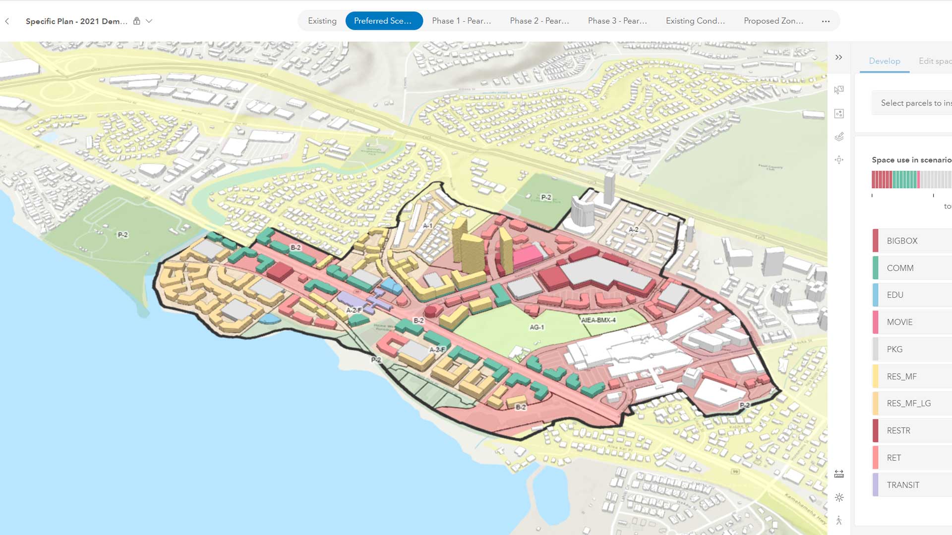
Texas city uses ArcGIS Urban to intelligently guide its development.

Economic mobility begins with affordable housing and affordable housing begins with zoning reform.

One of the most damaging and lasting economic impacts of the COVID-19 pandemic has been the increase of unused and vacated office space.

GIS plays a critical role in the zoning reform needed to deal with the housing shortage.

Eva Pereira, the city’s chief data officer, talks about how the City of Los Angeles is using open data.
The emergence of web-based GIS has evolved the role of planners.

Unlock the troves of valuable data kept in Microsoft Excel spreadsheets and add it to ArcGIS Pro easily.

Configure banners for your ArcGIS Online site to make sure users of your site get important messages.

Use this simple process to retire outdated items on your ArcGIS Online site when they have been made obsolete by new items.

Self-service government uses GIS to deliver services more efficiently.

Esri vector basemaps are optimized to quickly generate and update maps and apps.