displaying 2991 results
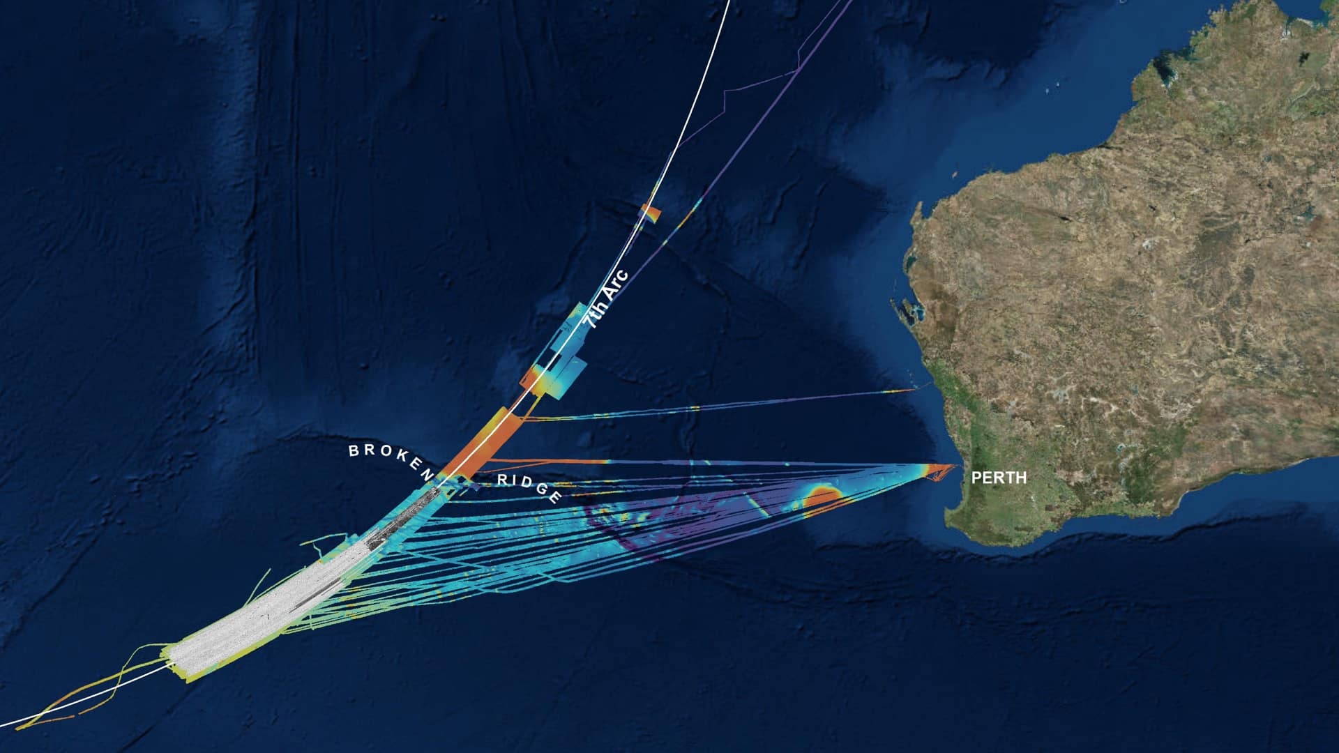
Geoscience Australia deployed location technology to search methodically for the missing Malaysia Airlines flight MH370 aircraft.
Increasingly powerful and insightful maps drive improvements in awareness, collaboration, and understanding.
Location intelligence helps deliver civil legal aid to the most vulnerable populations.

The city of New Bern, North Carolina used GIS to turn around their ownership of derelict properties—powering parcel mapping, planning, and sales.
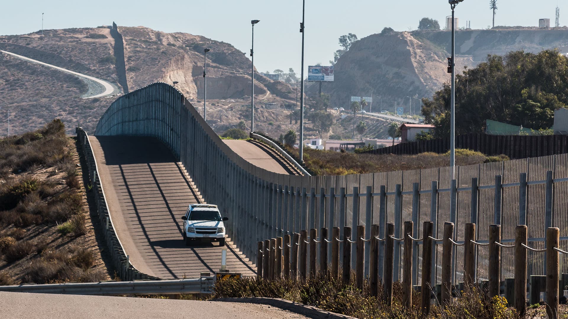
The USA Today Network deployed cutting-edge mapping technology to present the implications of a border wall along the US-Mexico border.

Theoretical physicist Geoffrey West believes in the power of geography to integrate city information for improved understanding.

GIS shines in the complex parks assessment of America's most populous county.
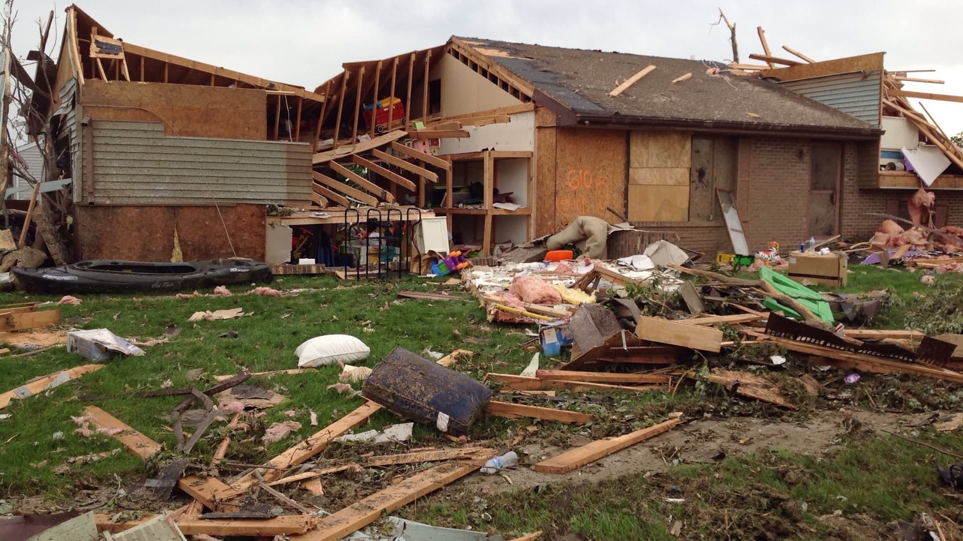
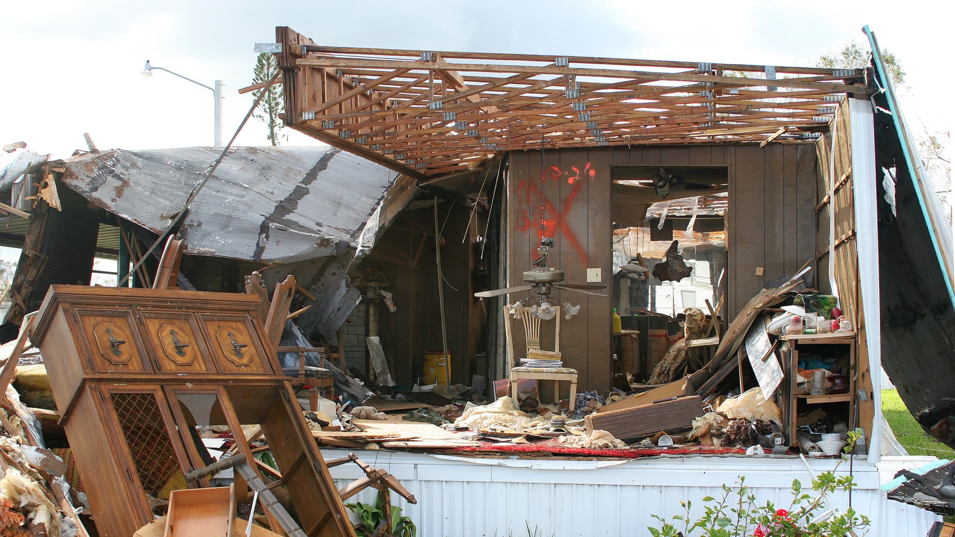
A speedy response after a tornado comforts the victims. Handheld apps ease their burden best.
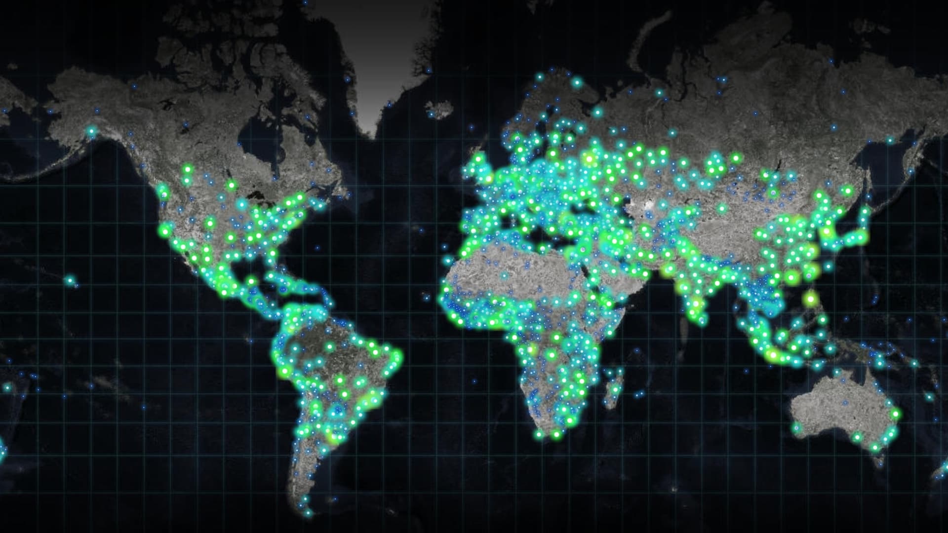
Humans have never been more connected, and our modern maps are a key connector.

The power of GIS rises from the unique way it connects seemingly unrelated information through location.
Protect your internal proprietary data by keeping it local—on your organization’s network—using Data Appliance for ArcGIS.
Irish Water is using GIS to complete a project to repair or replace leaking water pipes in Ireland.