displaying 3264 results
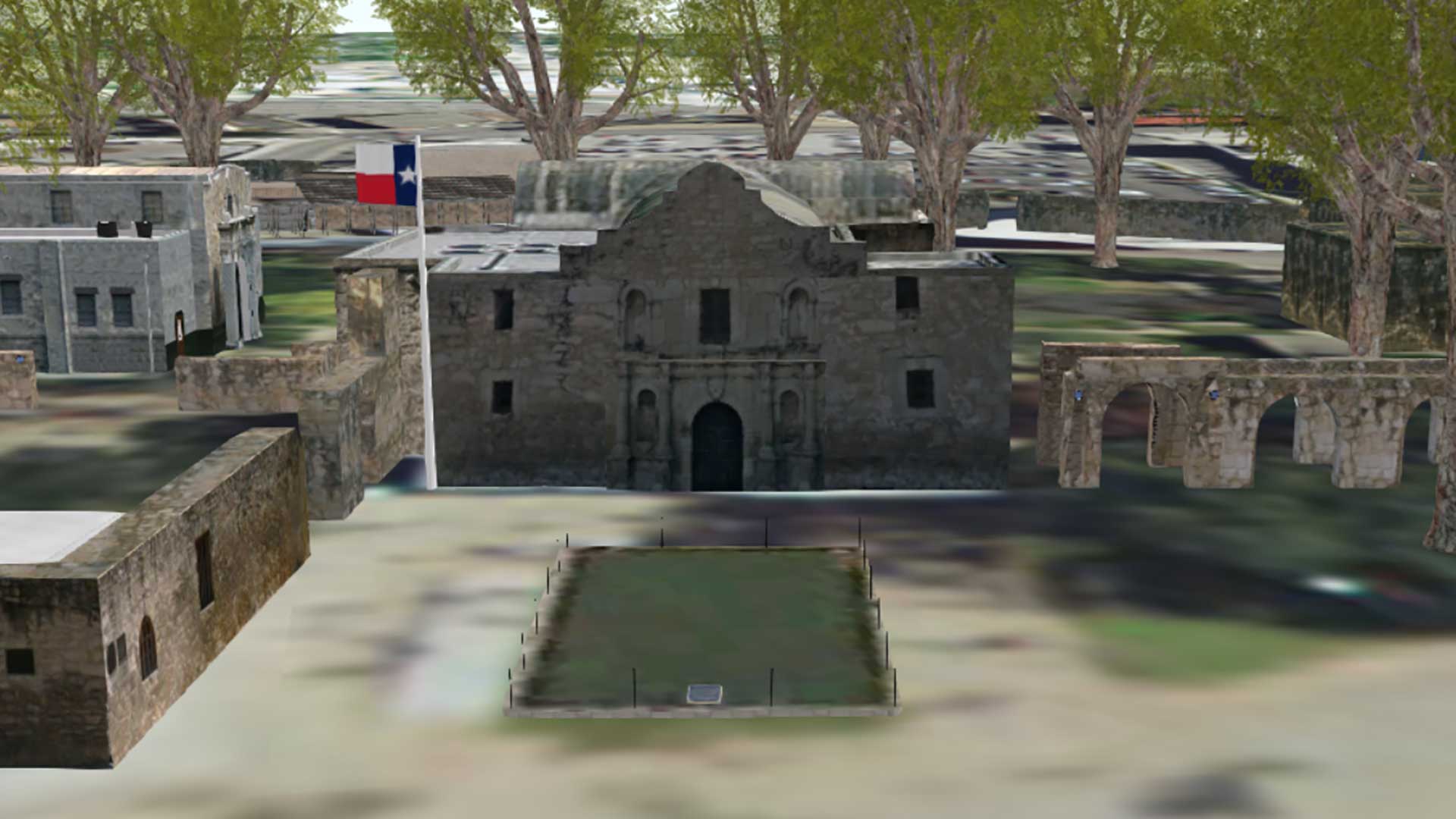
Engineers restoring the original site of the battle of the Alamo are using 3D GIS visualization of historic site.
GIS can integrate with corporate IT systems using the common thread of geography resulting in location intelligence.

According to Forrester, "Esri is pushing beyond the traditional GIS markets that it has long dominated into the location intelligence market."

Citizen Science GIS makes science more understandable and ensures society benefits from scientific discoveries.

Over the years, GIS has grown to cover a very broad horizon. It’s no longer the domain of specialized departments; instead, it has become deeply…
Esri invites developers to build, test, and push the boundaries of geo-enabling applications with a new plan that gives them free subscriptions…
Until recently, it was not easy to reproject a digital elevation model (DEM) from geographic coordinates to another coordinate system without in…
Attribute Assistant is an add-in that uses a series of predefined methods to automatically populate attributes when updating or adding new featu…
Spatial Mathematics: Theory and Practice through Mapping by Sandra Lach Arlinghaus and Joseph J. Kerski the book‘s premise is that mapping can b…
It’s not every day that a musician inspires a mapmaker. But that’s exactly what happened at the 2013 Esri International User Conference (Esri U…
Nadika Senadheera’s job as a GIS consultant takes her to places where death may be next door.
Local governments strapped for funds can take a hyperlocal approach to funding community projects using a new GIS-based application. ZenFunder i…