displaying 3148 results

Horry County, South Carolina, uses Insights for ArcGIS to analyze trends and make predictions.

With advanced geospatial technology, Colorado agencies can identify snowslides before they happen.

Though Nadika Senadheera sometimes ventures to dangerous places, her passion for GIS and feeding the hungry keeps her on the front lines...
Mapping will be front and center during 4H National Youth Science Day on October 9, 2013.
Esri is gearing up to host major regional user conferences in Lima, Peru, and Munich, Germany.

How did you celebrate GIS Day? Your peers report how the projects they pursued.
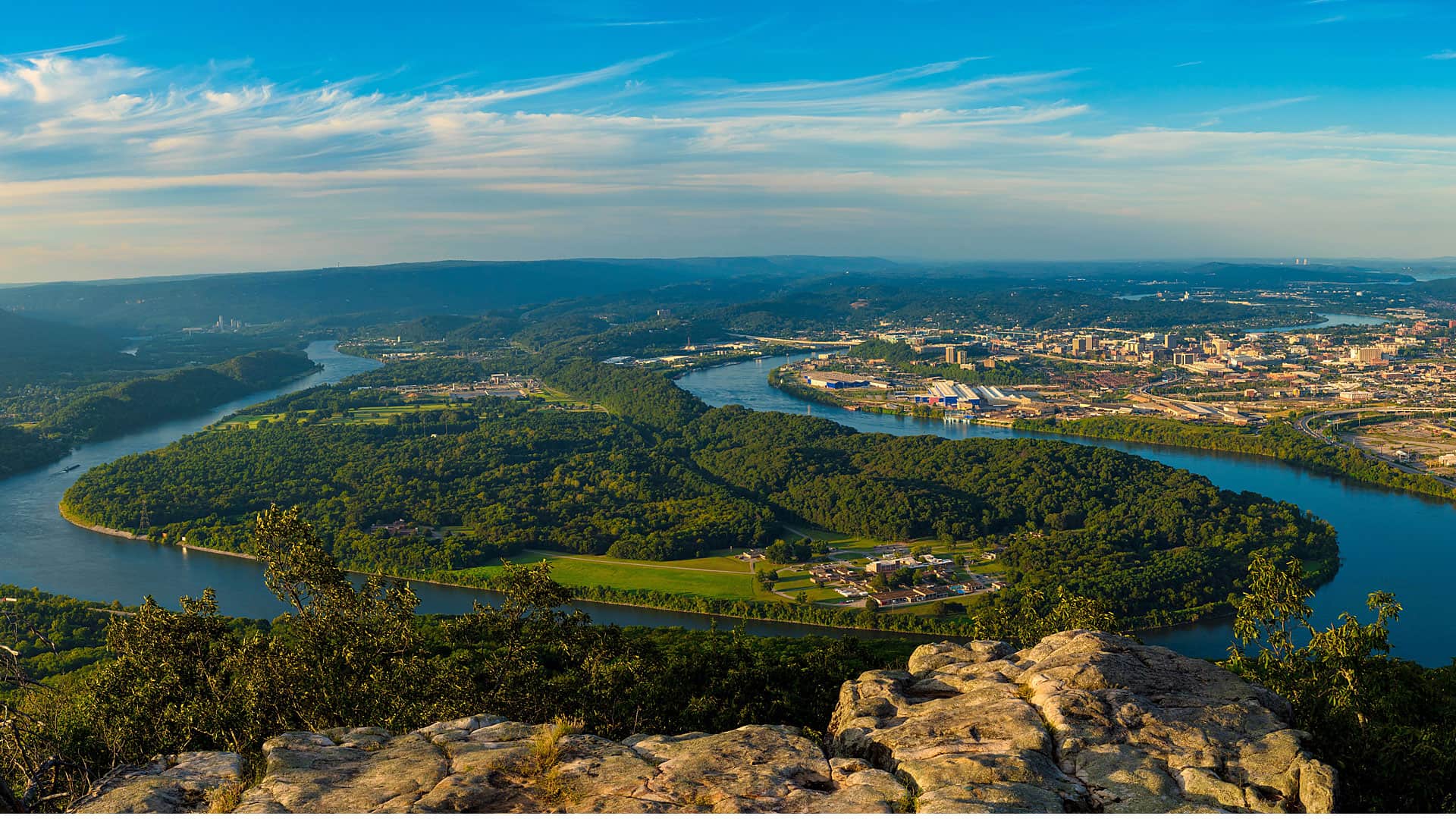
Thrive Regional Partnership is using geodesign technology and methodology to plan smartly and sustainably.
Recording artist will.i.am is into much more than music: the founder of the Black Eyed Peas calls himself a “tech enthusiast” .
In the new frontier of real-time GIS, Esri's ArcGIS GeoEvent Processor for Server ingests data streaming in from sources such as...
Data feeds for your GIS go real time. Maps in your tablets and smartphones go offline.
Len Bundra, from Toms River Municipal Utilities Authority (TRMUA), built an online map that became a go-to information source for homeowners.

The South Carolina Air National Guard quickly processed satellite imagery after Hurricane Irene by using GeoImaging Tools for ArcGIS...