displaying 3013 results

As workers return to the office, companies are using indoor location intelligence to optimize the postpandemic workplace.
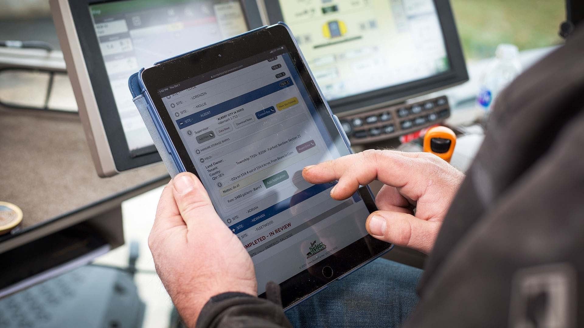
The nation’s fourth-largest pork producer relied on strong business–IT collaboration to implement a precision-agriculture app.

A smart workplace begins with awareness—of assets, conditions, people, and performance. It gets smarter at each stage of maturity.

Local governments are now seamlessly merging operations management and spatial analytics.
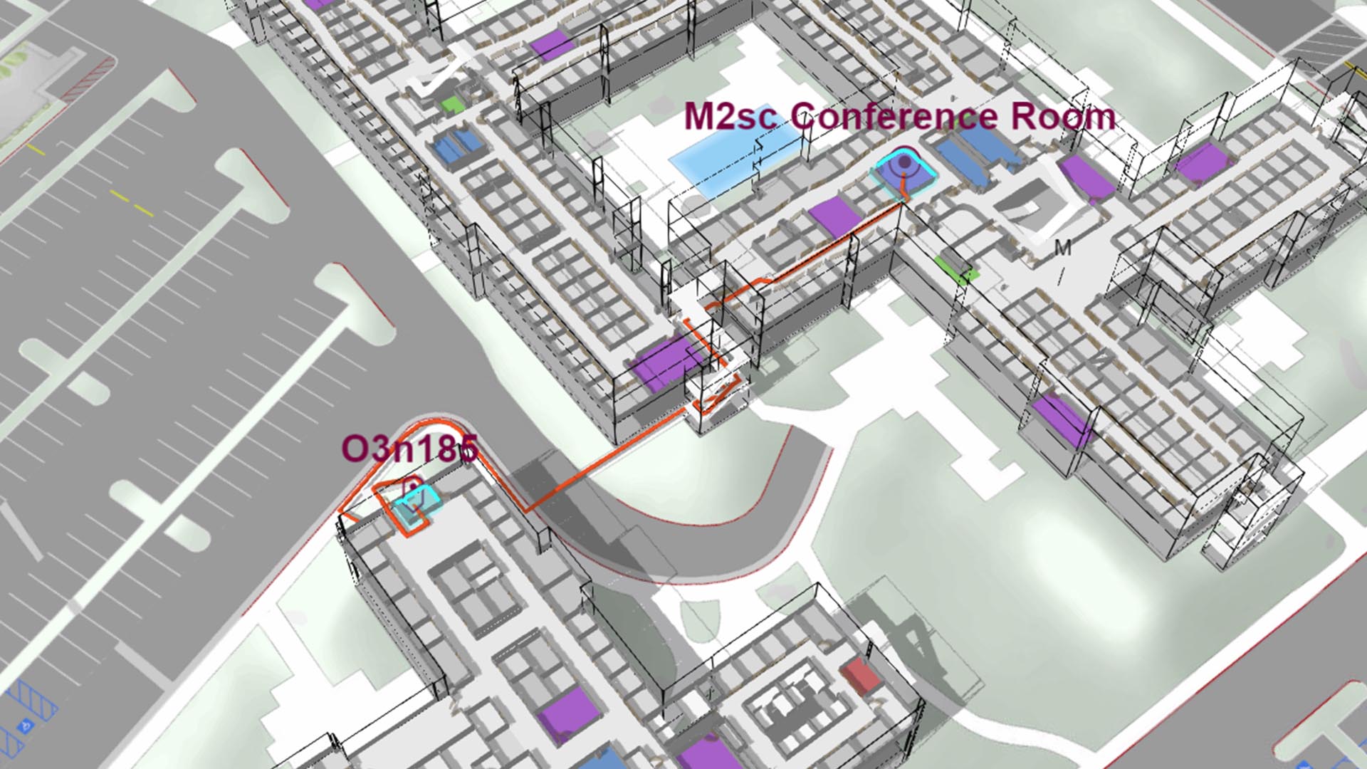
Advanced technologies are delivering convenience to employees of smart workplaces—and bottom-line benefits to their employers.

Geospatial apps provide a framework for black rhino conservation, leading to successful population management of this endangered species.
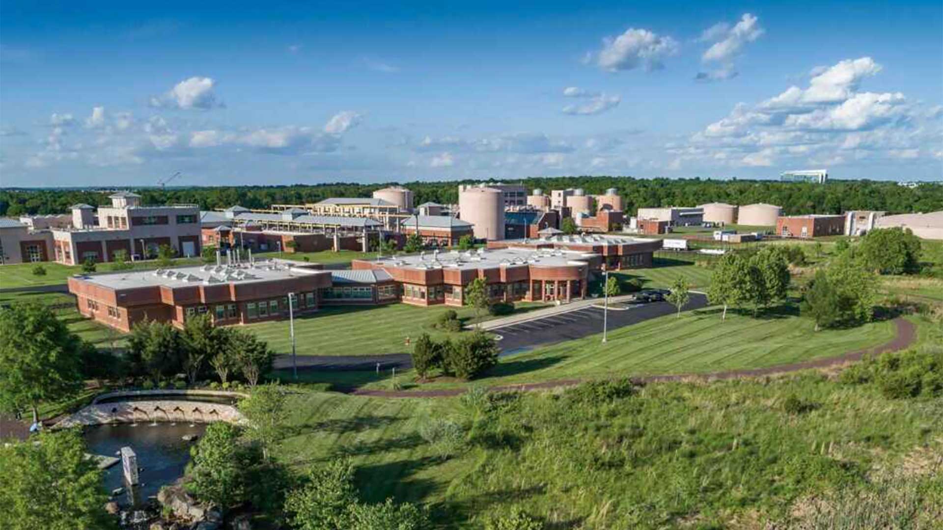
HRSD rolls together GIS, BIM, and business intelligence for a contextual awareness of asset management, capital planning, and system performance.
My ArcUser tutorials on mapping and analytical tasks, often related to natural resources or public safety, always give step-by-step instructions…

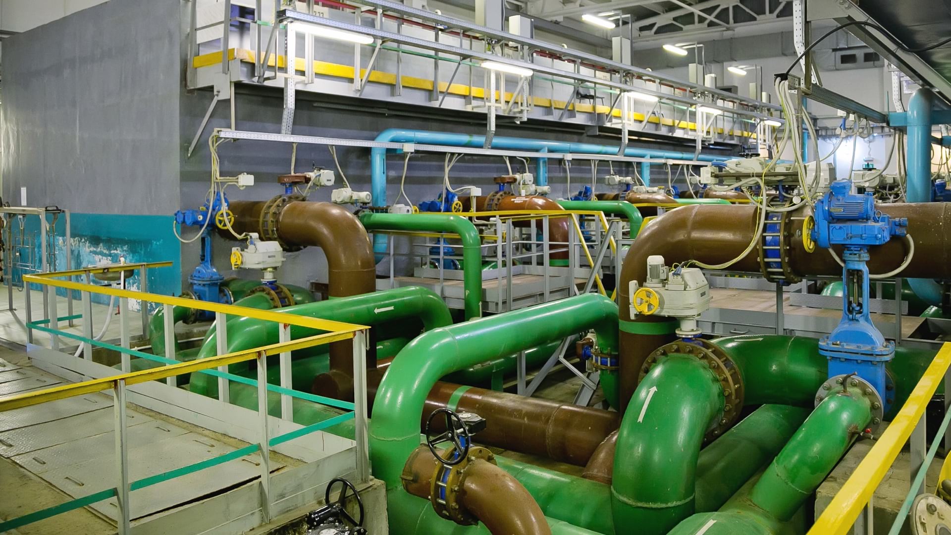
A water district created an app to improve its capital improvement plan (CIP) to better understand and control costs and operate efficiently.
Orange County, California, has one of the most innovative local government GIS implementations.
A Virginia utility company implemented a cloud-based solution designed to simplify the challenges of Esri-SAP integration.
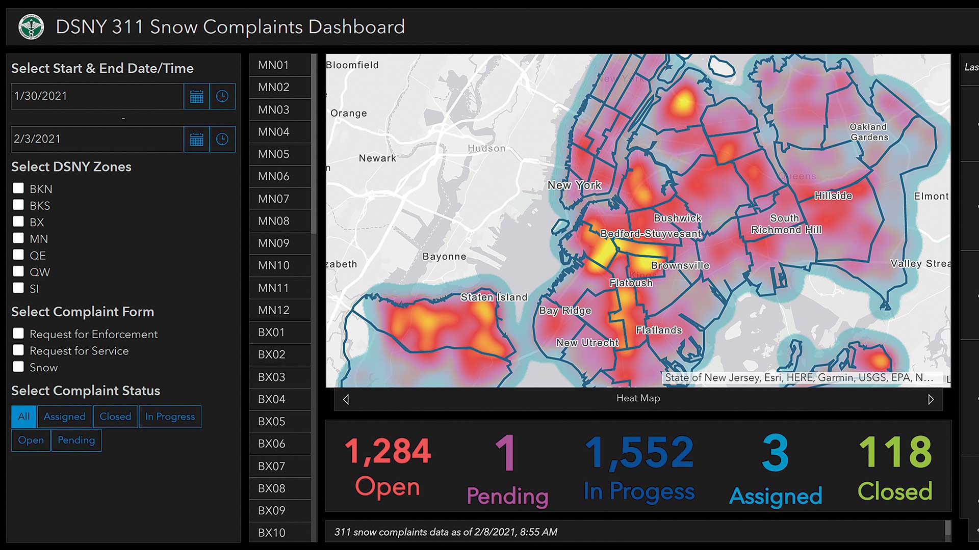
The City of New York employs GIS and live feeds to provide near real-time situational awareness to manage snow removal activities.