displaying 283 results
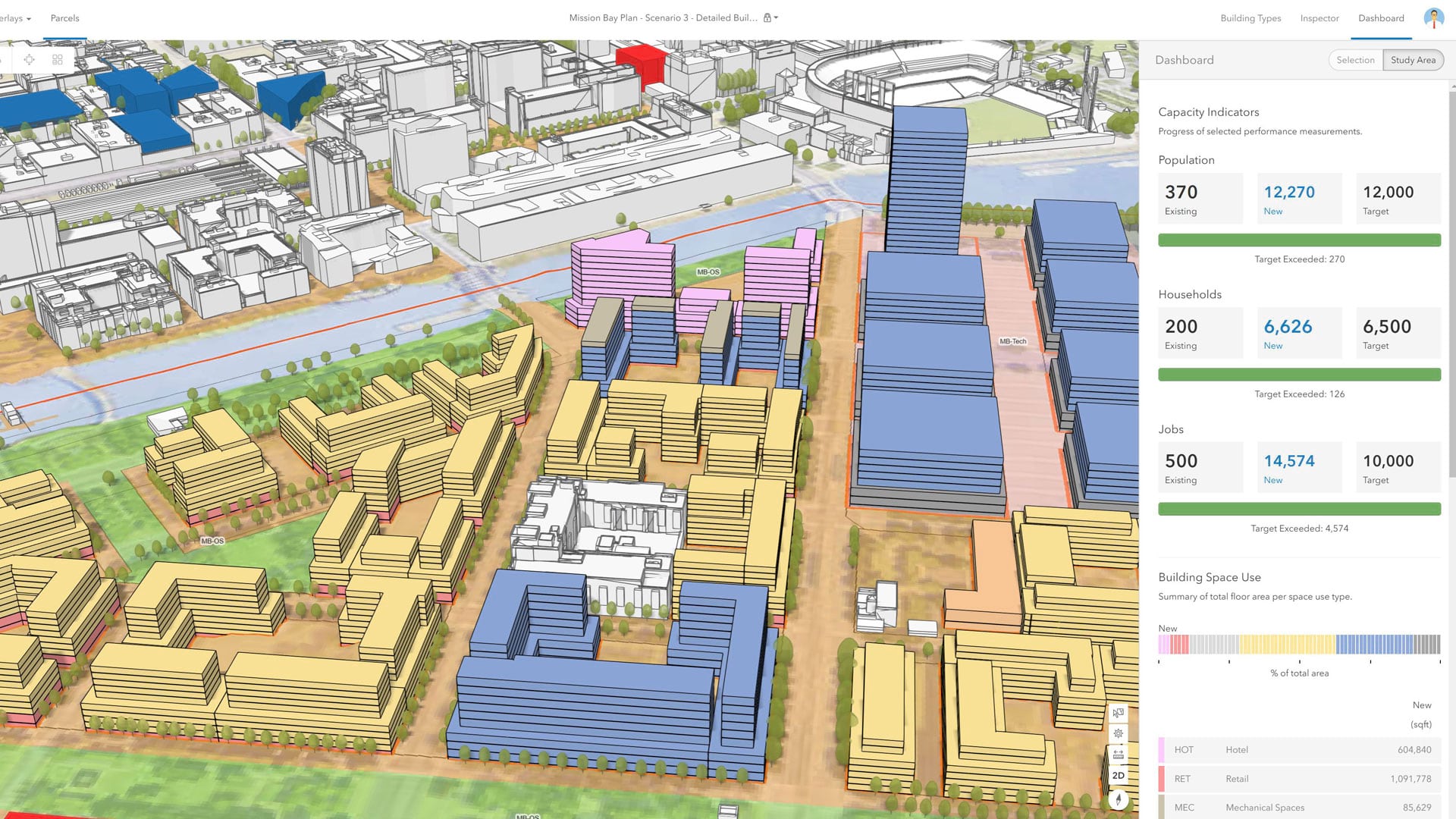
With an immersive 3D experience, ArcGIS Urban allows planners, governments, and citizens to visualize proposed development in their cities.
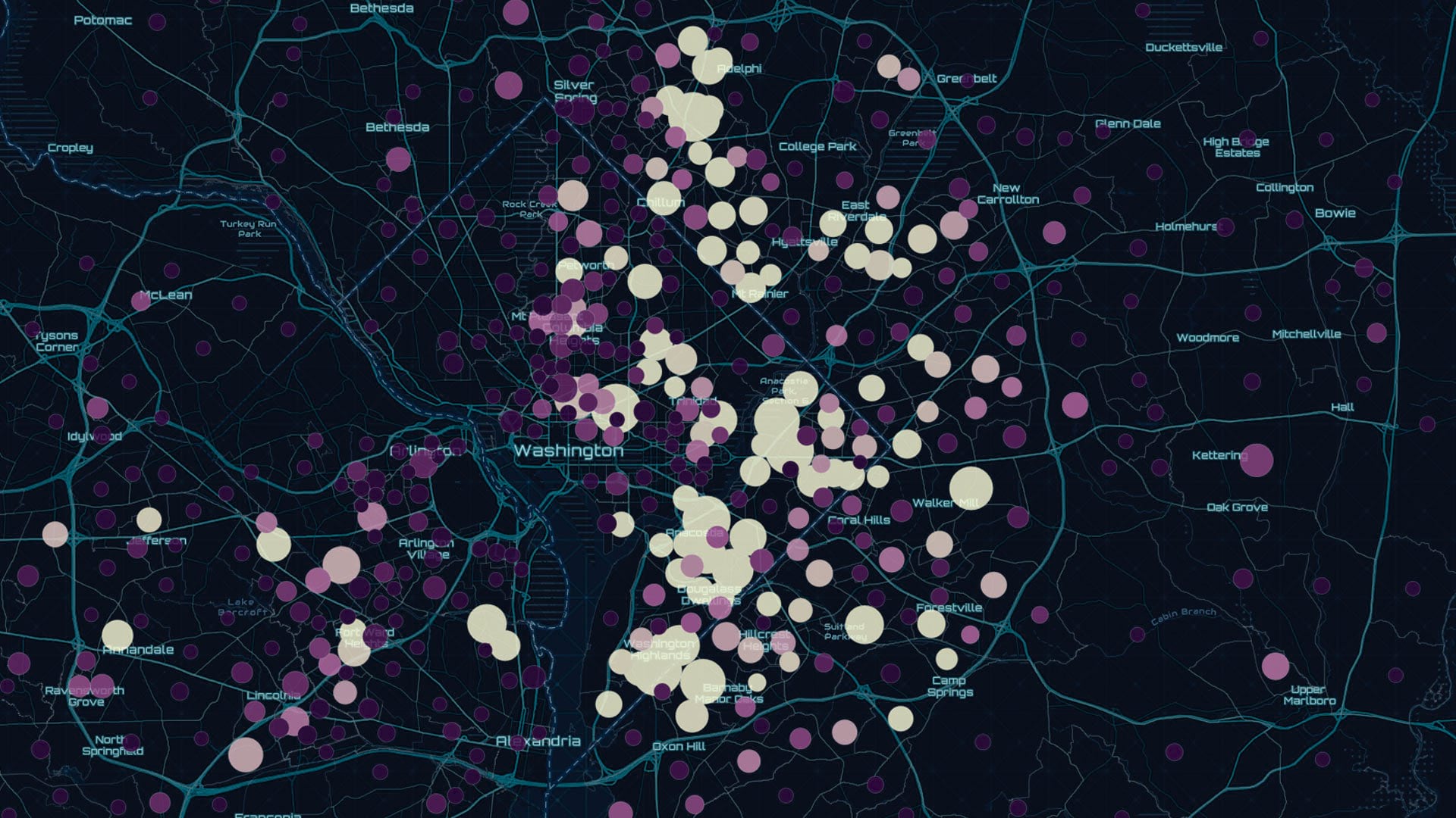
The preauthored maps in the new Esri Maps for Public Policy app foster collaboration and drive fact-based decision-making.

The new Maps for Public Policy web app from Esri provides free access to preauthored policy maps, allowing anyone to explore community issues.
Technology and People Need to Work in Sync to Create Resilient Communities
Installed from a DVD, SpatiaLABS from Esri Press are designed to supplement college coursework with computer lab activities that enhance...
National GIS of India is an innovative program within the country's Twelfth Five Year Plan that has generated much interest. Spearheading many…
India has one of the fastest-growing economies in the world. Renowned for its IT and software development, it is an important component in the…

As former senator and bill sponsor Orrin Hatch writes, the new law will increase collaboration and improve oversight.
To make cities livable and resilient, there needs to be a systems approach to planning and a movement to rebuild smarter...
Landscape architect and urban planner Arancha Munoz-Criado, a driving force behind implementation of a green infrastructure policy...
Geodesign methods and supporting technologies will be needed more than ever as the population increases.

The organization offers a safe place for people of all genders and from all geospatial fields to work together to overcome common barriers.