
January 21, 2021

Sweden, like many other countries, struggles with a housing shortage and lack of affordability. This isn’t the first time the country has faced such a crisis. In the 1960s, the Swedish Parliament passed the Million Dwellings Program which created a million new homes between 1965 and 1974 to accommodate the wave of baby boomers reaching adulthood. A similarly urgent movement to add housing is now under way.
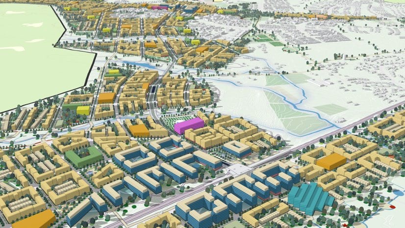
City planners in Uppsala, the country’s fourth largest city, are doing their part by designing a new district with 33,000 new housing units to accommodate 50,000 new residents by 2050. Today, the municipality of Uppsala has 230,000 residents and is expected to reach 350,000 by 2050, which is more than a 50 percent increase in the next 30 years. Much of this expansion will occur according to Uppsala’s comprehensive plan, but an area equivalent to 250 city blocks is being designed around green growth concepts.
“Normally we make plans for a couple of hundred new housing units here and there,” said Svante Guterstam, strategic community planner, City of Uppsala. “Now, we’re planning an entirely new district.”
As Sweden’s fastest-growing city, Uppsala attracts new residents based on its reputation as a research center and its ambitious sustainability policy. For instance, Uppsala University—founded in 1477 as the first university in Sweden—has long focused on natural sciences, its motto containing the phrase truth through nature. The Swedish University of Agricultural Sciences, also located in Uppsala, recently created the Uppsala Green Innovation Park to incubate businesses with a sustainability bent, and partnered with the city to research urban development projects.
The city’s green approach became world leading over the past decade with a pledge to be fossil-fuel free by 2030 and climate positive by 2050. The Uppsala Climate Protocol—acting as a local Paris Agreement—brings together 42 local businesses, public agencies, associations, and the city’s two universities to meet its climate challenge. Many of these same stakeholders are involved in creating the Uppsala Climate Roadmap, which will create a concrete guide on how to phase out fossil fuels.
With this background, it’s no surprise that when city planners set out to create a southeastern city district, they adopted the data-driven and model-centric approach of geodesign powered by a geographic information system (GIS).
“We’re testing out cutting-edge techniques and working to find new solutions for becoming more sustainable,” Guterstam said. “With two universities in Uppsala, we have a close connection with the academic community where we can explore creative and innovative approaches that include new actors and ways to have a smaller climate footprint.”

Uppsala planners are concentrating on a sustainable urban model that adds to residents’ quality of life, doesn’t subtract from biodiversity or degrade the environment, and cuts carbon emissions. A detailed zoning plan and 3D model built with ArcGIS Urban help the planners visualize and present plans for the new city district.
“We value the model a lot during the working process because we can test different outcomes and see—and also show, for example, the politicians—that if we do it this way, this is the outcome, and if we do it that way it’s another outcome,” said Marie Nenzén, strategic community planner, City of Uppsala. “With the model, the outcomes become very clear and visible.”
The Swedish government promotes the planning of districts and even new cities to stimulate more housing. In return for Uppsala’s commitment to growth, the state will invest in new railway tracks to Stockholm, a new station, and a tramway.
The new district will be built on forest land currently owned by the city. Many of the trees will stay within green corridors, and the blocks have been designed so that large groupings of trees can occupy courtyards with houses built around them. There’s also an emphasis on leaving habitats intact and taking care to maintain natural systems such as groundwater flow.
“The natural areas that are close to the city, and sometimes in the city, are very dear to the people of Uppsala,” Nenzén said. “We want to leave as much as possible undeveloped and untouched, while also addressing the demand for housing. It’s a constant balancing act of trade-offs.”
The city and its partners are also exploring how to update traditional city infrastructure management —such as water, wastewater, transport, and energy systems—to be more natural and energy efficient. “We need to find completely new ways of building this infrastructure to have circular systems,” Guterstam said.
The new city district will create sustainable living as well as a new city center south of the historic downtown.
“When fully built it will be a dramatic change compared to the current city that will have an impact on the identity and concept of Uppsala,” Guterstam said. “There will be a different balance with another urban center and southern entry.”
Given this transformation and the need to clearly communicate information, the detailed planning proposal includes an interactive model that allows anyone to view what has been planned.
“The interactive 3D model gives you a feeling and impression of this future district in a way that written documents or 2D maps can’t,” Guterstam said. “Now we can zoom and fly around this new urban area and get quite a good sense of what is coming.”
Early in the planning process, the planning team struggled with the amount of tabular data about project requirements. The number and size of spreadsheets kept increasing, and data in that format made it tough to engage and collaborate with the multiple city departments involved. It was also hard to conceptualize and share a physical representation of the complex district master plan.
“We started off thinking of the model as a tool for communication,” Guterstam said. “After we built the model, we realized that it provided a way to study and share scenarios in a simple way that makes urban planning much more understandable.”
The scope of the southeastern city district exceeds that of past plans as well as the work experience for most of the project’s planners, architects, engineers, and researchers. The model helps everyone see the project’s scale and mold the urban form with their own hands to grasp what works and what doesn’t.
“It’s a learning process to understand the kind of density that will fit within the area of the agreement,” Guterstam said, stating that “3D modeling is very useful to try different building and block sizes and what scale it produces. Does it resemble Manhattan or a historic European city?”
The 3D model is built on top of a digital elevation model captured with lidar scanners to show the real topography. Lidar also captured existing buildings and all the trees. The realistic model enables everyone to see how the proposed development will look in the context of the current city. The model has helped the planning team test approaches and configure and see new areas, and ultimately it will help the city and its residents make informed and sustainable decisions.
Uppsala leaders are considering a range of factors to make the city more sustainable, including mandating wood building materials since the country is richly forested and wood is a renewable resource. They are also looking closely at mandates on energy, water, and resource consumption.
“With this smart model, we can also get indicators for how sustainable the plan is,” Guterstam said. “In order to achieve the targets for 2030 and 2050, we need to back-cast to see if what we plan will help us reach our ambitious climate and sustainability goals. We have a very good chance of influencing these kinds of decisions now in the planning process, because once the district is built its hard and expensive to change the urban systems to enable and encourage sustainable lifestyles. We need to identify solutions and techniques that actually take us where we need to go.”
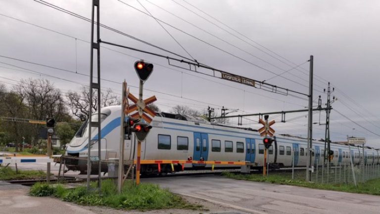
The rail network and new tramway form the spine of the new city district, matching a growing pattern of urban planning called transit-oriented development that reinforces the value of denser urban pedestrian-oriented areas centered around public transit, and having strong cycling connections.
Even before the southeastern city district was conceived, transportation was a strong focus of Uppsala’s efforts to become carbon neutral. Uppsala’s buses are powered by renewable energy and biofuel produced from local food waste. New bike lanes and a two-story bike-parking garage next to the train station encourage people to leave their cars at home. The city also launched a Climate Made Easy campaign in 2019 to help residents reduce the carbon emissions they are personally responsible for.
“With coherent urban planning we can set incentives for sustainable lifestyles where you’re not car-dependent and can live without a car by using public transit,” Guterstam said.
Though planners took much care to reveal the right level of detail in the model for the early planning phase, they anticipated confusion from residents who aren’t used to seeing such detailed plans.
“In public communication it can be challenging for many to understand that the plan is very much a work in progress still,” Nenzén said. “We get questions that we can’t answer at this stage. But it also shows that the model spurs a lot of curiosity, and the public wants to see and use this model.”
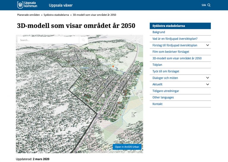
In fact, of all the elements that Uppsala has uploaded to the 2050 planning site, the model has received the most web traffic. The model has also become popular with the many stakeholders working on the plan.
“It was fun to see how people on other teams got interested in the model,” Guterstam said. “They were asking about how we’re using it and if it could also be applied to their projects. It’s different from how we’ve worked in the past. We have full control of the model instead of having an external consultant architect create a model for us and who we then have to ask for changes that we sometimes would get back weeks later.”
For city staff, the ability to quickly make changes and see the impact of alternative designs is helping drive adoption of new workflows and the use of new tools.
“Some have questioned the flexibility of the plan,” Nenzén said. “Demonstrating how easy it is to make changes in the model makes it easy for people to understand that we can change it when needs change. For instance, when the demand for more freestanding houses was voiced we could use the 3D model to identify locations and study how it would impact the height and density of the remaining apartment blocks.”
The accelerated feedback loop fits the moment because Uppsala’s agreement to expand comes with a timeline. The plan must be in place, and the city has to start building 800 new housing units per year by 2025 to secure the national government’s infrastructure investments. Before the city begins building, a lot of parallel processes need to take place.
Planners and architects are conducting public consultations according to planning law. The city is at the proposal stage now, and during the spring of 2021, the first detailed planning will take place, which will require another rigorous set of revisions. In this next phase, the 3D model will be further refined to visualize streetscapes, determine the scale of the buildings, consider the right mix of forest and trees, and review water and stormwater processes. The visualization will also help determine the materials used to construct the buildings and infrastructure.
“During this process it has become clear that this tool has a lot of potential as we get more detailed and have more data,” Nenzén said. “For example, we want to test and see the outcome of daylight and shadow studies and make more connections to sustainability planning.”
Learn more about achieving urban transformation through a more analytical and parametric-driven process.


