October 8, 2024

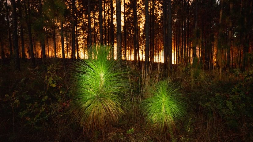
Longleaf pine ecosystems are important allies in the fight against climate change and biodiversity loss. With their efficient use of water and resistance to fire and insects, the US Forest Service has recognized these pines as one of the best climate-adapted species for the Southern US. Furthermore, the ecologically diverse grasslands with these important trees are vital habitats for more than 600 plant and wildlife species, including 29 that are endangered or threatened.
Driven by the realization of longleaf pine’s critical role, there has been a concerted effort to restore longleaf pine ecosystems across their original range, stretching from Eastern Texas to Southern Virginia. Once spanning 90 million acres, these ecosystems have dwindled to about three percent of their original size.
This restoration effort benefits from 60 years of close study of these ecosystems at Tall Timbers in the panhandle of Florida.
At Tall Timbers, prescribed fire has been one of the key tactics in returning vigor and biodiversity to native ecosystems. Tall Timbers manages a series of research plots and more than 13,000 acres. Some plots are burned every year, others every four or five. Some have never been burned, and some are burned in different seasons.
Kevin Robertson, fire ecology research scientist at Tall Timbers, is part of an extended team that applies geographic information system (GIS) technology to capture details of the organization’s natural resources research. They use GIS mapping and spatial analysis tools to plan fire research that links the amount of fuel (live and dead plants) in the ecosystem, weather conditions, and fire behavior. After each fire, Robertson and his team use GIS to record the impacts to wildlife and plants.
“We never have a research plot without it being in GIS,” Robertson said. “Putting together details about the trees and fire alongside the topographic location, the soil type, the plant community, and the climate has led to important discoveries.”
Tall Timbers, located in Northern Leon County, Florida, started out as a quail hunting estate established in 1895 by wealthy New York City architect, Edward Beadel. His nephew Henry Beadel inherited the property and carried on the hunting tradition. When he saw quail populations decline by the early 1920s, he worked with other nearby landowners to sponsor a study to understand why.
When the study emphasized the importance of fire, it led to Tall Timbers being known as the “birthplace of fire ecology.” When Henry Beadel died, he endowed his land at Tall Timbers as a research laboratory for further investigation into the value of prescribed fire and education about its benefits.
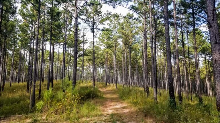
In an old growth longleaf pine community known as the Wade Tract, Tall Timbers researchers and the project founder William Platt have mapped and studied more than 20,000 pines for more than 45 years. The trees have been mapped every few years to track the distribution, height, and health of every individual tree larger than two centimeters in diameter. After a burn, researchers use GPS units to collect location-specific data on how the fire has spread and how it is influenced by the pattern of trees.
A GIS-powered environmental digital twin forms the basis of this work. It’s used to manage the ecosystem and dig into the details about how the forest behaves with and without fire. The twin helped Tall Timbers scientists unlock insights about how the pines regenerate and to identify the ideal fire frequency to enhance biodiversity. It’s also helping to answer research questions about the distribution of soil chemicals, multiple plant species, and ecosystem carbon.
Some scientists speculated that new patches of longleaf pine grew where there was the most sunlight. Others hypothesized that root competition caused new trees to grow in dense clusters. However, with the digital twin, researchers could study the data and find patterns of trees and fire spread that determined the cause and effect.
“We were able to map where trees were regenerating to see that unburned patches are where regeneration was occurring,” Robertson said.
In Florida, 90 percent of fires are prescribed at intervals intended to match the natural, historical patterns of longleaf pine communities across their entire range. In the past, lightning strikes were a common cause of fires. Indigenous North American Tribes would also set fires, aware of the many benefits. Over millions of years, the landscape has grown dependent on fire.
The digital twin of longleaf pine communities has helped Tall Timbers understand the benefits of fire and pass this knowledge along to the country’s wildland firefighters.
Now, Tall Timbers hosts the National Interagency Prescribed Fire Training Center, where federal, state, local, and Tribal government agencies and other organizations share fire knowledge and receive training on how, where, and when to burn.
The understory vegetation in pine communities grows quickly, and if fire isn’t used at least every three years, the fuel load may become too dense for most native plant and animal species. Without fire, land managers would need to use chainsaws to thin the forest, which is much more complicated and expensive.
“We sometimes use the analogy of mowing your grass to help people understand these systems,” Robertson said. “The trees survive the fire. The grass and the woody plants of the understory are mostly just top killed by fire and re-sprout.”
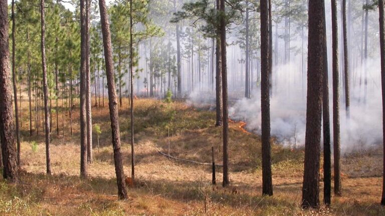
Visitors to the training center learn from the measured and managed approach that organizations like Tall Timbers take with fire, using GIS to monitor, make plans, and execute strategies. Beneficial fire requires a landscape-level awareness that the technology provides.
“We use GIS to understand the balance between the ecological need and safety, and for being aware of smoke and other impacts,” said Holly Nowell, the director of the Smoke Science Program and an assistant scientist at Tall Timbers. “We have shown that we have better habitat where there is higher burn frequency.”
Tall Timbers has recently started a new department to study smoke. The environmental digital twin helps researchers understand the behavior of smoke and guide it away from vulnerable populations.
“We’re really in a challenge to learn how to burn in such a way that prevents the Environmental Protection Agency air quality standards from being exceeded,” Robertson said. “That involves geography, knowing where the smoke is coming from and working with landowners to spread their burning out over time.”
While the environmental digital twin has been essential for smoke modeling, additional modeling is needed. Researchers want to be able to discern “the movement of heated air and how that influences the fuels in front of it.” They also need to know how air is being drawn into the fire so they can predict how fire will behave.
For now, visitors to Tall Timbers can observe the environmental digital twin in action. More importantly, land managers can observe how fire helps longleaf pine ecosystems thrive and support a rich biodiversity.
“Fire is tightly connected with biodiversity because if we don’t have frequent fire in this ecosystem, we lose most of our endemic plants and animals,” Robertson said.
“When you walk by these plots, the types of birds that you hear and see are completely different,” Nowell said. “In overgrown plots, you won’t hear any quail calls and it’s difficult to see any species. When you walk into the plots we maintain regularly with fire, you’ll spook the quail and see red-cockaded woodpeckers—an endangered species.”
Learn more about how GIS guides wildfire planning and response, and how GIS safeguards biodiversity.


