


February 7, 2023 | Terry Bills | Infrastructure
August 8, 2024
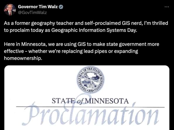
Minnesota Governor Tim Walz understands the power of geography. He has used geographic information system technology, or GIS, to address issues impacting people and places since the 1990s. When he first put floppy discs into his Apple IIe computer to look at data on maps, he became hooked on how GIS technology helped him understand important issues and develop solutions.
Walz shared this geographic approach for two decades as a high school geography teacher. Then as a member of Congress, he brought a science-based perspective to geopolitical changes and challenges. Now, as governor of Minnesota, Walz has used GIS maps to analyze policy decisions and communicate complex issues to the public.
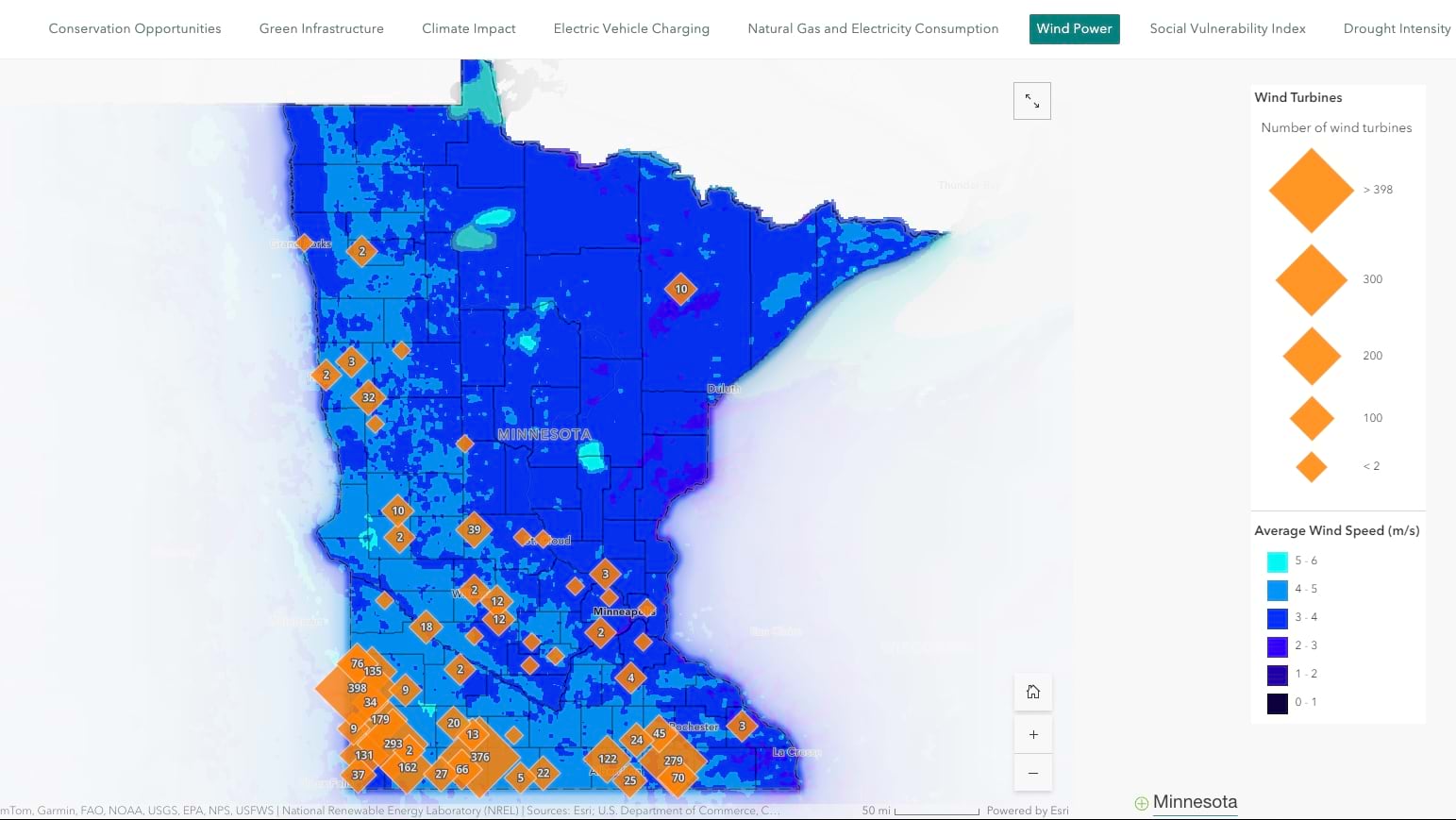
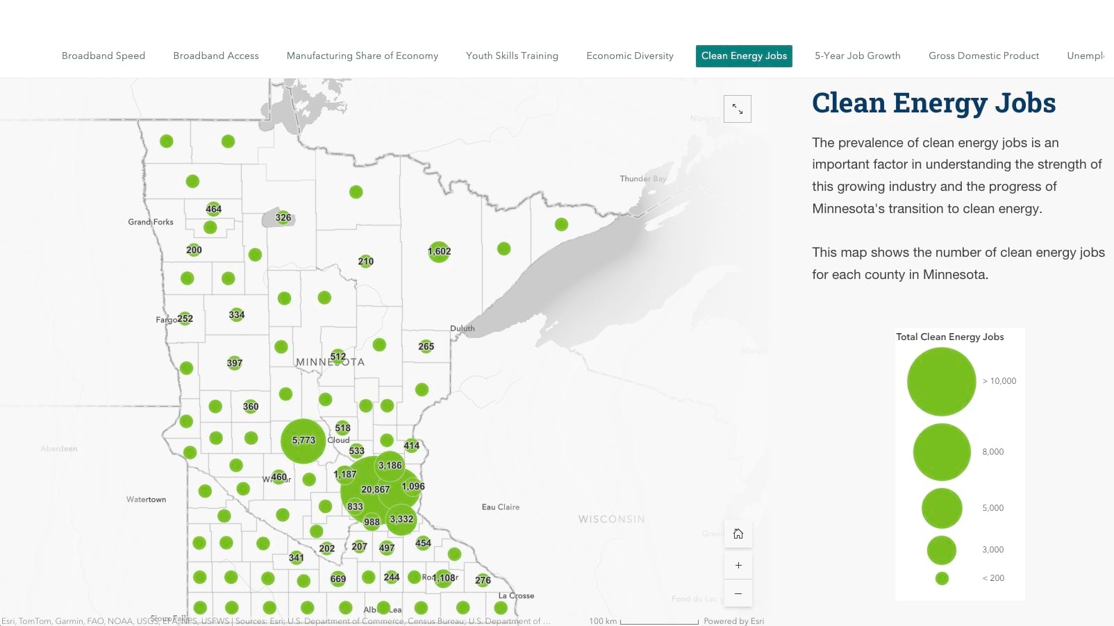
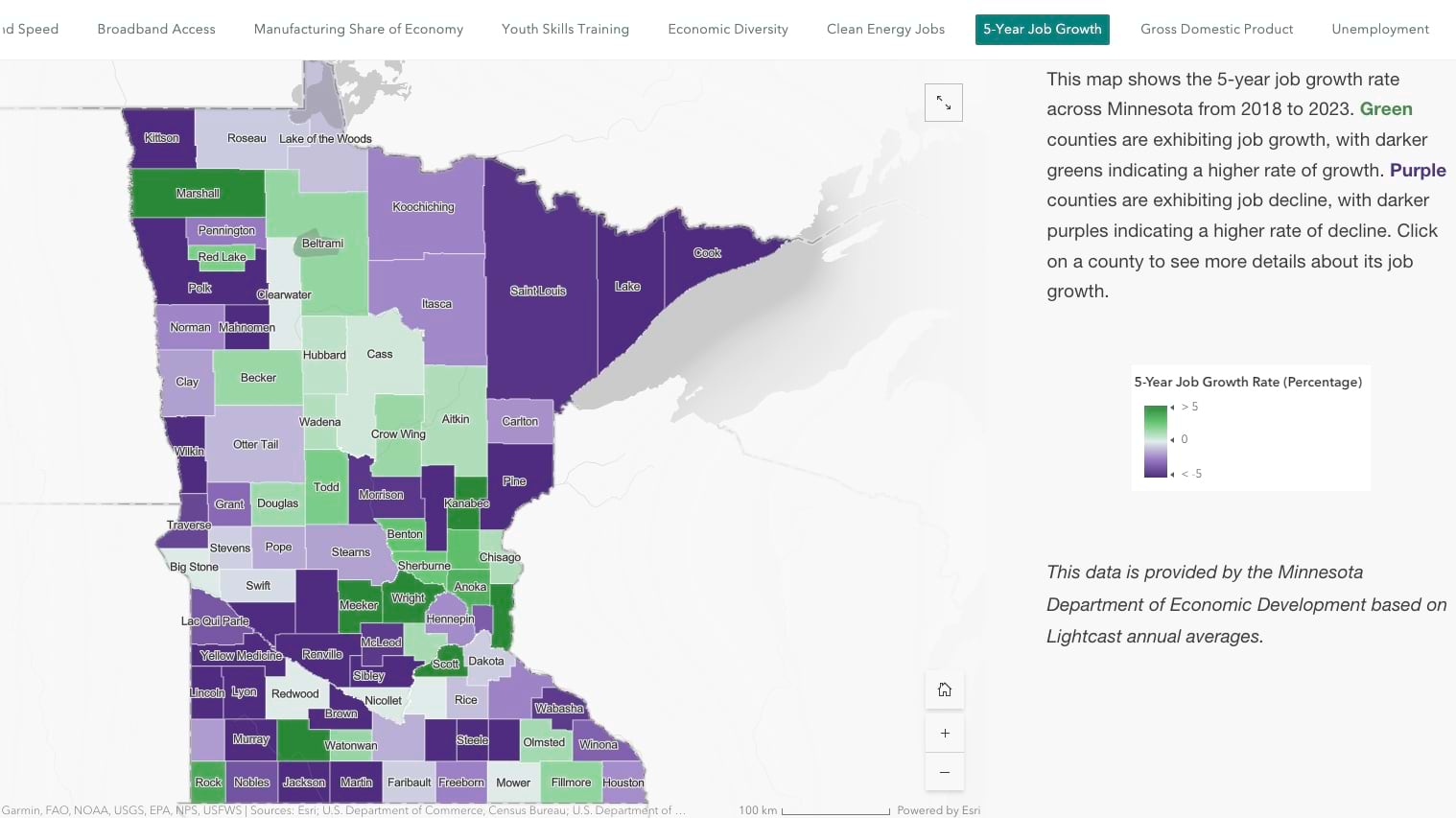
By layering all relevant data onto a state map, GIS has equipped Governor Walz and other Minnesota leaders with practical insights to tackle a range of challenges faced by government officials at every level. These challenges include—expanding clean energy, managing housing costs, providing school meals, increasing access to jobs and childcare, and improving broadband equity. Walz also noted the important role GIS dashboards played in dealing with the COVID crisis, tracking the virus and statewide response. This led to some of the highest vaccination rates and lowest deaths in any state.
When Governor Walz designed the One Minnesota plan to improve the lives of all Minnesotans, he knew geography would play a key role. And GIS maps would help ensure the state served all people in all ZIP codes and of every economic status.
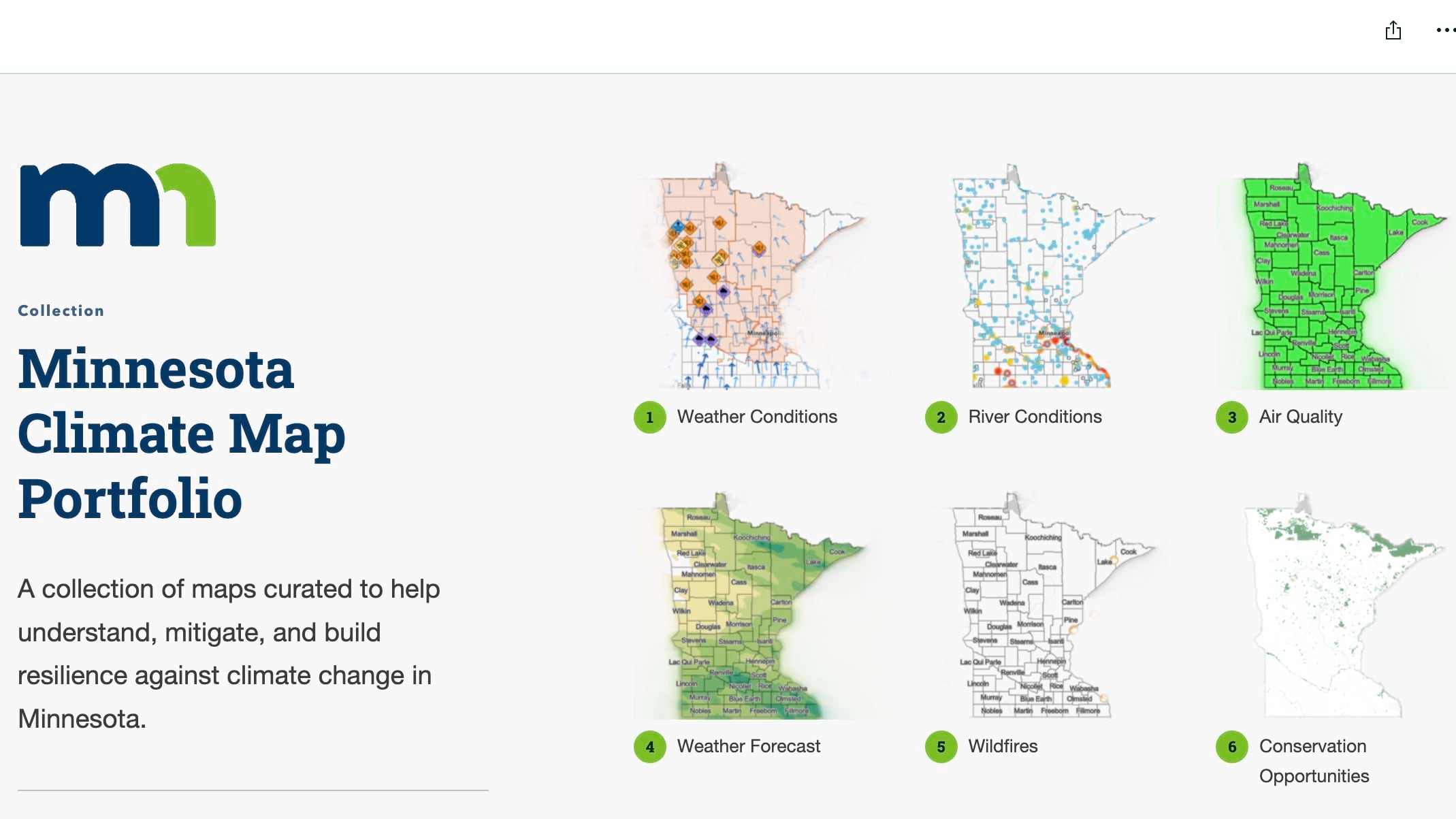
Now, a series of maps in the Minnesota Executive Map Portfolio guide initiatives around cross-cutting issues. Walz calls this use of maps and dashboards “results-based governing” because it uses a data-driven approach to tackling challenges and demonstrating progress.
“If the public doesn’t know how we’re going to get there; If there’s not measurable, displayable progress that they can see, it’s going to be very difficult to get them to buy in,” Walz said.

For transportation, there are maps to see the age of roads and bridges, and what projects are being built. For education, there are maps that show how students are performing in rural and urban areas and by race and economic status. For climate resilience, there are maps that show extreme heat, flood risk, and where people are most impacted.
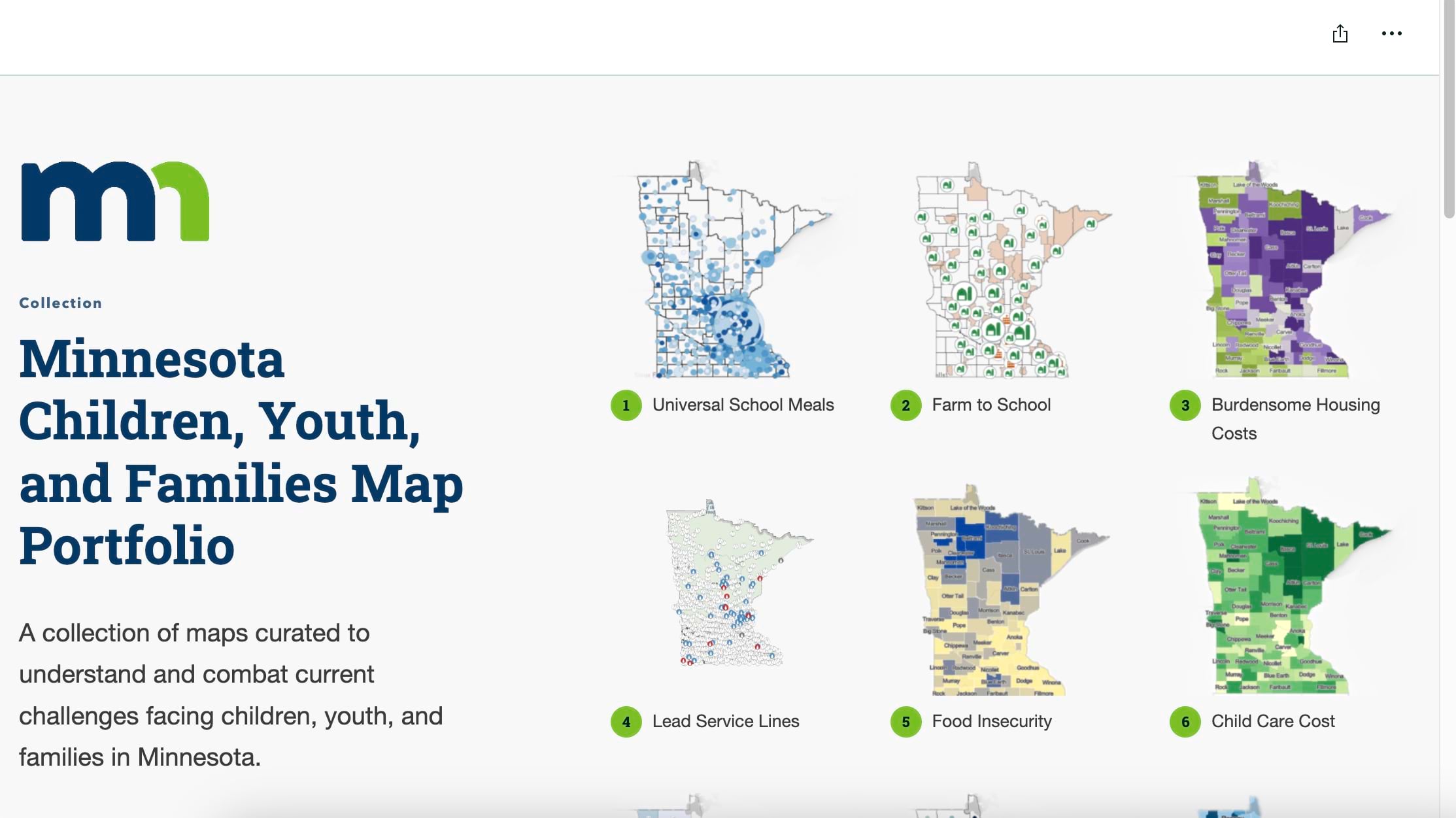
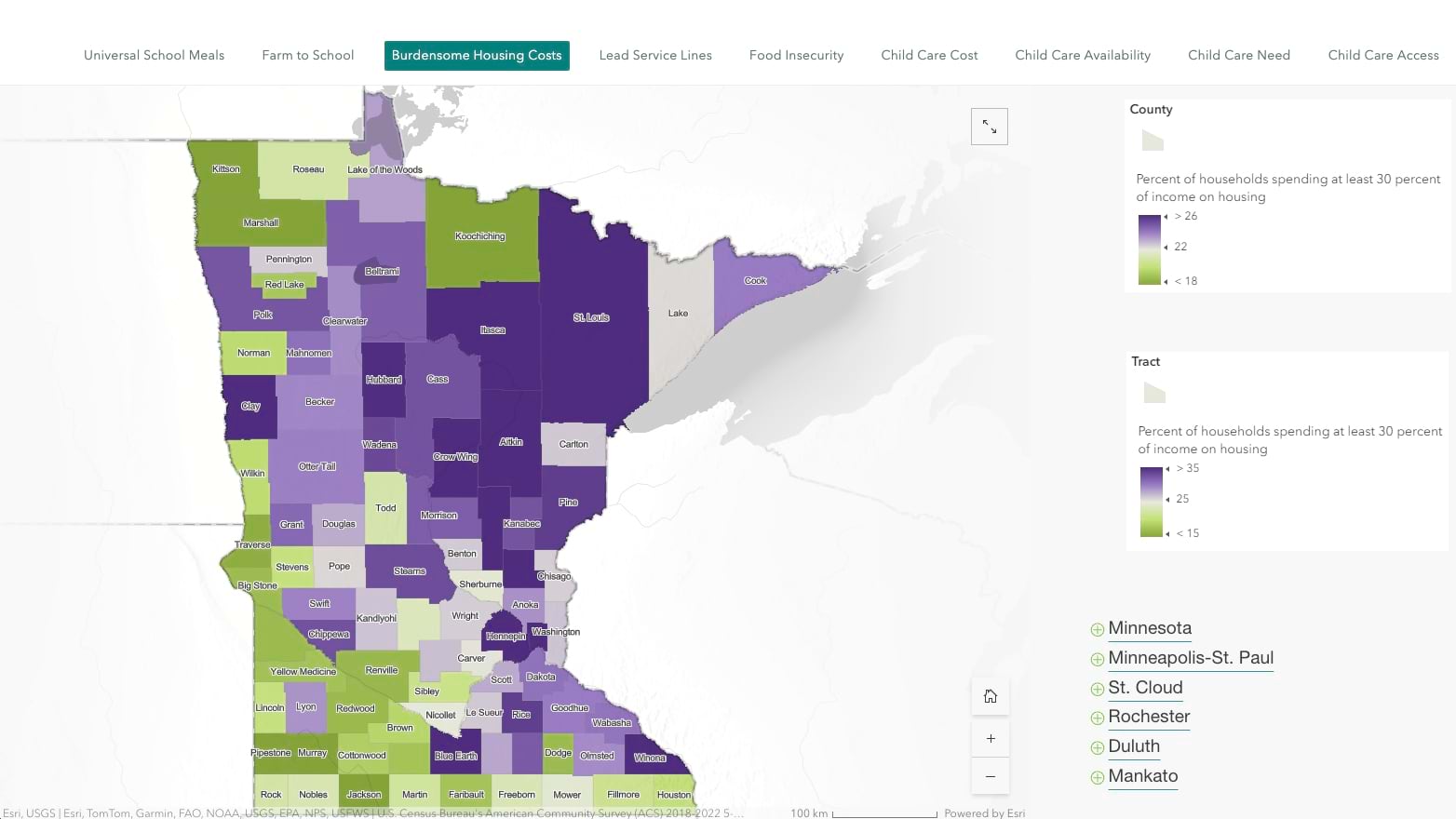
A recent initiative mapped water service lines to homes, identifying hazardous lead pipes, and then monitoring their replacement.
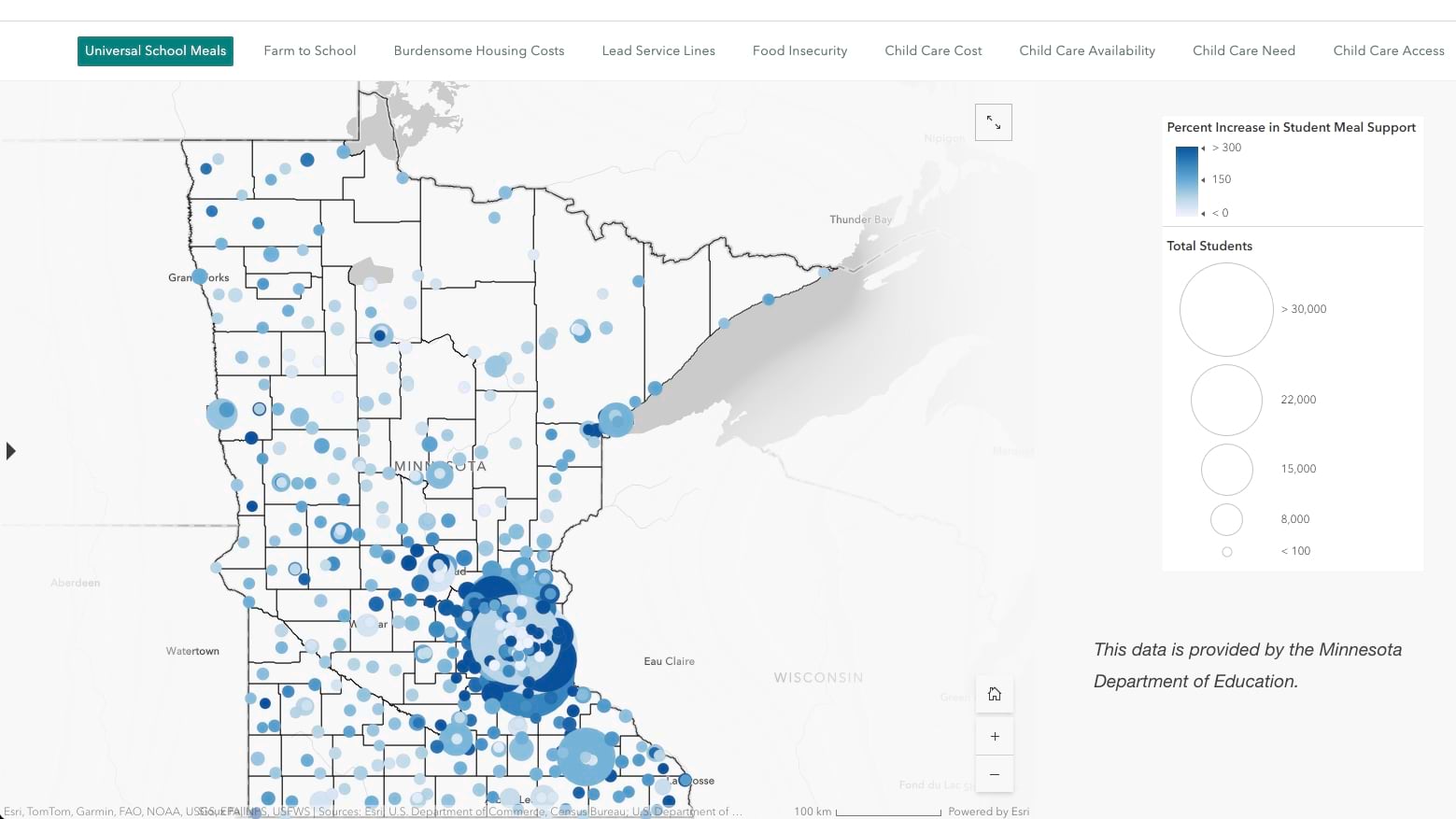
Maps are also supporting several statewide initiatives to address child poverty. As a schoolteacher, Walz saw how hunger impacted student performance. His solution: provide breakfast and lunch to all students, leveraging Minnesota’s ample food resources as one of the nation’s top agriculture producers.
“Truancy rates went down, achievement rates went up, and behavioral issues went down,” Walz said. “It works.”
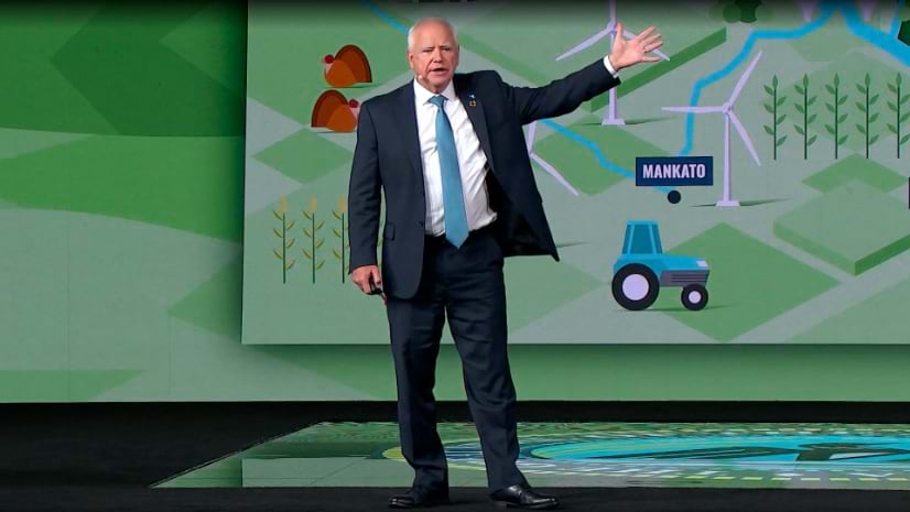
In a keynote address at the 2024 Esri User Conference, Walz spoke to a crowd of more than 20,000 GIS professionals, technologists, and policymakers—individuals who, like him, are passionate about maps and recognize their capacity to enhance decision-making in government.
He talked about how location influences people’s access to resources and opportunities. “I won’t debate geography as destiny, but where you are has a lot to do with who you are,” Walz said.
Walz’s approach to governance has been shaped by his surroundings in Minnesota, a state known for its rich legacy in GIS expertise and social innovation. The state has an abundance of GIS data, advanced maps, and geospatial decision-support tools, with a wealth of GIS experts across its state and local government agencies, academic institutions, and businesses.
Minnesota is also known for its excellence in Spatial Data Infrastructure, a term that relates the collection of foundational data needed to answer key questions. The state gathers and shares data about its physical features, such as elevation, land parcels and their uses, transportation networks, and the waterways and water bodies in the “Land of 10,000 Lakes.” It collects and manages population data from the US Census Bureau about the people who live there, including age, occupation, gender, race, and more. Layers of high-resolution imagery showing details of buildings, forests, and fields creates even more context. This data can be visualized together on GIS maps to reveal patterns, understand problems, and provide options to solve any issue.
For instance, the goal to reduce child poverty: maps layered with data about access to childcare, cost of childcare, and unemployment rates reveal potential causes and solutions. Maps show decision-makers where communities need greater access to employment, childcare, and subsidies.
In Minnesota, GIS also supports collaboration among state agencies and local governments on projects and initiatives. By sharing data on a map, everyone involved can easily understand what’s happening and where to enact policies and allocate resources.
Governor Walz has often remarked about the power of GIS as a leadership communication tool. “As governor, the ability to use what I knew about mapping and the visual display of data to convey complex issues, to affect changes amongst people, is really important.”
A geographic approach has helped Walz translate the One Minnesota vision of a fair society into concrete results that make a difference in people’s lives.
In his current campaign for vice president, Walz continues to leverage maps to grasp the diverse challenges facing leaders and policymakers across the the country, emphasizing the broader significance of geospatial literacy.
Walz said: “Given the right set of tools, to the right people who are versed in this language, you can start to make true differences, true ways to unite our world, a true ability to be able to bring things together.”
Learn more about the power of GIS.