
Mapping allows us to see what's relevant, and what's not, and decide where we should focus. And so, mapping provides the framework for everything.
August 3, 2018

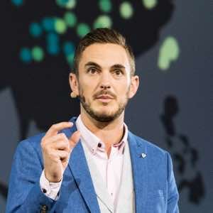
A Conversation with Thomas Crowther, Professor of Global Ecosystem Ecology, and founder of the Crowther Lab at ETH Zürich
From the Crowther Lab in Switzerland, Thomas Crowther and his interdisciplinary team of researchers investigate how Earth’s ecosystems regulate the carbon cycle—an essential first step in predicting and fighting climate change. This team uses ecosystem science to create a holistic understanding of forests and their capacity to combat climate change at a global scale.
Crowther is an assistant professor of Global Ecosystem Ecology at ETH Zürich where he directs the interdisciplinary Crowther Lab. He is also a Marie Curie fellow at the Netherlands Institute of Ecology and an adjunct professor at the University of Minnesota. Here, he answers questions about his work and research.
This interview has been edited and condensed.

Mapping allows us to see what's relevant, and what's not, and decide where we should focus. And so, mapping provides the framework for everything.
Where are we currently with our understanding of climate change and its implications?
We are closer every day, however, until we get a handle on the ecological system that regulates the terrestrial carbon balance, we can never predict climate change accurately. We need to have a spatially explicit understanding of the biosphere before we can do that. Observing and understanding the world is the first step to managing uncertainty and getting better predictions.
What led you to your current focus on the earth’s soil?
We actually have a good understanding of the above ground world, it’s been extensively studied, but we don’t know as much about the belowground world. So, every time we explore another aspect of the belowground world, we find new things about how the world fits together. For instance, there are probably more animals in the Arctic than the Tropics, and that’s transformative information.
We know a great deal about the climate, soil, geology, physics, and chemistry of locations around the world. But we don’t know the first thing about what organisms are there. This means that we don’t know anything about the drivers—the bits that are making everything happen.
Until your work, nobody knew how many trees there were on the planet. What led you to tackle this question, and how did you go about it?
My friend Gregor Hintler was working on this question with Plant-for-the-Planet. He asked a number of foresters who said it wasn’t possible to accurately quantify how many trees exist on land. Eventually he came to me, and I was sure that we could gain a greater understanding of the global forest system.
We started compiling data from foresters who have been taking inventories of forests around the world. The more ground-sourced data we collected, the more the word spread, and the more people volunteered to send us their data. Eventually we had data from hundreds of thousands of forest plots and we began pairing those with satellite data. The combination of ground sourced data and satellite data gave us a whole new vision of the global forest system.
We discovered that there are more than 3 trillion trees on Earth—seven times the number previously estimated. We have since focused beyond the number of trees to globally quantify tree types, size, density, and species. We are also cataloging the world’s soils including the role and impact of soil organisms. This data will help inform the number of trees that our planet can support, where and what species should be planted.
We’ve now formed the Global Forest Biodiversity Initiative, which combines experts from more than 250 institutions around the world to continually refine the global forest perspective.
Why do you think you were the first to take up this challenge?
The variability of ecology discourages ecologists from trying to get too broad. Ecological processes are so different around the world. In order to get an understanding of these processes, ecologists have traditionally specialized in just local environments. We thought it would be cool to explore what is causing this ecological variations across large spatial scales, giving us a global perspective that can help us to understand how and why these differences exist.
The global scale of the tree density project was nice because it forced me to draw on people with a range of different expertise in different regions of the world. We’ve continued to combine experts and now have a fully interdisciplinary approach taking place in our lab.
How does geographic information system (GIS) technology – location technology – play a role in your research?
GIS allows us to apply spatial science to ecological questions. It combines modeling, visualization, and spatial analysis to form the framework for our collaborative approach.
GIS stores data about trees, soil, and climate in layers, georeferencing it based on its geographic location, so it can be paired with other data. We’ve compiled more than 250 global layers of environmental characteristics, adding tree and forest data to soil data such as pH level, texture, and soil depth and climate data such as temperature, moisture, and precipitation.
We pair the information from all of those layers with the measured data on whatever ecosystem characteristic—whether it’s the number of trees or the diversity of animals or the amount of carbon in the soil. We can then run analysis to interpolate or extrapolate across the data points to see patterns and gain a global perspective.
How does your work tie into Earth system models?
Earth system models consider a lot more complexity, including the environmental feedback loops that regulate our climate. For example, as things get warmer, carbon emissions from the soil increase. As CO2 in the atmosphere increases, trees tend to grow more quickly, absorbing more CO2 in the process. There are thousands of these kinds of feedback loops, and we need to run very complicated models around the world to figure out how those feedbacks will change over time.
We need to understand the current biosphere, and how it is changing over the rest of this century. A lot of the current values we have about what will happen to respiration under warming is based on best estimates using our current understanding of ecological theory. Now we have the tools to more accurately calculate those values. Every time we get more information at a global scale, we plug it back in to parameterize those models and reduce the uncertainty.
How does the study of microbial competition aid your work?
The theory of how everything fits together and connects, and how diversity is established and maintained, underpins everything we do. We work on competition as a structuring force in communities across a range of different scales. We take microbes and put them in petri dishes and see which ones win under which conditions. This helps us see how we can manipulate communities to maintain high levels of diversity and achieve different levels of composition. Without that theory, we would just be taking information we don’t understand and extrapolating it and making big claims.
You might have heard of the Wood Wide Web, the concept of mycorrhizal fungi connecting most of the world’s plants and forest trees. There’s an epic network of organisms below the ground that are acting on things that we couldn’t have comprehended. In some cases when a tree is sick, and another tree is healthy, the fungi will redistribute nutrients from the healthy one to the dying one.
If you lack the ecological knowledge about how things compete, you start making this a bit magical. I don’t like it when people paint the picture of everything’s a harmonious magical world and everyone is helping everyone else. The fungus reallocates nutrients most effectively for its own survival.
There’s a relationship between competing for your own survival whilst facilitating the survival of everyone else, that is more like the real answer. It’s like saying in a tennis match that the two opponents are helping each other by encouraging the ball boy to give the balls to each player. Whereas really, they’re competing against each other and the ball boy just redistributes the balls.
Do you credit technological advancement for some of these breakthroughs?
We couldn’t extrapolate the local data to a global scale without NASA’s satellite data. We couldn’t fill in the gaps without big data on climate and geology. The last couple of decades have seen an exponential increase in our ability to observe the world, and now we’re at a time where we’ve got unbelievable amounts of information and technology to change our vision.
We’re constantly improving the efficiency of our modeling approaches. Every day there’s new approaches that can help us to get over slight problems in previous year’s research—refining, refining, and refining more. That process is the key to it all.
It’s not just about understanding the forests, it’s also about where to take restorative action, right?
We are as motivated by that as anything. I think that’s definitely been the biggest tangible impact of any of this research. Describing the biosphere provides immediate details that people can understand, informing where to restore, what to restore, and what the consequences will be.
If you’re designing an international collaborative restoration project like Plant-for-the-Planet, we can provide the carbon sequestration numbers that can be achieved. It goes all the way down to a tiny scale. If you’re trying to plant 1,000 trees in an area in Costa Rica, you can zoom in on the map and say, this is my area, this is how many trees are there, this is how many I could restore, and these are the species that could live there.
Mapping gives us that perspective and it’s central to it all. One of the guys in my lab recently said something rather deep—”ecology without maps is like poetry without words.” Most ecologists stop before they make a map. In my view, if you don’t check that it makes sense on a map, then you haven’t finished.
To learn more about the work being done at the Crowther Lab, watch this video of Tom Crowther’s 2018 Esri User Conference presentation below (12 minutes).
Learn more about how GIS helps users respond to ecological crises and restore biodiversity faster.