February 18, 2025 | David Gadsden | Conservation
April 15, 2025
Before the COVID-19 pandemic, NHS Scotland had abundant data but lacked context to maximize its value. Specifically, the agency’s data was not tied to location—which limited their understanding of how location affected health outcomes and service delivery.
The pandemic, however, became a catalyst for health-care systems worldwide, driving adoption of geographic information system (GIS) technology.
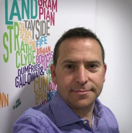
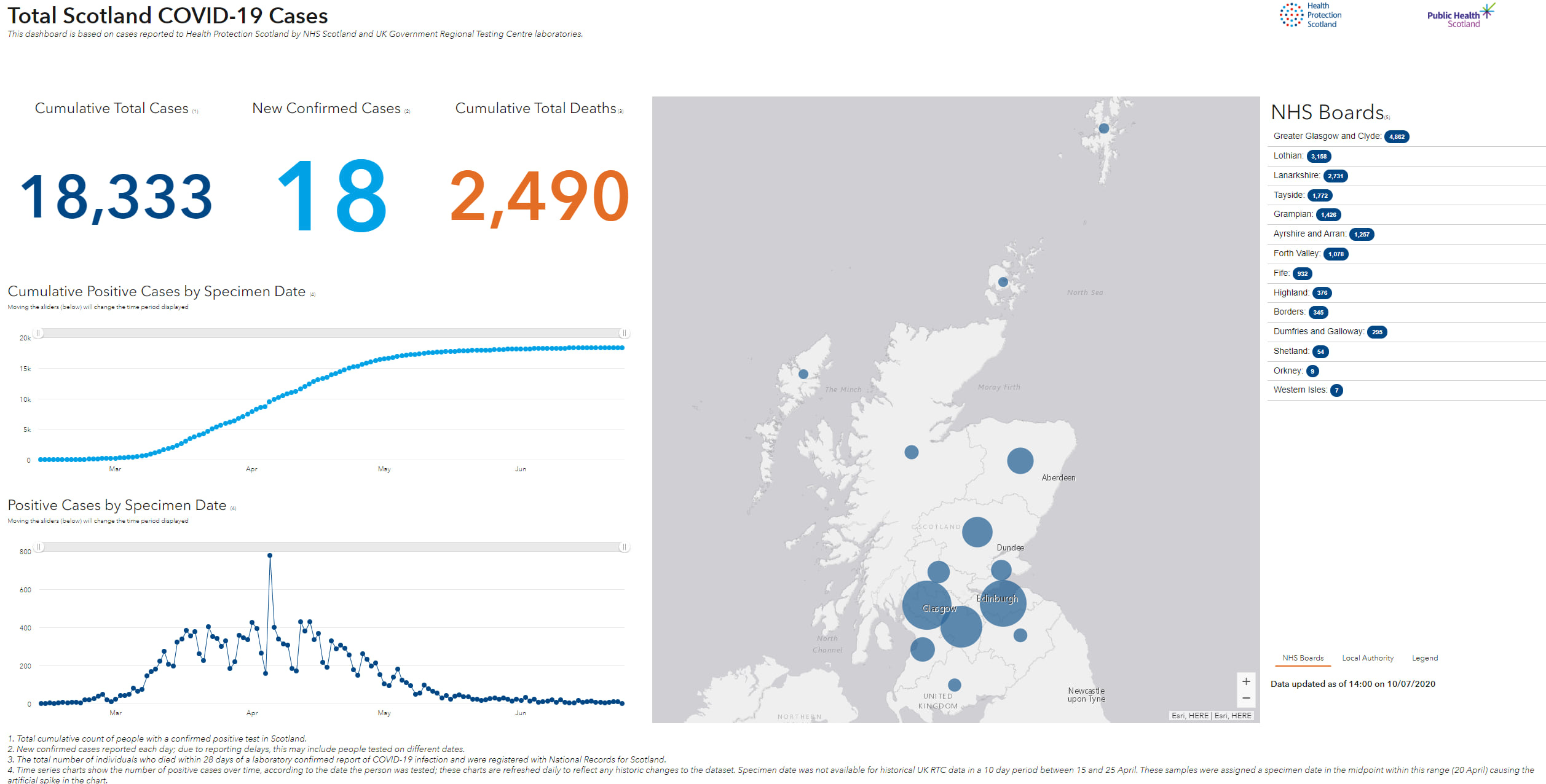
“The light was shone; people started to realize the question of ‘where?’ is really important,” said Andy Gasiorowski, a principal information development manager for Public Health Scotland, a specialty board of NHS Scotland.
Gasiorowski took to GIS tools right away. He used his data science and health-care knowledge to create a contact tracing app for incident management teams to better view and understand the spread of infection. He also created maps for urgent decisions such as where to put testing sites and give vaccines.
From that start, Gasiorowski knew there was more that location intelligence could reveal.
“I’ve worked away at this for quite some time on my own, but now we’re in a very fortunate position whereby we’ve invested more in GIS, and we now have a small but perfectly formed team around me,” Gasiorowski said.
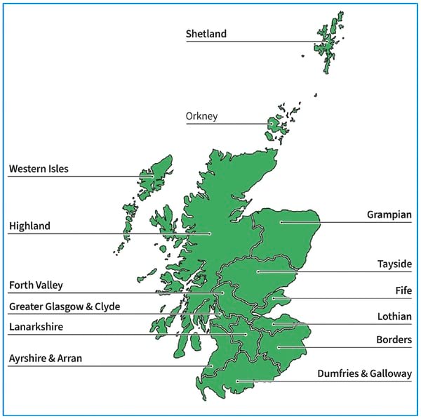
Scotland’s ambitious 2045 net zero emissions legislation required all government entities to participate. Former health and social care secretary Humza Yousaf emphasized in the NHS Scotland Climate Emergency and Sustainability Strategy that addressing environmental impact was a shared “moral obligation” for protecting human health. The strategy connects population wellbeing with environmental health. Tasked with creating more sustainable healthcare through GIS, Gasiorowski discovered NHS Scotland’s 22 regional boards lacked a unified inventory of facilities and land holdings.
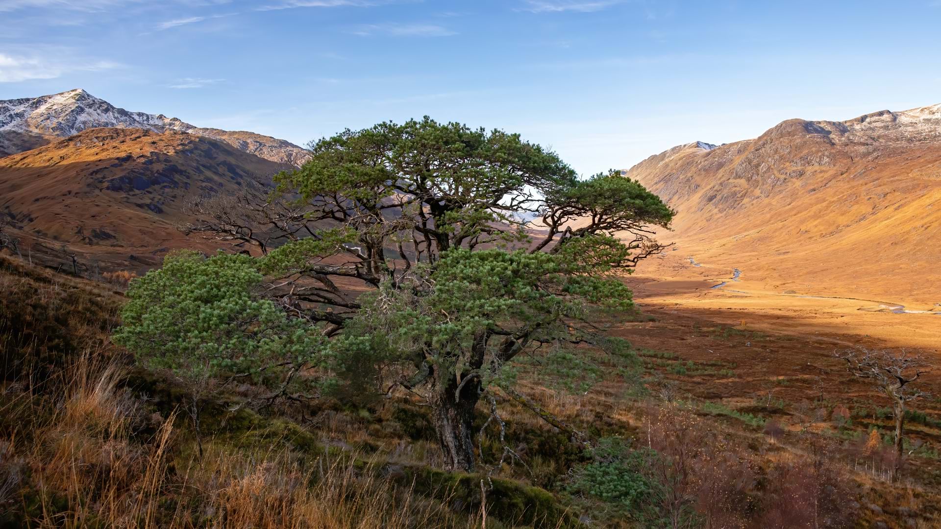
“One of our first deliverables was to digitally map the extent, quality, and accessibility of our green space,” Gasiorowski said.
The GIS team discovered that 52 percent of NHS Scotland’s real estate holdings were natural areas, from small patches of lawn to large, forested estates. Of the total area of 1,572 hectares, 825 acres consist of trees, grass, scrubland, and agricultural land—almost twice the size of the country’s famed Loch Lomond nature reserve.
With green spaces now identified, the agency aims to enhance areas near health-care facilities to promote nature access, food production, and active living.
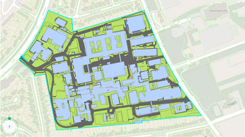
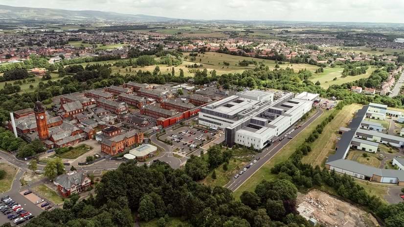
Previously, regional boards focused on buildings that housed patients and staff, using computer-aided design (CAD) drawings or paper floorplans. Many didn’t know their property boundaries or total land holdings. Gasiorowski’s team partnered with 22 national estate organizations to compile property lists, converting both digital and paper records into GIS. They verified addresses and mapped details including land size, parking, bicycle storage, electric vehicle charging stations, gardens, paths, and roads.
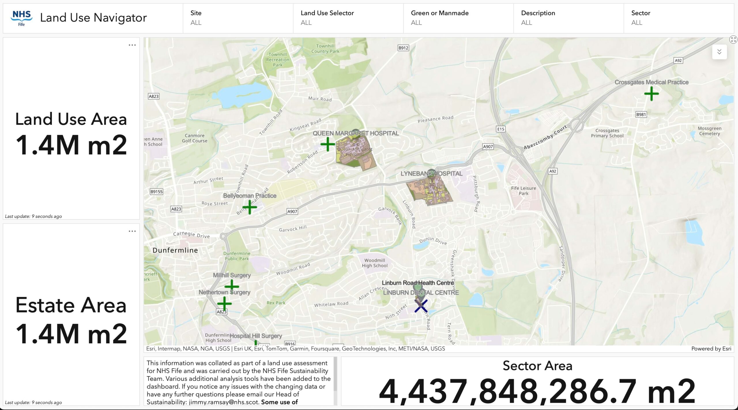
By managing and visualizing all real estate data in GIS, the team ensures a holistic understanding of built and natural environments. To make the real estate data widely accessible, they created an interactive mapping app and dashboard to allow Public Health Scotland staff and the regional boards to see the locations of green corridors and active travel networks to support planning and decision-making. The Fife regional board collated its holdings in a Land Use Navigator to allow anyone to explore its land and buildings.
“There’s always been that understanding of the therapeutic benefits of greenspaces, but now, we have the data to support green health initiatives—adding courtyards and green roofs accessible to patients,” Gasiorowski said.
Gasiorowski and his team also made the greenspace assessment available to the public.
“Public Health Scotland is a public resource, and this land should be used for public good where possible,” he said.
The information has sparked conversations with organizations and groups across Scotland to reimagine green spaces and unlock public value.
This isn’t the first time that Public Health Scotland has used GIS to develop interactive map-based web apps that make public health information more accessible. Using the Sweet for ArcGIS web application from Esri UK, the agency gathered the boundaries for all 942 general practitioners (GPs) offices in Scotland.
Moving forward, there are a number of ways GIS can continue to deepen understanding for the public and health organizations in Scotland.
“I had a discussion with someone on one of our mental health teams about how we can help with suicide reporting,” Gasiorowski said. “That reporting is not being done in a spatial manner currently, and sadly a lot of insight is probably being missed.”
As the connection between human health and environmental health becomes more apparent, Public Health Scotland’s green space data is being used for biodiversity studies and sustainability planning.
Biodiversity UK, an organization working to reverse the loss of species due to land development, has worked with Public Health Scotland on habitat surveys for some of the biggest estates.
The work is similar to a bold new initiative from England, dubbed Biodiversity Net Gain (BNG), which requires land developers to create 10 percent more biodiversity than was there before the land was developed.
“Only the Netherlands across Europe is further ahead in understanding the biodiversity side of their holdings, but there’s a lot more that we need to do,” Gasiorowski said.
Gasiorowski and his team are continually working to update the data and collaborate across agencies.
“We want this to become a living, breathing dataset, with ongoing communication with 22 organizations,” he said. “For this long-term work, it’s key that we have processes in place to know when changes to their estates take place.”
Learn more about how GIS is used to improve care in public health and restore health to the natural world.