


April 23, 2024 |
Sunny Fleming | Conservation
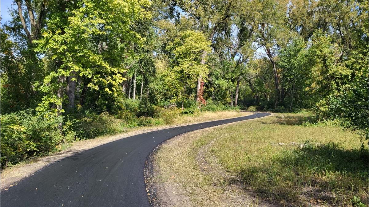
The trails crisscrossing Des Moines, Iowa, stand out as one of the city’s most popular amenities. More than 2.3 million trips were logged on the city’s paved trailways by cyclists, runners, and walkers in 2023.
However, limited resources have made maintaining the trail network difficult. When park planner and landscape architect Colby Fangman joined the City of Des Moines Parks and Recreation Department in 2017, he faced a daunting backlog of deferred maintenance needing to be documented and corrected.
“We only have one full-time employee and one seasonal employee taking care of 70 miles of trails,” Fangman said. “Our trail system got way over its skis in terms of maintenance, staffing, and financial allocation.”
Routine upkeep (such as mowing, tree-trimming, and trash removal) consumed most of the days for the two trail operators. They didn’t have time to fix problems, such as potholes or erosion, so most issues compounded and worsened.
“We had so many issues,” Fangman said. “We had no money. And our city manager is a finance person, so we were clearly instructed to: Prove you have issues. Prove what it’s going to cost. Prove you have a plan to address it.”
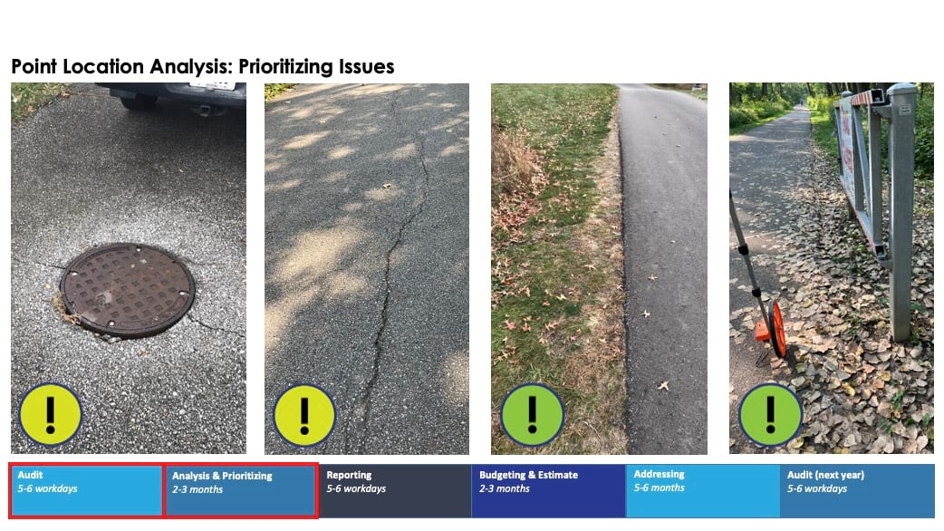
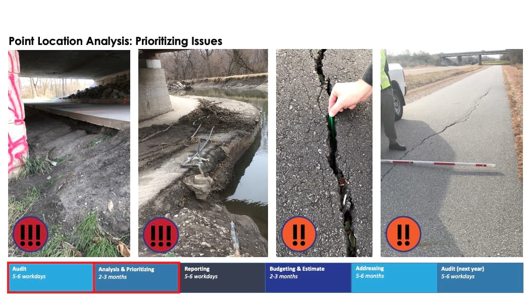
The backlog of park projects ranged from minor noncompliance issues to major safety hazards. Fangman and his colleague Derek Hansen, a fellow park planner, needed to show where each problem existed and prioritize areas of concern. They used geographic information system (GIS) software to guide their approach.
Fixing Des Moines’s damaged trails started with making a map. In 2019, Fangman and Hansen developed a new point location audit and analysis strategy to capture maintenance concerns and display them geographically.
As part of their new strategy, they conduct an audit every fall to gain a baseline understanding of trail conditions. The park planners scour each mile of concrete and asphalt, noting liabilities such as cracks, unstable embankments, and rotting trees.
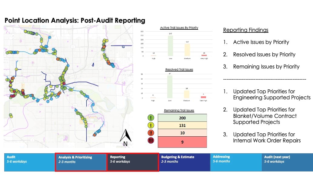
Fangman and Hansen use a GIS data collection app to record the precise location and details of each issue. Then, the results are presented on a shared trails audit web map, which categorizes issue points by level of liability and repair status.

After each yearly audit, they analyze the data to determine where repairs are most critical. This enables limited resources to be wisely spent.
In 2023, supported by their analysis and dynamic web map, park planners presented city leadership with a proposal for additional trail maintenance funding. The proposal outlined a $3.9 million increase over 10 years to support trail operations and capital repairs.
When Fangman and Hansen presented the proposal to the city manager, a bill had just been passed to reduce spending by cities and counties across Iowa. Despite the new financial constraints, city leaders approved the Parks and Recreation Department’s proposed budget increase for trails. “We were able to prove the value of applying more funding to address all these liabilities,” Fangman said.
Clear data and visuals, supported by community feedback, helped persuade city leadership.
Des Moines residents consider the city’s 22 trails a beloved and vital commodity—one that provides community wellness and connectivity. In addition to gauging trail usage, the City of Des Moines conducts resident satisfaction surveys every two to three years. Consistently, residents rank trails as a top priority.
The new trail maintenance budget not only meets community needs, it also mitigates risks.
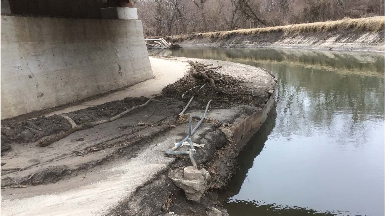
Trails pose an inherent liability to cities. People have 24-hour access to trailways, and maintenance concerns raise the potential for harm. Improperly placed pylons may restrict access for users with disabilities. Uneven surfaces may cause a cyclist to wreck. Flooding can knock over fencing and undermine trail stability.
As Fangman and Hansen audit Des Moines trails, they assign priority levels to each issue. These levels factor in liability. “Derek and I triage our issues based on health, safety, and welfare,” Fangman said. “What is the greatest risk to the user? This is also inherently the greatest risk to the city in terms of litigation.”
The highest-priority problems demand immediate mitigative action. Failure to do so could put trail users and staff at risk. These issues include cracks or gaps in pavement large enough to catch bike tires, dead trees that pose a hazard of falling, and unstable soil that could cause the trail to collapse.
Typically, repairs of this magnitude require assistance from the city’s engineering department, the public works department, or contractors. Since the trail audit web map is shared across city departments, engineers or other city employees can quickly reference the data park planners collected.
“It allows others to see what we’ve seen, so we can work together towards addressing it,” Fangman said.
Nature finds new ways to challenge the park planners with each turn of seasons. After three years of drought, Fangman and Hansen saw a huge spike in issues due to soil weakening.
“We jumped from 400 to 900 active trail issues between our 2022 and 2023 audits,” said Hansen. This equates to about $5 million in new damages in a single year.
Luckily, the point audit and analysis approach treats the trail maintenance program as a living system. The trail audit web map updates in real time, and priorities can be adjusted based on resident feedback or other contextual factors.
The park planners were rewarded with another financial windfall last year, following their increased budget proposal to city leaders.
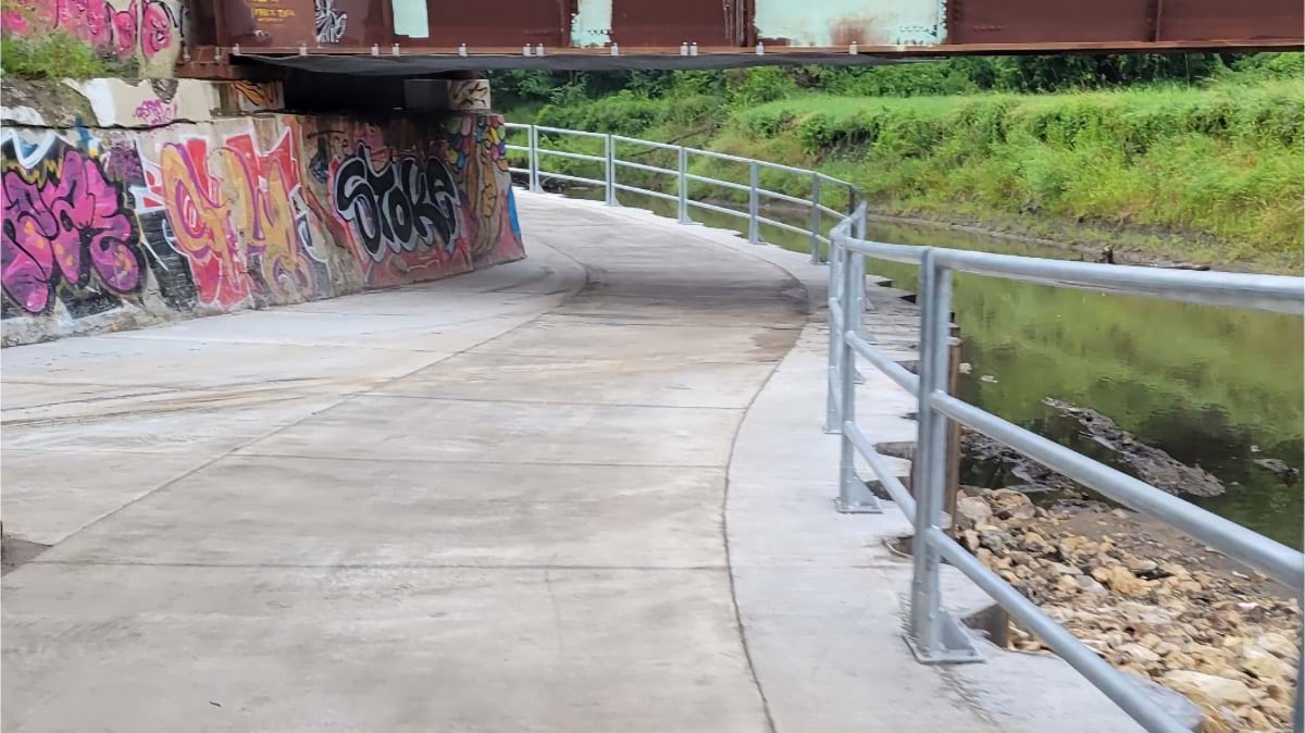
“We also got a one time, one million-dollar allocation from the city’s American Rescue Plan funds,” said Fangman. “The city manager told our department, ‘Take a million and pick off two of your worst corridors.’”
Thanks to careful data collection and GIS, Fangman and Hansen knew exactly which trails to target. Construction began in the Spring of 2024.
Learn how cities take a geospatial approach to outdoor recreation with GIS.