
July 30, 2024 | Dawn Wright | Conservation
February 24, 2025
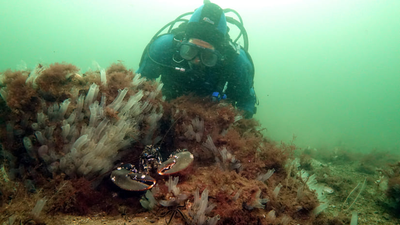
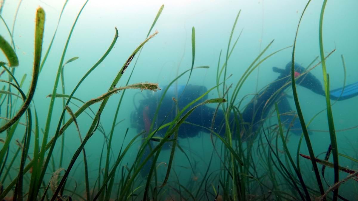
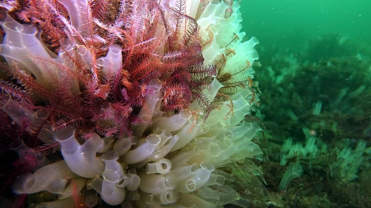
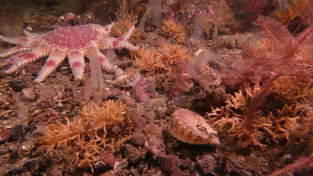
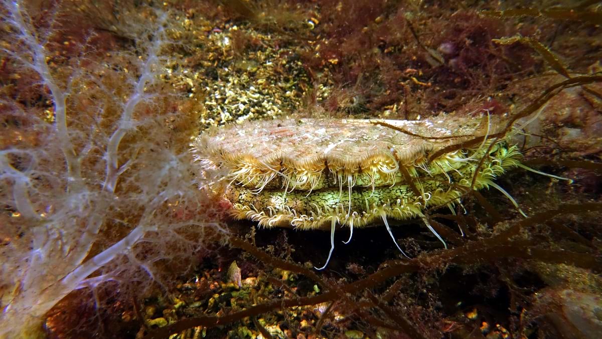
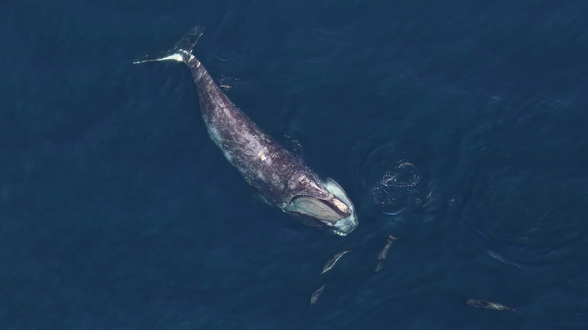
The chilly Scottish waters off the Isle of Arran are coming back to life. Colorful sea creatures flourish, seagrass meadows sway with the currents, and shellfish populations thrive.
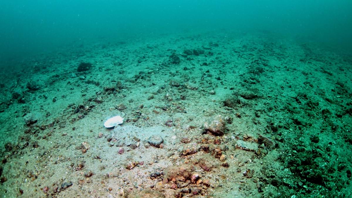
Three decades ago, the seabed had been badly damaged—stripped of its vitality by destructive fishing practices. This comeback showcases the impact of grassroots action combined with cutting-edge science.
It’s a comeback that started when Howard Wood was diving in the seas around Arran with his friend Don MacNeish. They noticed devastating changes to the once-thriving fisheries and their local dive sites. The culprit? Extensive commercial bottom dredging and trawling—unsustainable fishing practices of dragging heavy metal dredges and large nets along the seafloor.
At the time, a local fisherman explained to Wood the environmental dangers of trawling.
“[The fisherman] was against dredging and trawling the seabed because it would ruin ‘the crust’,” Wood explained. “The crust is the top layer of the seafloor that supports smaller marine creatures and juvenile fish.”
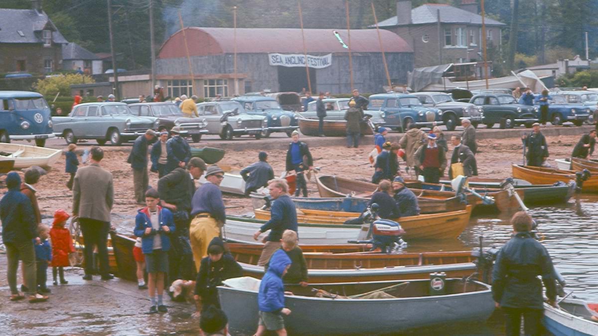
As trawling expanded, marine life declined. Local fishermen saw their catches plummet, affecting the entire community, which relied on the ocean for both economic and social well-being. By 1994, catches were down by 96 percent.
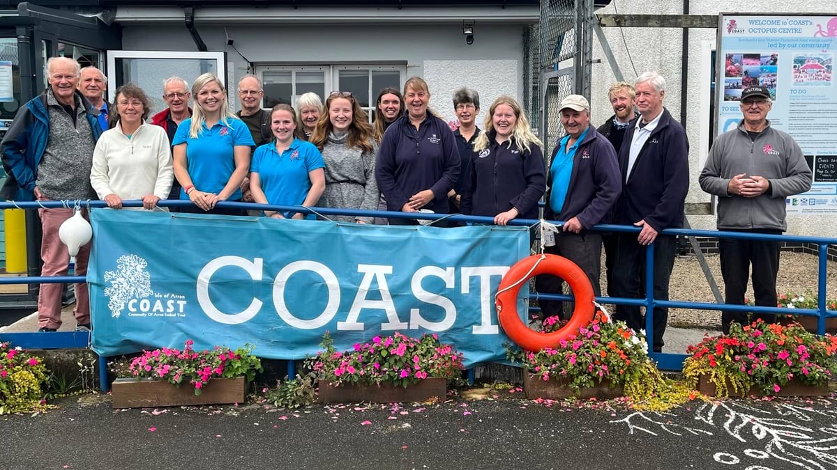
Recognizing the urgent need to reverse the decline of Arran’s marine habitats, Wood and MacNeish combined their personal savings and founded Community of Arran Seabed Trust (COAST) in 1995. COAST is a group of volunteer activists committed to protecting and recovering the local marine environment.
COAST was built on two guiding principles: engaging the local community to drive change, and leveraging research and technology to monitor marine health.
“The seas are a public asset,” Wood said. “They should be managed for the benefit of the country, not specific vested interests.”
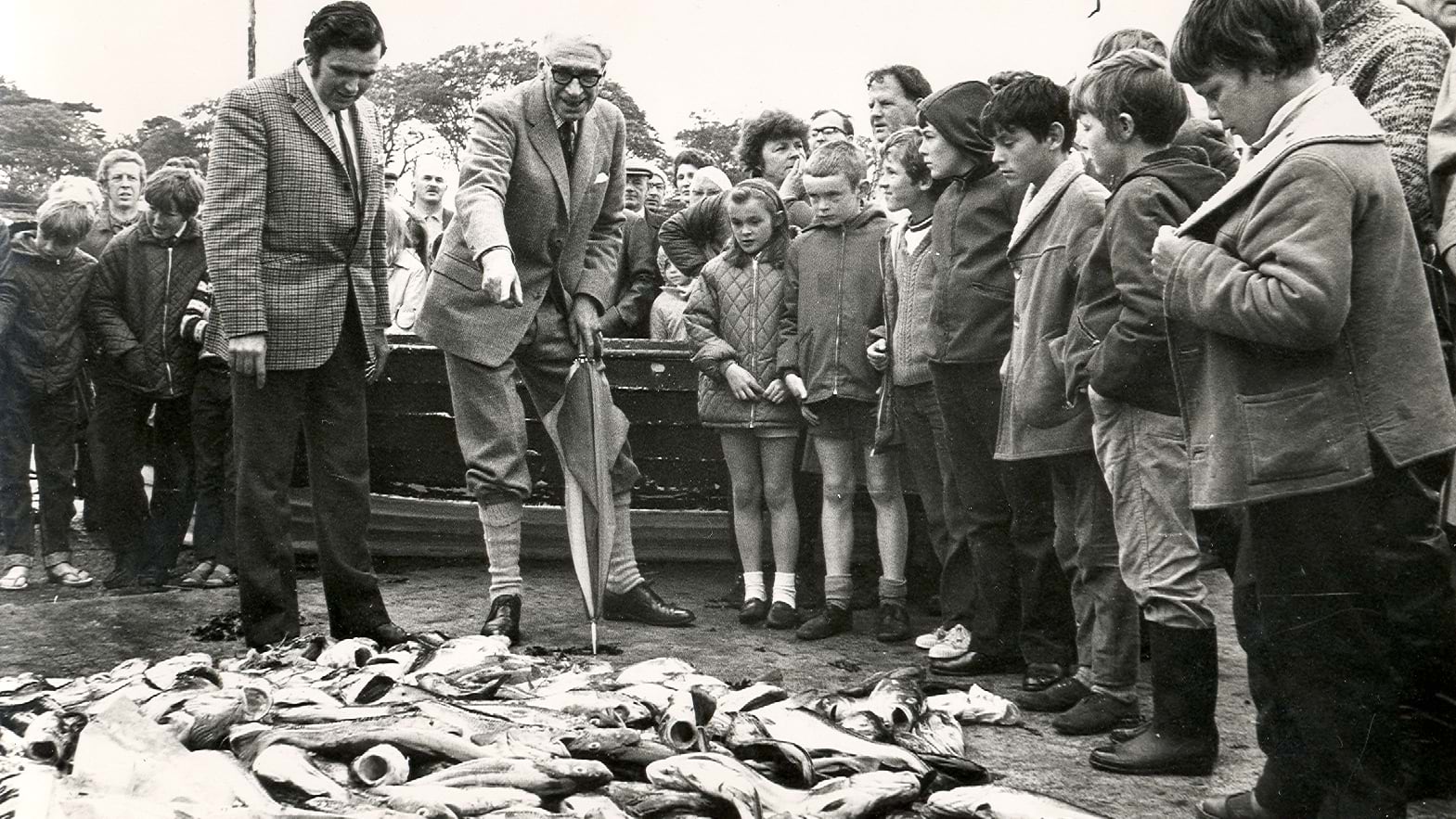
To engage the community, Wood started collecting vintage photos from fishing festivals and competitions—illustrations of the decline marine life had suffered over the years. When people saw how much had been lost, it made the need for conservation impossible to ignore.
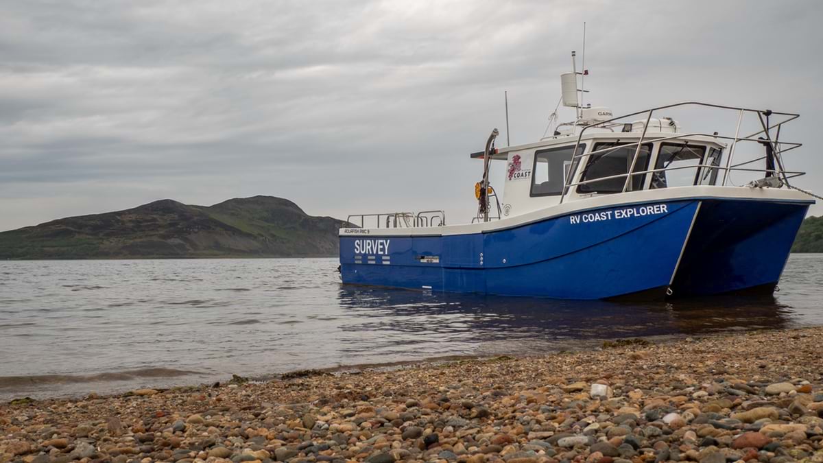
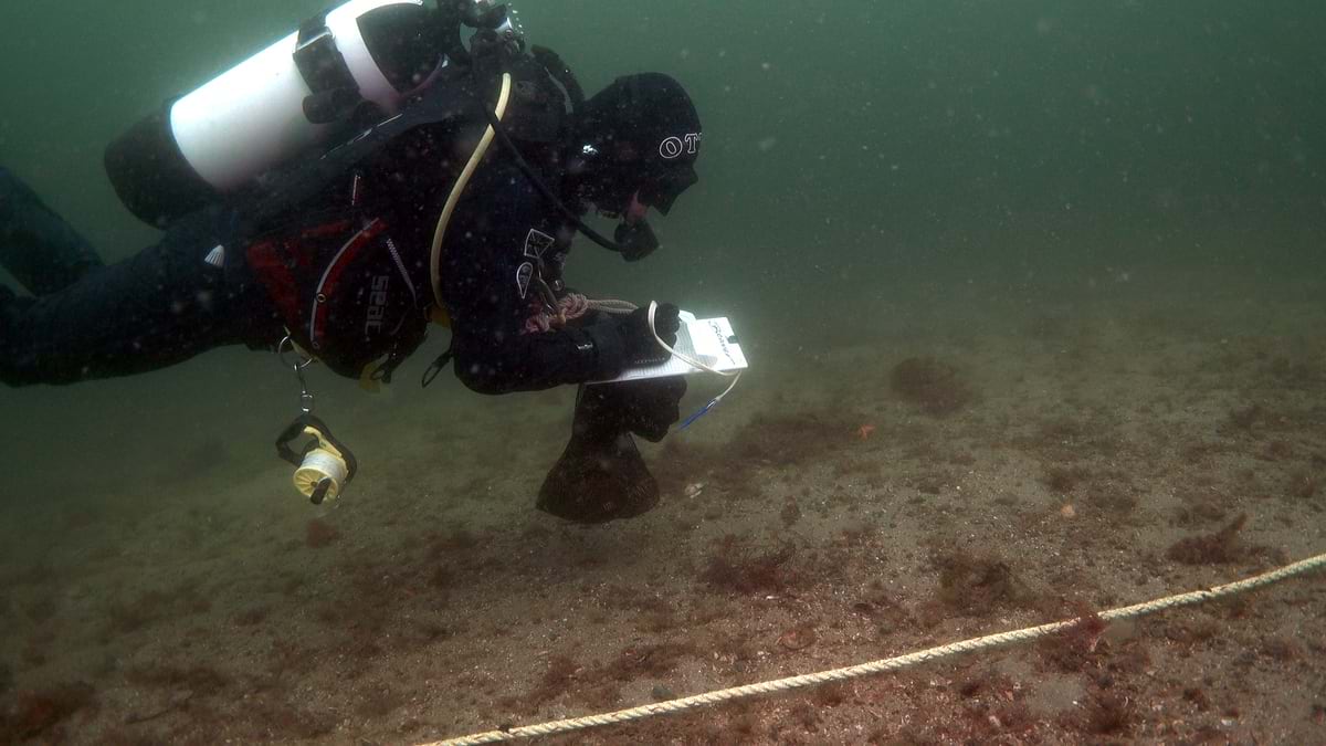
COAST’s success relied heavily on local divers and snorkelers. The volunteers were trained to identify marine species, map seagrass meadows, capture vivid images of the seabed, record species sightings, and monitor key species as important indicators of ecosystem health.
This foundational work provided vital data, showing the extent of marine decline and helping the organization’s leaders advocate for protected areas.
From its earliest days, COAST recognized the importance of scientific evidence in achieving its conservation goals. Through partnerships with institutions like the University of York, COAST teams began monitoring the effectiveness of their conservation efforts and tracking ecological changes over time.
They used interactive maps made with geographic information system (GIS) technology to monitor seagrass and other habitats and establish baseline data.
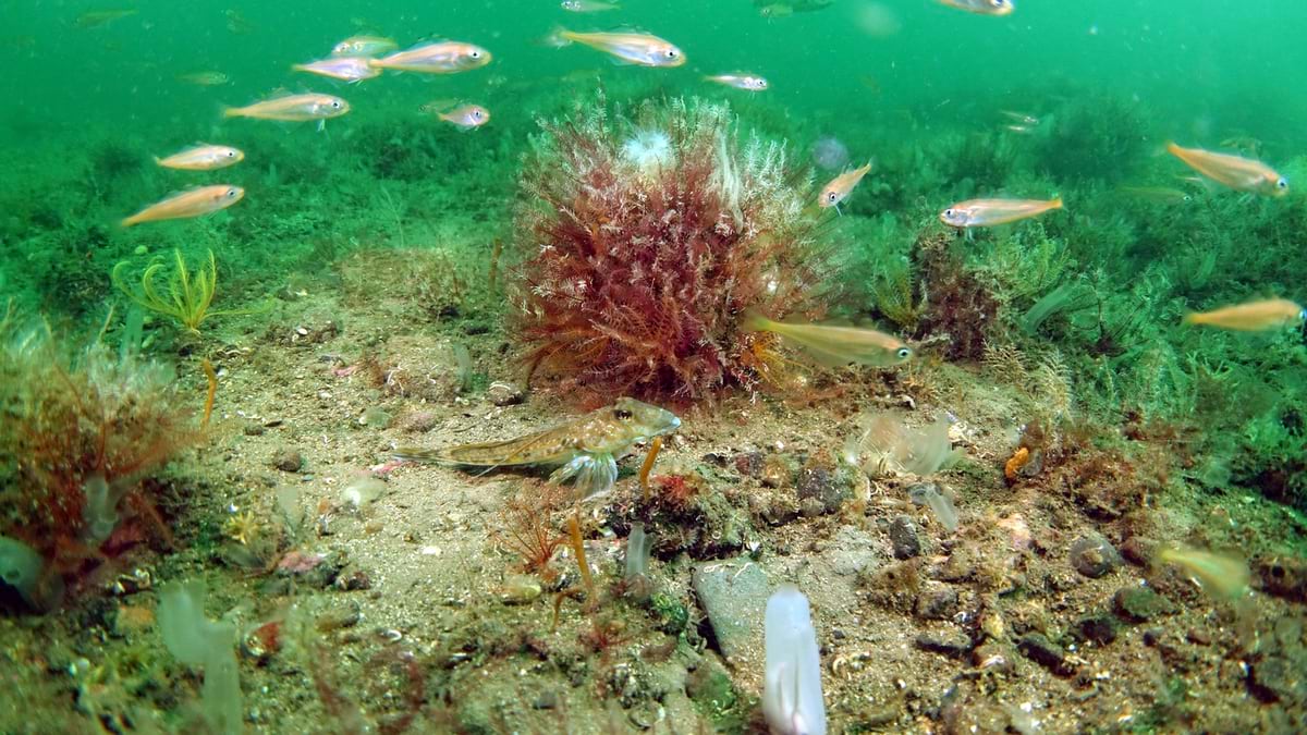
Following this approach, scientists observed long-term shifts in the ecosystem. The results were remarkable. Since the introduction of fisheries management measures, species like king scallops have surged in number. Scallop populations increased tenfold in some areas, and once-barren seabed now teams with life.
“In the no take zone and marine protected area around Arran, we’re seeing indications of the crust reestablish itself, these positive changes happening within a decade, and in some areas, even within four or five years,” Wood said.
This data has been vital for convincing policymakers that marine protection delivers tangible benefits. COAST’s work also aligns with global initiatives, such as the 2024 United Nation’s biodiversity framework that includes protecting 30 percent of the planet’s land and ocean by 2030.
Beyond the Scottish coast, COAST’s efforts serve as a road map for other communities. It’s proof that local advocacy, when backed by science, can create long-term change.
To ensure broad support for marine conservation, COAST has invested in educational outreach. In collaboration with Esri UK, COAST uses GIS maps to tell the story of seabed recovery.
The maps reveal a visual timeline of biodiversity restoration, bringing Scotland’s underwater world to life for people of all ages.
“Many people have never seen what’s beneath Scotland’s dark waters,” said Lucy Kay, COAST’s marine protected area project officer. “But GIS lets them connect with the ocean in new ways.”
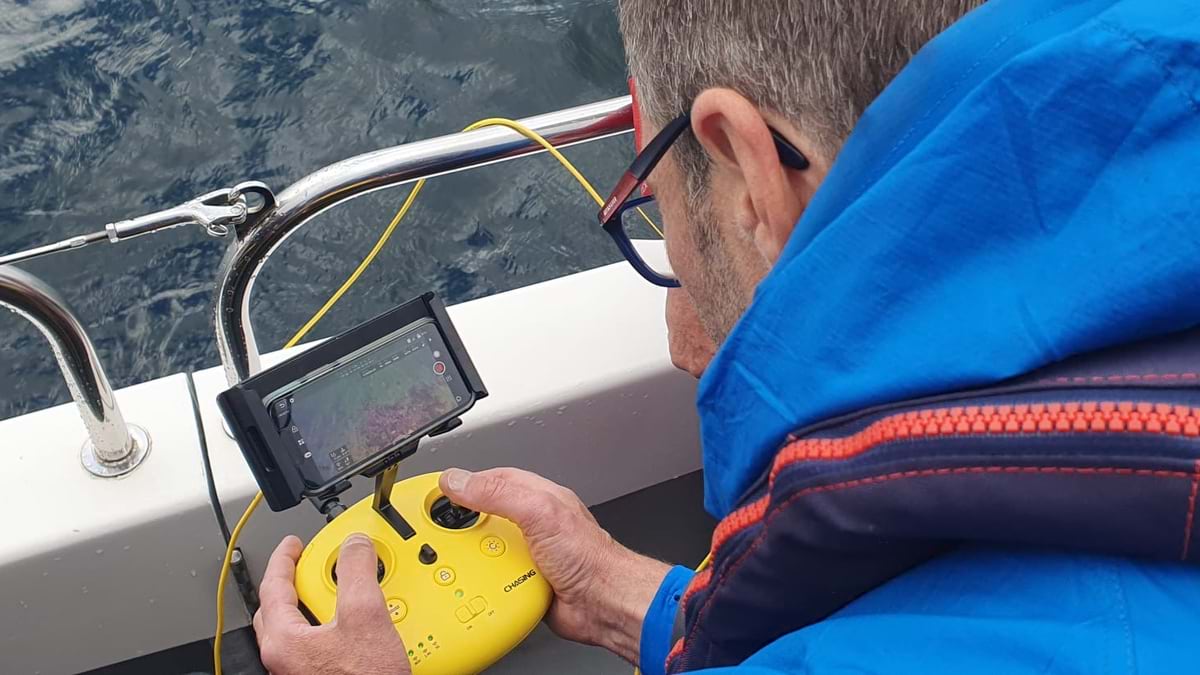
Through its school programs and citizen science initiatives, COAST brings the ocean directly to participants using remotely operated vehicles, allowing them to explore underwater habitats and witness marine life in real time from the comfort of dry land. At the COAST Discovery, visitors can observe live underwater video and learn about marine ecosystems through hands-on workshops and exhibits. These initiatives not only educate but also inspire action, helping more people understand the importance of protecting marine habitats.
The contributions of local divers and volunteers have been crucial in collecting the data and imagery that supports COAST’s campaigns. These people’s efforts have helped revitalize marine life and attract more visitors to Arran, boosting the region’s economy.
COAST’s success shows that when community determination is backed by data, lasting change is possible.
Looking ahead, COAST plans to expand its research efforts, involve more community members, and strengthen educational outreach. With a new visitor center offering citizen science projects, volunteer opportunities, and workshops, the legacy of the diver advocates continues to grow—inspiring a new generation to protect our oceans.
Learn more about how GIS helps maintain healthy marine ecosystems.