April 23, 2021 | Jack Dangermond | Resilience
May 10, 2021
The new Biden Administration report, Conserving and Restoring America the Beautiful, is a welcome answer to the clarion call of several emerging global movements, chief among them Half Earth, to stop the rapid loss of species and improve resiliency to climate change by setting aside more of the Earth’s surface for nature before it’s too late. The president proposes preserving 30 percent of US land and oceans by 2030 (30×30) through “a ten-year locally led campaign to conserve and restore the lands and waters upon which we all depend, and that bind us together.”
As a scientist, I’m excited the Biden Administration recognizes the need for data and science to shape decisions and actions. As an oceanographer and geographer, I’m also excited because the most critical part of the mission—deciding where to conserve—is one for which we have the technology and approach to support. That specificity can be found in precision conservation, a relatively new methodology that is redefining how landscape and seascape conservation should be approached with smart maps ensuring that conservation projects are of the right size, implemented at the right place, at the right time, and at the right scale.
As the 30×30 directive ushers in a new era of needing to work with nature rather than against it, we must reevaluate lands and seas with an eye on biodiversity, carbon emissions and other environmental factors. We also must be mindful of issues of environmental justice as well as the interests of Indigenous populations, economic health and local communities. To accomplish this, we can borrow from the fields and practices of precision agriculture and precision public health and advance on precision conservation. These precision approaches are made possible by the range of data collection, management and analysis supported by a modern geographic information system (or GIS), which helps answer questions about the balance between natural systems and human-made systems.

Knowledge about people, place, and planet enabled by GIS will be crucial to ensure 30×30 actions are environmentally and socially intelligent.
During the coronavirus pandemic, we have seen how essential science, public policy, and technology can be in tackling complex challenges to advance the greater good. We have learned that interactive maps and spatial analysis can provide greater awareness and context and that sharing of data on a dynamic map allows diverse groups to act together with purpose.
As local and national leaders respond to Biden’s “America the Beautiful” report, they will need precision conservation to meet the capabilities and intensity this moment demands.
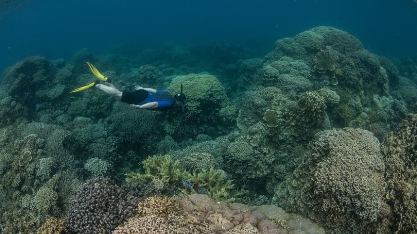
The location intelligence that can be applied through precision conservation can reveal pathways to smart conservation. For instance, 30×30 goals aim to set aside last-chance intact ecosystems before they are harmed. Working with a modern geographic information system, scientists can quantify available places, qualify an area’s ability to enhance biodiversity or harden climate resilience, and provide critical context to help us understand the role of local and regional ecosystems in the bigger picture.
Just as the agriculture and public health sectors have been using maps and modelling from a geographic information system for better outcomes, the ambitious objectives of the 30×30 program can be guided by GIS technology, which helps us look across space and time to unlock new knowledge about nature and its ecosystems.
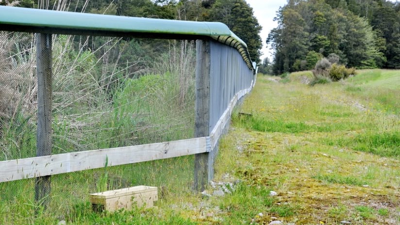
Advanced location intelligence from GIS is already empowering a broad range of conservation initiatives:
In the US:
Today, entirely new kinds of maps and data visualizations are made possible by the instrumentation of natural and human-made systems and the integration of many types of data. This enables radically enhanced contextual awareness, which lets us understand and optimize issues and entire complex systems.
As we’ve seen with the pandemic and as we’re discovering with issues like climate change and sustainability, this greater contextual awareness is critical to our decision-making and problem-solving. Importantly, GIS is the technology of contextual analysis. GIS not only integrates and analyzes diverse data sets, but it also brings the physical world, including people and place, into the core of that analysis, enabling us to see the interconnectedness of our many systems.
The Biden Administration’s 30×30 effort presents an unprecedented opportunity to unlock and integrate data sets which describe the natural world and which will enable a decision support system for preserving our country’s rich biodiversity.
By applying nature-based conservation strategies, 30×30 aims to slow and reverse the environmental degradation that has led to species decline and extinction. This idea of designing with nature has long been a guiding focus of GIS, a technology that works by layering large varieties of data on an interactive map for deeper understanding.
GIS can capture a wealth of expert knowledge in a single place: a hydrologist’s understanding of stream flow; a geologist’s understanding of earth structure and process; a botanist’s knowledge of plant physiology and classification; an oceanographer’s understanding of fish migrations and hurricanes; a policymaker’s understanding of implications; and the domain expertise of many more specialists and generalists.
The technology can also integrate with advancements in earth observation and artificial intelligence, adding more regular and precise measurements and new monitoring capabilities. Drones, for example, provide flexibility, new perspectives, and greater sensing capacity. And anyone can contribute – with GIS workflows, mobile phones can be used to capture data and share knowledge about a place.
Sharing maps, models, and GIS-based analysis within a 30×30 decision-support system will empower stakeholders to accelerate action and ensure sustainable impacts.
In short, we have the mapping and analysis tools we need – and are ready to support our leaders as they take on this grand challenge.
To discover more about conservation and geographic information systems technology, visit: https://www.esri.com/en-us/industries/sustainability/conservation/overview