
November 12, 2024

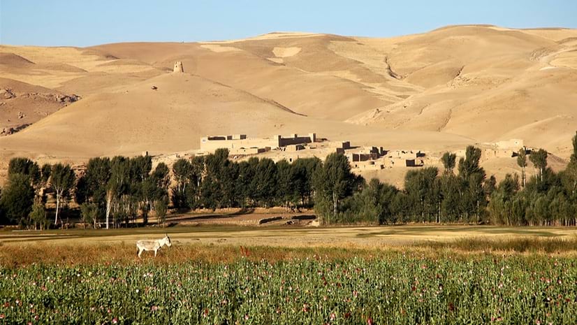
When the Taliban took control of Afghanistan in August 2021, one of its first policies was to ban poppy cultivation. The halt in a trade so intertwined with the country’s economy was bound to affect its most vulnerable people.
Richard Brittan, managing director of the geospatial analysis firm Alcis, got to work creating a clear picture of the humanitarian impact. Using high-resolution satellite imagery and geographic information system (GIS) technology, Alcis’s analysis could tell the stories of human suffering and political instability to support aid efforts. Through maps and data, analysts could monitor key factors including changes in crops and the movement of migrants to Europe.
“We’re in this rapidly evolving space where the use of spatial tools and open-source intelligence shows the dynamics of what’s going on,” Brittan said. “As the volume and resolution of spatial data has increased, we can get really powerful insights.”
Alcis has 20 years of experience in Afghanistan and has worked in many other complex, fragile regions of the world—collecting data, delivering information products, and consulting on policy. Its clients include national governments, international agencies, banks, private businesses, and the United Nations.
In places such as Afghanistan, where the chaos of conflict forces frequent relocation, it’s difficult to find an accurate map of where people live. Since 2017, more than 1.5 million Afghans have been internally displaced. Over the past 50 years, 7 million Afghans have migrated to other countries.
Alcis uses GIS, imagery, and input from residents to map the current conditions impacting the people and economies of countries in conflict or recovering from it.
GIS provides a portrait of the situation, with workflows to reveal where people are vulnerable and who has advantages. The formula considers factors including population density, crop health, who farms higher-value orchards and vineyards, number of livestock, whether lights are on at night, the distance to roads and markets, and access to healthcare or education.
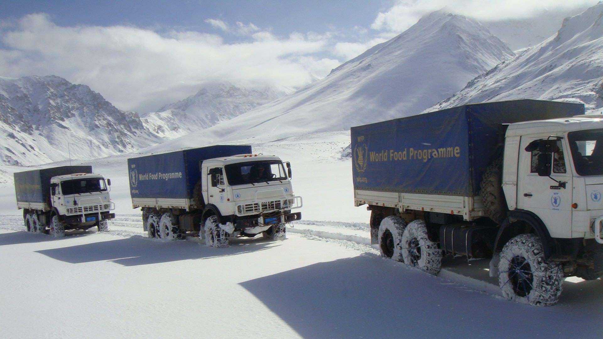
With this information, aid organizations can see where to respond and learn who needs the most assistance. Alcis delivers insights to humanitarian groups such as the US Agency for International Development (USAID) and the World Food Programme.
Location-based analysis also revealed interesting trends in Afghanistan’s water usage and poppy production. Water scarcity is a cause for concern in the desert region, with the potential for widespread displacement of people if groundwater is depleted.
Alcis uncovered a trend of farmers using solar-powered pumps to pull water from the aquifer beneath the desert in southwest corner of the country, with more than 100,000 reservoirs popping up since 2022.
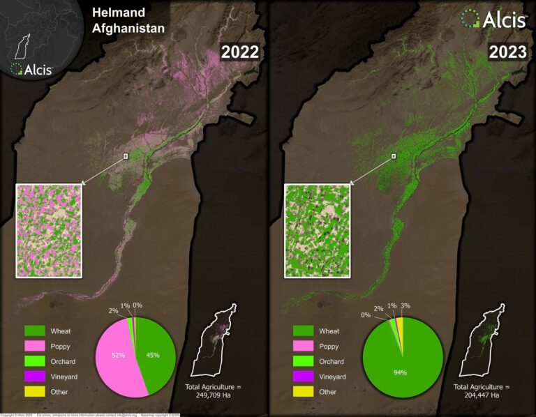
“This is just one house pulling water to irrigate those crops,” Brittan said, pointing at the features on a map. “The dark green is opium poppy; this is wheat.”
Data showed that many of the farmers do not own the land. So, Alcis determined the most marginalized are growing poppy there, pulling water they need now, but without long-term stewardship of the land.
For its water tracking effort, Alcis has been mapping the causes and effects. Drought conditions have lowered the water table, forcing subsistence farmers to dig deeper. Conflicts over water cross over into Iran as well, erupting in violence among those living near the border.
“If there’s canal runoff here, with agricultural productivity increases, you’re going to have downstream consequences on people here,” Brittan said, pointing at the map. “What happens when the water goes dry? Nearly 2 million people will be on the move.”
This ability to surface tipping points for aid organizations helps them anticipate changing needs. When weather patterns change or reports come in about wells going dry, they can see the wider implications that Alcis has mapped.
David Mansfield, a frequent collaborator with Alcis, provided on-the-ground awareness of current conditions in Afghanistan. He conducted more than 300 interviews with farmers, drug producers, and drug traffickers over a span of four months.
This data was added to the map, revealing an 85 percent reduction in poppy production across the country in 2023. Analysis also found the price of opium has increased 10 times since the ban, and many farmers are sitting on an inventory of opium. Alcis calculated a total stockpile of opium that exceeds 13,000 tons.
“From a global war on drugs narrative, there’s an extraordinary story there about curtailing production,” Brittan said. “However, the landowners who have the inventory and are politically connected are the ones who benefit. The land-poor and sharecroppers are missing out. Many of them have left the country already.”

Brittan recently presented a report about the 2024 opium season in Afghanistan to the UK government and other partners. “We went into who are getting away with growing it, who have lost out, and what that means for food security and livelihoods,” Brittan said. “Additionally, we looked into the threat that the drugs being produced would have on drug-consuming nations.”
Alcis’s work in Afghanistan has led to other engagements. “It has helped us prove our methods and take them to other countries,” Brittan said.
The company recently completed an analysis of migration out of Turkey, Libya, and Egypt into Europe. Working on food insecurity in Uganda, in a region where more than 20 percent of the people eat less than one meal a day, Alcis analysts mapped where people live. They then worked to find the most vulnerable among them for distribution of food during the hungry season. Other ongoing work helps health organizations reach people in remote regions with vaccines.
Often this work is foundational. Current and comprehensive data on many regions has not yet been mapped. “The humanitarian and development communities recognize that tens of millions of people are just not on the map,” Brittan said.
Knowing where these people are, especially those who are struggling, is crucial for effectively delivering life-saving aid.
Through access to unique data, harnessing emerging technologies and constant innovation, Alcis provides Geographical Information Services (GIS) that enable better understanding, decisions and outcomes for clients in Disaster and Humanitarian and International Development who are addressing some of the world’s biggest challenges in fragile, war torn and complex environments. Explore a story created with ArcGIS StoryMaps and a report that Alcis produced about poppy production in Afghanistan:
Learn more about how humanitarian organizations apply GIS to analyze, prepare, and deliver effective assistance.


