
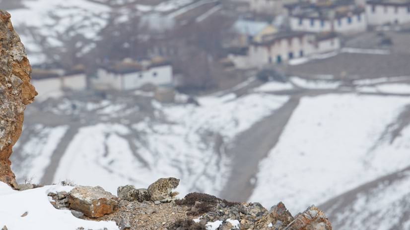
Tracking Ghosts: How Smart Maps Help Protect Solitary and Nomadic Snow Leopards
Using GIS technology, scientists map snow leopard habitats and analyze movements to protect individuals and guide conservation efforts.
Better vision. Better world.
Using GIS technology, scientists map snow leopard habitats and analyze movements to protect individuals and guide conservation efforts.
March 18, 2025
November 19, 2024
January 30, 2025
September 12, 2023
March 11, 2025
January 28, 2025
NASA's extensive satellite network offers free, accessible data on natural disasters, environmental changes, and more.
A 3D digital twin of the University of Kentucky campus integrates buildings, infrastructure, and crews to optimize facility and asset management.