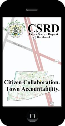
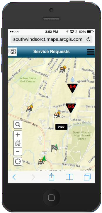
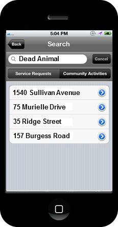
When residents of South Windsor, Connecticut, want to report a damaged stop sign, a dead animal on the road, or a missed trash pickup, they can use the town’s new iOS mobile app developed by Esri to alert the town’s staff to the problem.
And if public works employees spot and fix a pothole, they can use the same app on their town-issued iPhone or iPad to report to their supervisors that the work was completed. The Town of South Windsor Maps Viewer mobile app—also available online via the Citizen Service Request dashboard—is just one of the Esri ArcGIS powered apps South Windsor uses since obtaining an Esri Small Municipal and County Government Enterprise License Agreement (ELA).
The ELA includes unlimited access to many components in the ArcGIS platform, including ArcGIS for Desktop, ArcGIS for Server, and developer tools to build desktop and mobile apps, along with a subscription to ArcGIS Online.
“The real win for us, a community of 26,000, is everything we can dream, we have the tools to build,” said Scott E. Roberts, the town’s chief information officer and director of information technology.
And lately, South Windsor is dreaming big.
The town is modernizing and migrating all its dashboards—Citizen Service Request, Emergency Operations, Snowplowing, and Leaf Collection—from ArcGIS Viewer for Flex to ArcGIS Online maps and apps.
“ArcGIS Online provides us with the ability to collaborate with our staff in remote locations, interact in the field, and close the loop by receiving input from our citizens,” Roberts said. “Without ArcGIS Online, our GIS would remain in the hands of a few people within our buildings. This opens up real possibilities for improving processes now that it’s in the hands of more of our staff.”
A Community that Cares
South Windsor residents have a long history of collaborating and sharing information for the common good.
In the 1630s, the Podunk Indians and English settlers lived peacefully in what is today South Windsor, a town north of Hartford, on the Connecticut River. They dealt with issues such as diseases, land purchases, and conflicts with other Indian tribes.
That spirit of cooperation continues today, though the problems the citizens of South Windsor tackle now are less harrowing.
Handling Citizen Requests
The Citizen Service Request dashboard, available at the town’s website, was developed by the South Windsor Public Works Department two years ago to make it easy for people to report community problems such as missed trash pickup, potholes, defective streetlights, mailbox damage, fallen trees, and illegal dumping.
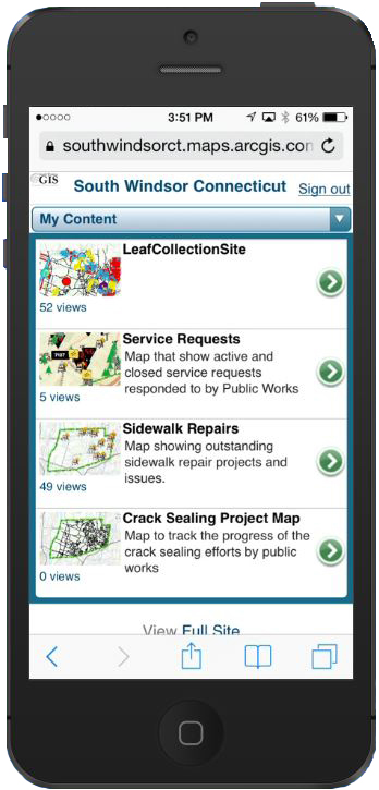
A developer from Esri Professional Services created the iOS app, the Town of South Windsor Maps Viewer (available at the Apple App Store) to make the same type of service requests using an iPhone, iPad, or iPod Touch. Now residents can either use the iOS app or the online dashboard to report an issue. The dashboard was built and deployed using Esri’s ArcGIS for Server.
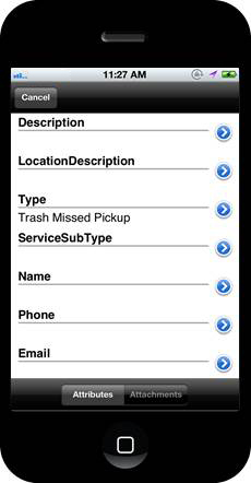
Here is how the iOS app works: Using the GPS capabilities on your device, you capture the location of the issue or problem then, on a simple service request form provide a description of the issue; enter the type of problem such as trash missed pickup; and include your name, phone number, and e-mail. Whether you submit your request via the app or dashboard, you will continue to receive updates about the status of your request until the issue is resolved.
“When a request from the public comes in, it is automatically processed and routed to the appropriate department for response and, if appropriate, a work order is issued,” said Dawn Mulholland, GIS analyst, Town of South Windsor. “At the same time, a receipt is sent back to the sender indicating that we have received the request and are processing it.”
Roberts uses this scenario of a missing stop sign as an example: Driving to work, you notice a stop sign near your house has gone missing. You pull your car over safely to the side of the road and use the Town of South Windsor Maps Viewer app to notify the town officials about the missing sign.
“By the time you get to work, you could have theoretically received a ‘thank you for your request’ e-mail,” Roberts said, adding that, after lunch, another e-mail could arrive saying that the work has been completed. “When you drive home, you could see a brand-new sign up.”
A Python script runs every 15 minutes. It searches for any new requests coming into the dashboard system from citizens or town employees. When one arrives, it appears as an icon on the dashboard. An e-mail with a work order is automatically generated and sent to the appropriate department to vet, and if approved, assigned to a crew. Once the job has been completed, the icon disappears from the dashboard and a final e-mail is sent to the requester, saying the service request was fulfilled.
City administrators like this automated system because it increases accountability by staff, provides them with metrics, and speeds workflow, according to Roberts. Town staff also use the Citizen Service Request dashboard to keep residents informed about projects such as road reconstruction, drainage work, and sewer manhole cover inspections.
Managing Operations with Maps
The town also uses dashboards for snowplowing, leaf collection, and emergency operations. While built with ArcGIS Viewer for Flex two years ago, the dashboards are moving to ArcGIS Online.
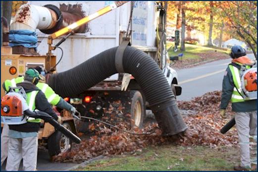
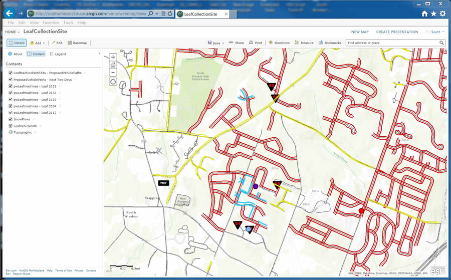
The Leaf Collection dashboard already has made the switch to ArcGIS Online. Streets marked in red show where leaf collection has been completed. Streets in yellow indicate the leaves will be collected over the next two days.
Staff make a PDF map of the dashboard and post the PDF online to remind residents that crews will be by soon to gather leaves. “We’re telling them to get [their leaves] to the curb,” Roberts said.
A Python script running at night also keeps the dashboard map up to date. Streets marked in yellow turn will turn into red after the leaves are picked up.
The town also invested in automatic vehicle location (AVLs) devices. The AVLs, installed in the trucks used by town employees and contract workers, monitor both the location and speed of the leaf collection and snow-plows.
“With our snowplowing and leaf collection dashboards, we can track both sides of the road with the AVL,” Roberts said. “This not only allows us to keep track of the drivers to make sure they are working on the assigned routes, but it also provides us with insight as to the operational progress of various programs. Additionally, the information is archived and available to managers to review in questionable circumstances. For instance, we know when a street was plowed and how fast the driver was going.”
The dashboards are configured to handle public works service requests. At a moment’s notice, they can be switched over to handle emergency operations such as dealing with fallen trees, downed electrical lines, and road closures. Emergency Operations Center commanders can monitor real-time situations and quickly coordinate responses using the town’s emergency operations dashboard as information comes in from first responders in the field.
The town uses Esri’s Collector for ArcGIS app, which works on smartphones or tablets, for collecting data in the field and overlaying the information onto maps accessed from ArcGIS Online. This is valuable for responding to citizens’ requests for service as well as maintenance and emergency situations.
For example, Collector for ArcGIS was used by the fire department to collect data on fire hydrants during an inspection. Crews also used the app to gather data on guide wires, hidden water valves, and other possible impediments to the town’s mowing vehicle. The vehicle operator saw the information on a map and knew where precautions needed to be taken.
Sharing the GIS Wealth
Because of the success South Windsor has had using GIS, the town decided to share its apps with neighboring communities.
“To share information with our surrounding communities is very beneficial to all of us,” Roberts said. “For example, there is no direct highway access into South Windsor, and during an emergency, knowing which roads are passable through neighboring communities is essential to emergency crews and our residents.”
South Windsor created a letter of agreement (LOA) to formalize sharing its applications with other municipalities. “Basically, the one-page LOA says that we will give the applications we develop to any towns interested in implementing a similar program,” says Roberts. “You still need to purchase the Esri licenses and the third-party packages that we have integrated, but we will give you our applications for free. The only stipulation is that if you make any enhancements or changes to the applications, you share those changes with us so that they continue to improve.”
Newtown, south of Hartford, signed the LOA with South Windsor. “Though I changed a few things in the code for our specific workflow and processes, [the applications] were pretty straightforward to implement,” said Steven Birney, Newtown’s GIS software specialist. “There are variables built into the application that allow you to easily make necessary changes.”
Matthew Galligan, South Windsor town manager, was quick to spread the word about the capabilities of the smartphone app and LOA at the recent Connecticut Conference of Municipalities. “At the moment, we have more than 10 LOAs with neighboring towns pending, and the interest in implementing the application continues to increase,” said Galligan. “Even the Capitol Region Council of Government has shown interest in the application because it can be adapted for use by larger agencies as well as smaller municipalities. Basically, it puts us all on the same page.”

