The Search tool in Map Viewer is used to find places on a map. By default, Map Viewer and ArcGIS Instant Apps use the ArcGIS World Geocoding Service locator to find addresses, places, landmarks, points of interest, and XY coordinates worldwide.
But Search can be refined or extended in a variety of ways. You can create a focused version of the World Geocoding Service locator (called a locator view) to return only certain location types, such as airports or other places of interest, meaning your search won’t be bogged down with unhelpful results. You can also constrain locator views by a geographic area, such as a country, state, or city.
Custom locators or locator views can be used across maps and apps and can also be shared publicly or used only within your organization. Note that you must have user privileges to create new items.
In this tip, you will learn to configure a locator view from the ArcGIS World Geocoding Service.
Create a Locator View Item
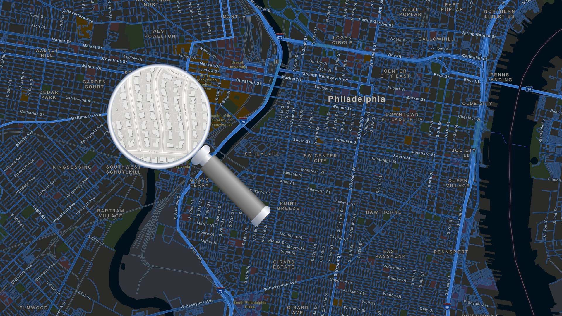
For this tip, you will create a locator view limited to the geographic area of Los Angeles, California.
Step 1: Sign in to your ArcGIS Online account.
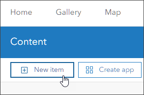
Step 2: Click the Content tab, then select New item.
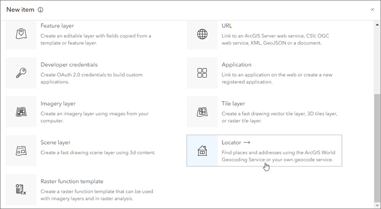
Step 3: Scroll down in the New item pane to find and select Locator.
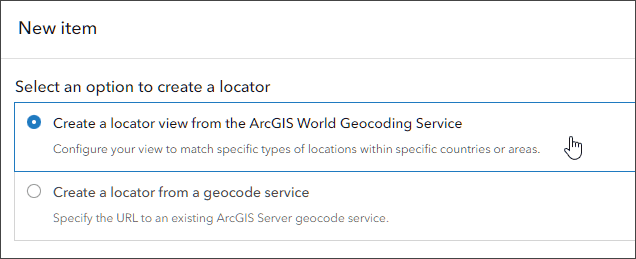
Step 4: Choose Create a locator view from the ArcGIS World Geocoding Service, then click Next.
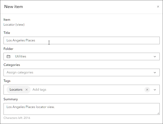
Step 5: Add a title, such as “Los Angeles Places”, and optional information, if desired, to the new Locator (view) item. When finished, click Save.
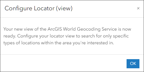
Once you click Save, the new locator item is created. You will be prompted to configure the locator view. Click OK to begin.
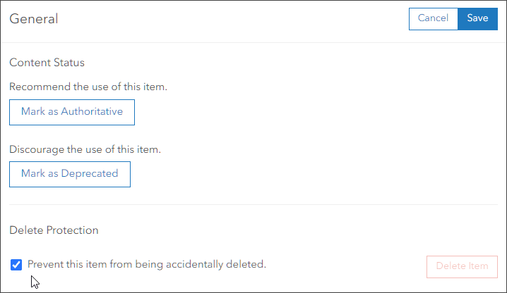
Step 6: The item Settings tab will open. Since you will be using this locator in your organization, it’s a good idea to select Delete Protection in the General section. Click Save to ensure delete protection is set.
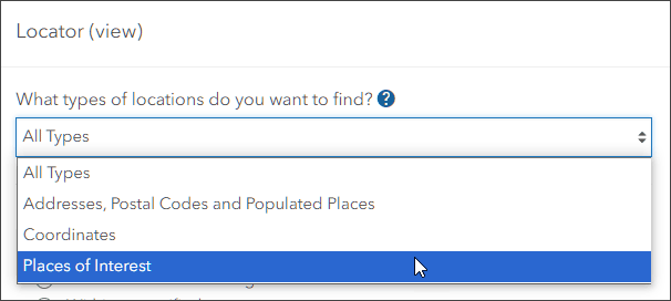
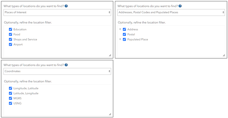
Step 7: Scroll down to the Locator (view) section. From the location type drop-down menu, choose Places of Interest. This limits the results returned by the locator view.
Once chosen, you can refine the location filter as desired. Each location type will offer different options. For this exercise, leave all location options selected.
Step 8: Since the locator view should focus on Los Angeles, in the next section, choose Within a specified area. Then, click Set Area.
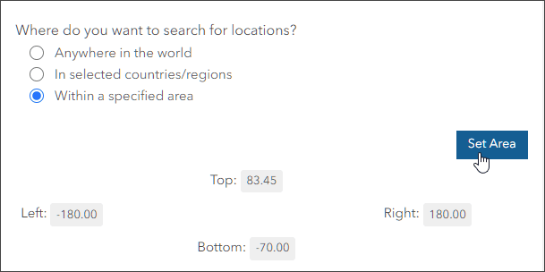
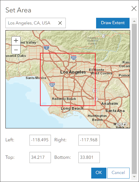
Step 9: Enter a location (in this case Los Angeles, CA, USA) and click the Draw Area button until it reads Draw Extent. Select Draw Extent and redraw the red rectangle to refine the area. When finished, click OK.
Step 10: Review other Locator options in the Settings tab. Click Save when finished.
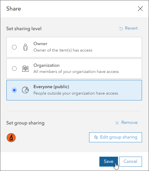
Step 11: In order to use the locator view, it must be shared to your organization. You can also share it publicly if desired.
Note that anonymous users will only have access to locator views that are shared with the public. Locator views that are shared with the organization are only accessible to organization members. Anonymous users will not be able to perform geosearch in any apps using locators that are only shared within an organization.
Since we want to publish a public app that anonymous viewers can use to find places in Los Angeles, the locator will be shared publicly. To set the sharing level, select Overview (to the left of Settings), select the Share button, set the sharing level to Everyone (public), and click Save.
No matter the sharing level, it’s a best practice to complete item page details to properly document the locator view.
Your locator view can now be configured for use in your organization’s maps and apps.
Step 12: Now you will add the newly created locator view item, configured in Step 10, for use in your organization.
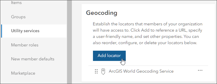
Select the Organization tab, then Settings. From the options on the left, select Utility services and locate the Geocoding section. Click Add locator.
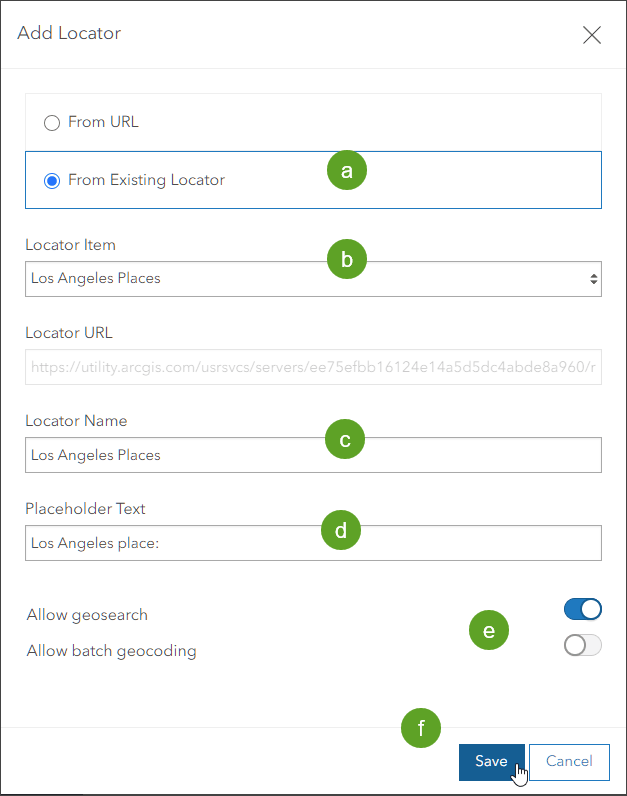
Step 13: In the Add Locator pane, complete the following steps:
(a) Choose From Existing Locator
(b) Select the locator item.
(c) Set the locator name.
(d) Add placeholder text.
(e) Choose the appropriate search settings (Allow geosearch and Allow batch geocoding).
(f) – Click Save when finished.
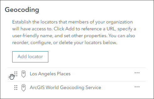
The locator view is now available for use in your organization. In the list at the bottom of the Geocoding section, you can set the order of organization locators via the drag-and-drop function.
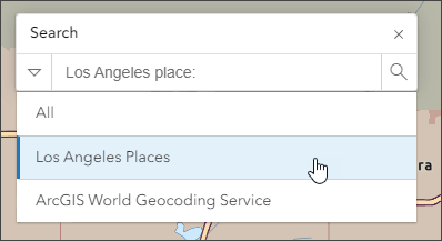
Once configured for your organization, the locator view is available in Map Viewer for all members. If you share the map using your organization URL, anonymous viewers can also see the locator view as a search option.
In Map Viewer, open search, click the locator you want to use, and begin entering text to search within the specified area.
For more information, visit:
