Everyone loves a good story and using ArcGIS StoryMaps is a great way to tell one.
To give you the opportunity to demonstrate your skills using this next generation story builder, you are invited to enter the 2019 StoryMapper of the Year Contest sponsored by Esri. The contest will also give you the chance to give back to your community at the same time.
Classic Esri Story Maps uses templates to combine maps, text, and multimedia content to tell stories that address many topics, including social issues, the environment, agriculture, sports, health, and tourism. Many government organizations create story maps to inform the public about their services and policies. With ArcGIS StoryMaps, users no longer need templates—they can build stories using the new builder block palette.
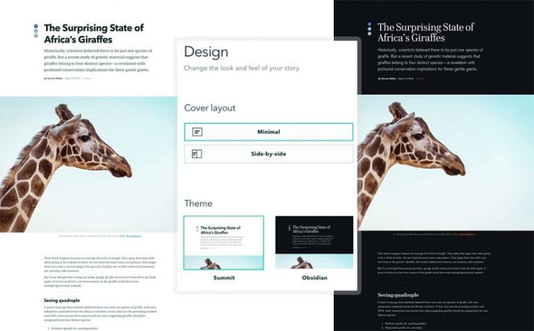
Mapping is also much simpler. Easy-to-create express maps can be made within the story itself. Other major enhancements include one-click design themes that make your content look polished and professional and a responsive design experience that helps your content look beautiful on any mobile device. And it’s now possible to author stories from a tablet.

The StoryMapper of the Year Contest started July 8, 2019, and the deadline for submission is 5:00 p.m. (PDT), September 30, 2019. The contest submissions must be created using ArcGIS StoryMaps, not classic Esri Story Maps apps.
The 2019 contest will work differently than contests in years past. To up the ante, Esri added a monetary prize and community element. When participants submit their entries, they will also describe how they would use a $5,000 donation from Esri to make a positive impact on their communities through storytelling.
For example, they might want to purchase laptops for 7th graders at a local school and host a classroom workshop on GIS or story maps. Or, they could work with a nonprofit to empower the homeless to tell their stories. Participants are encouraged to be creative and think big, as their contest entries will also be judged on the merit of their $5,000 idea.

The Esri StoryMaps team will select the top 25 entries and three guest judges will winnow those down to the top five finalists. Guest judges will include geography and storytelling all-stars Alex Tait, the geographer at National Geographic; Michael Goodchild, professor emeritus and geographer at the University of California, Santa Barbara; and James Fallows, a staff writer for The Atlantic.
Once the top five entries are selected, they will be featured on the StoryMapper of the Year Contest website and starting October 21, 2019, online voting will begin by the public to choose a favorite.
The entrant who gets the most online votes will win the grand prize and become the StoryMapper of the Year. Contest participants are encouraged to invite their friends and followers to vote. Esri will also promote the finalists on esri.com and on the company’s social media sites including on Facebook and Twitter.

The winners will be announced by Esri president Jack Dangermond on November 13, 2019, which is GIS Day, and published on esri.com.
The grand prize winner will receive the following:
- $5,000 for use in partnership with a local government entity, school, or nonprofit organization
- 1 Esri Technical Certification exam voucher valued at US$250
- 1 ArcGIS for Personal Use license valued at US$100
- A certificate of recognition
The four runners-up will each receive $1,000 for use in partnership with a local government entity, school, or nonprofit organization, plus the same voucher, license, and certificate of recognition described above.
“Esri Story Maps has evolved tremendously over the past eight years, but this is our biggest leap forward yet,” said Allen Carroll, program manager for storytelling at Esri. “We’ve taken the feedback provided by our storytelling community to create this next generation storytelling tool and deliver a great new experience for our users. Our goal is to enable tens of thousands of people to create sophisticated, map-driven narratives that rival the New York Times, the Guardian, and the Washington Post.”

To read more about the genesis of ArcGIS StoryMaps and what the new builder offers, read Carroll’s article “Game Changer” in ArcWatch.
To read a tip on how to make your first story map using the new builder, visit Getting Started with ArcGIS StoryMaps. To start creating your own story map, visit ArcGIS StoryMaps.
For more information on classic Esri Story Maps and how to switch to ArcGIS StoryMaps, visit the ArcGIS StoryMaps product road map page.
To learn more about the winners of last year’s competition, read “Story Maps That Amaze” in the September 2018 issue of ArcWatch.
