A Sustainable Ride to Europe and Beyond
Esri's Ian Koeppel discusses Rail Baltica, the high-speed rail project that will link the Baltic States to Europe.
Esri's Ian Koeppel discusses Rail Baltica, the high-speed rail project that will link the Baltic States to Europe.
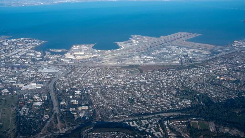
Josephine Young from the San Francisco International Airport details the world-class travel hub's multi-billion dollar technology revamp.
Brevard County has built a comprehensive street viewer in ArcGIS Enterprise to catalogue and maintain the county's infrastructure.
With extreme heat events predicted to increase significantly, will railroads be able to withstand future heat waves?
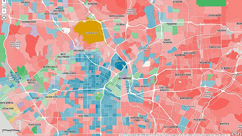
KeAndra Cylear Dodds from LA Metro talks about how mapping and technology are helping reduce inequality of transportation access in LA.
Listen as Anne Shaw, Executive Director at Transport for West Midlands, discusses geospatial technology's role in public transportation.
Listen as Allie Kelly from The Ray talks the role of geospatial technology in planning and designing sustainable roads and highways.
Magdy Mikhail from Agile Assets joins Terry Bills from Esri for an informative webinar on how to incorporate GIS into pavement management.
Walking seems to be the most popular alternative to driving to work alone in Beverly Hills, California. How do your neighbors get to work?
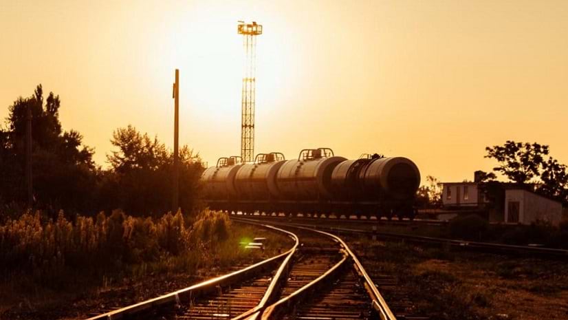
Twenty-five years ago, the Exxon Valdez struck a reef, causing a massive oil spill off Alaska.
The Utah Department of Transportation uses the UPLAN portal it created in ArcGIS Online to share and work with maps.
The Vermont Agency of Transportation used the Collector for ArcGIS app on a smartphone to identify and inspect railroad crossings.