The Dynamic Role of Parks in Our Communities
Explore the role of GIS in parks and how a Tennessee city is using this technology to become America's first National Park City.
Explore the role of GIS in parks and how a Tennessee city is using this technology to become America's first National Park City.
Explore how an Alabama city modernized its sewer system management using ArcGIS and ITpipes inspection software.
In Seguin, Texas, a one-person GIS shop implemented ArcGIS Enterprise and ArcGIS Monitor to track GIS performance.
Public works is responsible for key infrastructure that keeps a community running. Learn how they incorporate equity into their work with GIS.
In the City of Memphis, GIS data is critical to the maintenance of vital infrastructure that prevents flooding and keeps the city flowing.
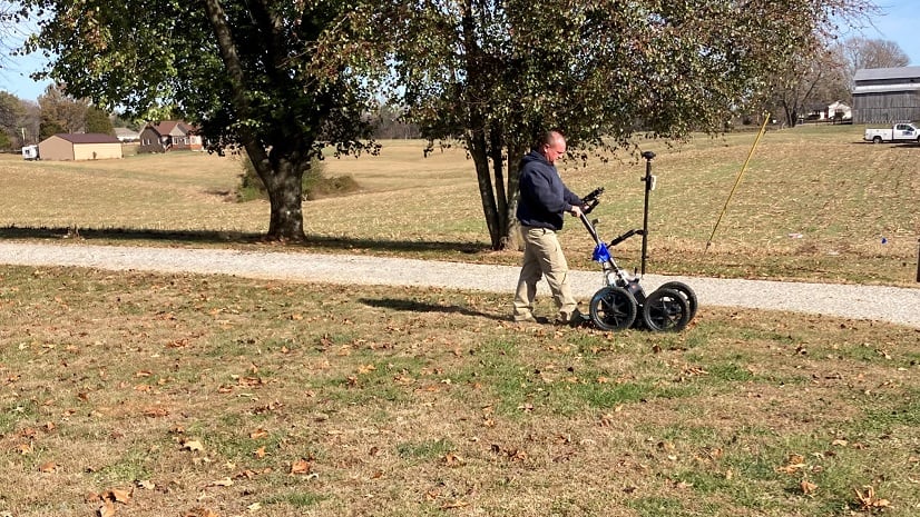
Learn how Warren Water implemented GIS, accurately mapped system assets, and improved efficiency with digital workflows.
A new, custom GIS-based sign management app called GISAssets for the Apple iPad is helping the city of Ames, Iowa.
Thi app was created by the City of Brooklyn Park to encourage people to volunteer to keep hydrants free of snow and ice during the winter months,
Worried that another Snowmageddon will strike? This snowfall forecast map will prepare people for what's next, snow wise, across the US.