oy Scouts use paper maps and compasses for orienteering. But they got to try their hands at testing their spatial skills with web-based and mobile mapping apps at the 2013 National Boy Scout Jamboree.
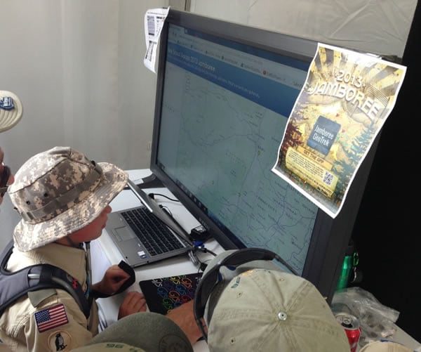
Inside a tent on the grounds of Summit Bechtel Reserve in West Virginia, the Boy Scouts lined up to learn about geospatial technology from Esri, which provided them with the software and services to get started. Several thousand Scouts downloaded the ArcGIS app onto their smartphones. The app helped them helped the Scouts and their leaders get from point A to point B inside the sprawling 10,600-acre venue.
“The use of phones during past Jamborees was not encouraged,” said Sarah Linden, the technology and innovation program manager for BSA Summit Group. She said that with AT&T’s sponsorship and wireless service for this event, that changed with this Jamboree. “This was the first time Scouts could come and download [a mapping app] and use it to navigate the site.”
That turned out to be an excellent idea, given that the property is so vast and the terrain so rugged.
“It was a 45-minute hike between the camping locations and most of the activities,” said Esther Worker, Esri youth community manager. She said that the ArcGIS app, which tapped into AT&T’s wireless service, geolocated where the user was inside The Summit. The user could then reference various Summit maps created specifically for the Jamboree, organized through various hashtags, to see where the venues were located and how to get there.
Scouts could then plan what routes to take as they went about their day, moving to and from places such as the Trax, a high-adventure bicycle motocross (BMX) facility, and The Bows, an archery area “It helped them navigate. It helped them understand the Jamboree world,” Worker said.
Esri developed the ArcGIS app to help users navigate maps, collect and report data, and perform GIS analyses. People with ArcGIS Online for Organizations accounts or trial subscriptions can use the app to work with content in ArcGIS Online. It’s available from Google Play, the Apple App Store, Windows Phone Marketplace, and Amazon Appstore.
“Many Scouts today are using GPS, and many have smartphones, so they can be geoenabled,” Worker said. For the next Jamboree, Esri’s app will include a routing component, she said. Scouts will be able to create routes to destinations, whether it’s to reach a friend’s campsite or hike to one of the four lakes at The Summit for a day of kayaking. “Young people today,” said Worker, “are of the mindset that the technology they use will just work.”
A user-friendly routing component will be a great addition to the app, said Linden, who was recently hired to grow GIS and associated technology at The Summit. “It has to be simple, and it has to be straightforward,” she said.
The Scouts also got the opportunity to use Esri’s web-based ArcGIS Online to explore their hometowns and neighborhoods. Worker said many of the boys typed in their address and found their house and then answered a series of questions about what they saw when they looked at the imagery of their home and neighborhoods. They could switch the basemap from world topographic to satellite imagery. “We asked spatial questions,” said Worker, “such as, ‘What time of the year was the satellite image taken and what time of day? Was it a weekday or weekend? How do we figure that out?’ This warmed up their spatial thinking skills. And then if they were interested, they could add layers to the map like population.”

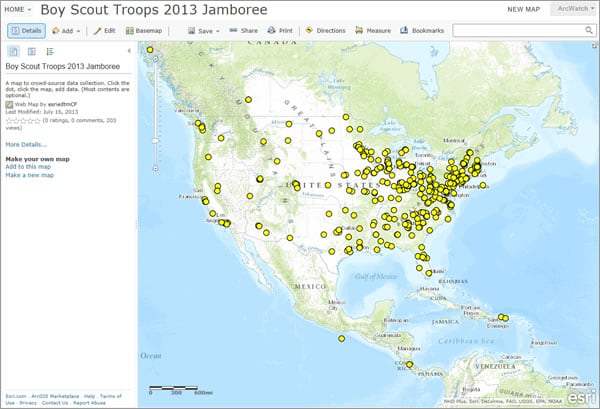
The Scouts also used interactive web mapping apps in ArcGIS Online such as BSA Jamboree MySite to crowdsource data about their Boy Scout troop on a map.
They could place a pin on the map that located their hometown and then open a pop-up window and add information such as their initials or first name, hometown, and troop number. The final result was a map that showed the location of where many of the Boy Scouts came from to attend the Jamboree.
“It was a really great introduction for all those Scouts [on] what GIS can do for them,” said Jim VanOstenbridge, an Esri solution architect.


