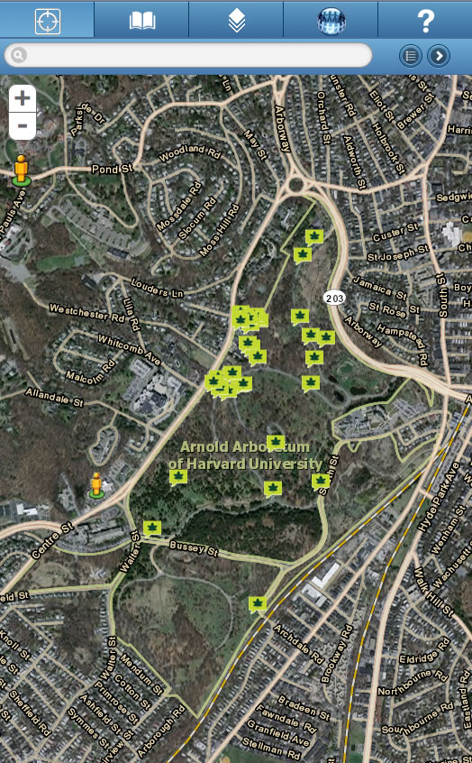
Using a new mobile mapping application developed with ArcGIS, visitors to The Arnold Arboretum of Harvard University can stroll through the lush garden with their smartphones and locate and learn more about the arboretum’s unique botanical collection. By tapping icons on the smartphone screen, they can find trees and plants, such as a full-moon maple in North Woods, the witch hazel near Hemlock Hill, and the Japanese beautyberry in Leventritt Shrub and Vine Garden.
The arboretum launched its Mobile Interactive Map (MIM) in May 2012, making it easier for everyone from scientists to visitors to explore its collections in person or virtually. Designed to educate visitors and assist in research, the application provides detailed information on botanical species, including their natural history and taxonomic placement, using a simple map-based interface.
Since its founding in 1872, the 265-acre Arnold Arboretum in Boston, Massachusetts, has grown botanical species from all over the world to conserve and study. Today, the arboretum cultivates more than 2,000 species, representing some 15,000 individual trees, shrubs, and vines.
Arnold Arboretum’s value lies not only in the diversity of its plants but also in the scientific research they support and inspire. The arboretum has earned a reputation for rigorous record keeping that painstakingly tracks the life of each accessioned plant from its beginning to its eventual end. “Every individual plant in our collection has a special story,” says Michael Dosmann, curator of living collections. “Our curatorial work focuses on preserving and sharing those stories as well as keeping tabs on all of our plants spatially and over time.” Many species are native to other countries, including Russia, China, and Germany, and have been bred, cultivated, and studied for centuries.

Developing the Mobile Interactive Map
Bringing MIM online via the mobile application or any desktop browser was a giant leap forward in making the breadth of the arboretum’s collection available to the public. Jason Sardano and Donna Tremonte, GIS developers at the arboretum used ArcGIS API for JavaScript and jQuery Mobile, touch optimized web framework, to build the mobile web application. MIM also functions as a desktop application, enabling not only arboretum visitors to use it on their smartphones but also anyone with online access. The browser-based application gives those interested in botany and Arnold Arboretum the ability to search the collection, find plants that are currently in bloom, and plan self-guided tours to specific areas such as the conifer and crab apple collections and the shrubs and vines of the Leventritt garden.

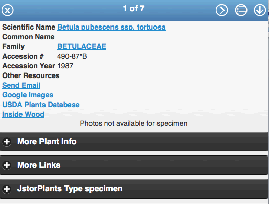
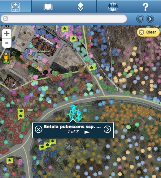
In MIM, about 15,000 dots—each representing a plant—populate a basemap of the arboretum grounds. Tapping one of those dots activates a pop-up window that contains more detailed information on that specific plant—its age and condition, where the arboretum acquired it, its latitude and longitude in the arboretum, and other information.
“There are several layers that can be turned on and off. Among them is a ‘Plants by Family’ layer that color codes the 15,000 dots to represent different [plant] families,” says Tremonte. “Users can also choose to color the plants by ‘Country Collected.”
In addition to providing a bird’s-eye view of the botanic and geographic diversity of the collections, MIM is a mashup of data inputs from other sources, including JSTOR, Flickr, and Google Images. MIM also links to external data maintained by other botanic gardens, the United States Department of Agriculture (USDA), and additional organizations.

Improving access to that data opens new possibilities for research by connecting botanists with authoritative resources on plant taxonomy, scholarship, and conservation through a single platform. “The portal allows visitors to access important information maintained—curated—by experts at other institutions, such as the USDA,” says Dosmann. “This allows the arboretum to put accurate and timely information into visitors’ hands but eliminates our need to maintain [that] data internally.”
Besides being an academic resource, MIM leverages social media that allow users to interact with the application. “The app accesses the photo-sharing services of Flickr to deliver photos for many of the plants and to allow the user to upload and view their own photos on the map,” says Tremonte. “We are also currently working on adding in Facebook and Twitter interaction.”
Users can also perform custom plant searches, quick searches, and spatial queries. The search function utilizes the onboard GPS functions of the mobile device and can show the distribution of queried plants throughout the grounds.

Digitally Mapping the Collections
Since the 1980s, Arnold Arboretum’s living collection has been digitally mapped and documented using a combination of various software packages. Curatorial staff currently use a suite of ArcGIS for Desktop and Esri mobile GIS software applications, coupled to a dedicated plant records software package known as BG-BASE. To broaden scientific access to collections data, the arboretum launched a desktop interactive map called Collection Researcher in 2011.
Built by arboretum Putnam research fellow Brian Morgan, who collaborated with arboretum IT and curation staff, the Flex-based desktop application served as a kind of prototype for the arboretum’s future mobile application designs. The applications are a key component of Harvard’s broader initiative to expand access to its resources for science and education.
“Bringing Collections Researcher online signifies a giant step in our efforts to share our remarkable collections with the world,” says arboretum director Ned Friedman. “We aim to ensure that everyone—from genomicists to environmental biologists, and citizen scientists to the visiting public—can access our plants and the biology that lies behind them.”

