
Last spring, students in Dominique Evans-Bye’s Environmental GIS class at Clark Magnet High School in La Crescenta, California, won $25,000 in scholarship money in the Lexus Eco Challenge.
Evans-Bye credits Esri’s massive open online course(MOOC) program’s Do-It-Yourself Geo Apps with giving the students the skills they needed to analyze data for the project, which involved studying Sargassum horneri, invasive algae found in the Pacific Ocean. The Lexus Eco Challenge, held annually since 2006, challenges students in grades 6 through 12 to study environmental issues related to the land, air, water, and climate.
Dominique Evans-Bye, a science teacher, has been incorporating GIS into her classes since 2005 and recently had her students take some of Esri’s MOOCs. Recently, Astrid Ng, from the Esri education team, interviewed Evans-Bye about the importance of these MOOCs in her classroom. The interview was edited slightly for clarity and conciseness.
Ng: Why do you like MOOCs?
Evans-Bye: I love the MOOCs because they’re fun. The instruction is varied with short presentations, quizzes, and hands-on mapping exercises. The directions for the exercises are clear and easy to follow. Students get a sense of accomplishment after successfully completing a map or app they can share. It’s nice for the students to be able to work on them on their own time and at their own pace.
Ng: Why did you decide to incorporate MOOCs into your students’ coursework?
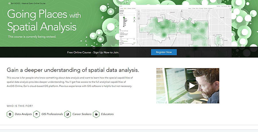
Evans-Bye: When I took my first MOOC, I thought, wow—this is great information. When I first heard about the Going Places with Spatial Analysis MOOC,I signed up to try it out. I thought it would be a great way to become more familiar with ArcGIS Online. I was still getting used to subtle differences between working with ArcGIS Online versus ArcMap.
Next, I encouraged my students to sign up and try [a MOOC]. I started by giving them extra credit to participate. The first MOOCs I had students work on were Maps and the Geospatial Revolution, from Penn State, and Skills for the Digital Earth, from Elmhurst College. I’ve always felt people learn better when given different perspectives of the material. First, they receive instruction from me and get a chance to work on some map tutorials. If they take a MOOC, they will get slightly differentiated instruction that lets them practice their skills and reinforces what they’ve learned, which helps them master the material.
Ng: How did MOOCs help your students prepare for the Lexus Eco Challenge?
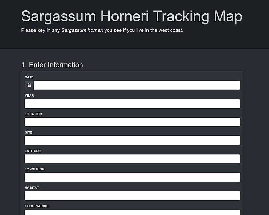
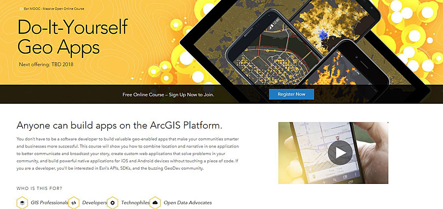
Evans-Bye: The cool thing about the Esri MOOCs is that students apply what they learn directly to their Eco Challenge projects. I had a lot of my students take the Do-It-Yourself Geo Apps MOOC in my GIS classes. This MOOC teaches people how to build apps using the ArcGIS Online platform. The Environmental GIS students applied what they learned from the MOOC and made web and mobile apps for the Lexus Eco Challenge. In this nationwide education program and contest about the environment, teens are empowered to create a better world. Teams must define an issue, make a plan to address the issue, implement the plan, and report on the results. Last year, my student team, the EcoNarcs 3.0, studied the invasive algae, Sargassum horneri, that is taking over the waters off the West Coast from Central California south through Baja, Mexico. In Do-It-Yourself Geo Apps, students learned how to create a GeoForm, a configurable app template that allows users to enter data through a form powered by a web map. The EcoNarcs students mapped Sargassum survey data from the University of California, Santa Barbara, and used their GeoForm to crowdsource additional invasive algae sightings.
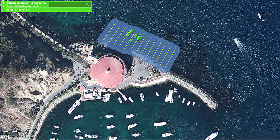
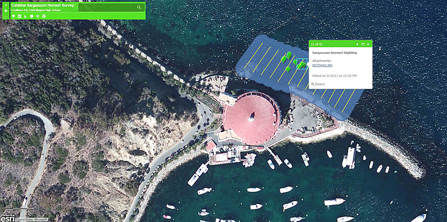
They made the form accessible to the local diving community by sending it to all the Southern California dive clubs they could find. To confirm that sightings were of the correct species of algae, people submitting the form were prompted to submit a photo of the algae with the form. I took the EcoNarcs team to Catalina Island to document the growth of Sargassum horneri at the Casino Point dive park. The students performed transect surveys while snorkeling, using the Collector for ArcGIS app on their phones in a Geckobrands dry phone bag. They received positive feedback and support for their project from the dive community and ended up winning $10,000 in the regional Land & Water Challenge and then $15,000 for first place in the national Final Challenge for that project.
Ng: What did the students do with their prize money?
Evans-Bye: The kids keep 70 percent of the prize money, the school gets 20 percent, and the teacher adviser receives 10 percent. The students typically save their portion of the prize money for college. The school keeps [its] 20 percent in a fund that I can draw from to buy equipment for my field trips and class projects.
Ng: Do you receive additional financial support to run these types of programs in your classroom?
Evans-Bye: I get a lot of support from our school’s Career Technical Education Department, especially with field trips. Other than [working toward] the money the students win from competitions, we apply for grants. When the Lexus Eco Challenge is over, I’ll have the students apply for scholarships or write grants. One year, one of my students cowrote a State Farm Youth Advisory Board grant with me, and we received $100,000 from State Farm [Insurance] to buy a remotely operated vehicle with imaging sonar and a new plotter printer for our GIS classroom.
Ng: What potential do you see for MOOCs outside your science and geography classes?
Evans-Bye: My favorite MOOC so far has been the one that teaches location analytics, The Location Advantage, and it’s weird because it’s not even in my area—I’m in the sciences. I can see great applications for it in other subjects that I don’t teach. For example, our school has a business and e-marketing class through our Career Technical Education program, and I’ve been encouraging the instructor to incorporate The Location Advantage into that course.
I’m also starting a GIS program at Glendale Community College, our local community college. Most of my students go there before going to a four-year university, so I’m creating a pathway so that they can jump from learning GIS in high school to continuing their GIS education at the community college. I plan to offer Introduction to GIS as a dual enrollment course at the high school in the spring of 2018. A dual enrollment course is a course taught at a high school by a community college instructor and taken by high school students. The kids get high school credit as well as community college credit for the class.
Ng: What has been the most valuable part of incorporating MOOCs into your classes?
Evans-Bye: The skills the students learn through the MOOCs are helpful and very relevant to what we do in class. It’s nice because they get to be creative while making their own web mapping applications. They learn skills that they immediately apply to other projects, not only in my class but in other classes throughout the curriculum. It also inspires them beyond their classes—I do hear my students say that they would like to pursue GIS as a career. One of my former students is completing a GIS certificate program right now.
Ng: What advice do you have for teachers that would like to use MOOCs in their classes?
Evans-Bye: As long as the students have access to school computers, it’s really easy. You just get them to sign up for a MOOC by using the school’s information (so that they don’t use their personal information). I tell the students to bring earbuds so that they can listen to lectures. I also recommend that instructors take the MOOC course first or with the students so that they know how to help students if they run into trouble.
Ng: Where are your students headed next? Any ideas for other projects?
Evans-Bye: We are currently working on a project to raise awareness in our community about marine health. We are placing trackers in plastic bottles to determine where they end up—are they really being recycled?
