Really.
This multiple-threaded 64-bit application is the professional, connected desktop GIS designed to help you work faster; visualize your data using 2D/3D, animations, and charts; and access resources and share your work easily.
Although ArcGIS Pro uses a new ribbon interface, it uses the same familiar basic concepts—maps, layers, and basemaps. ArcGIS Pro is included with the ArcGIS Desktop product. If you have ArcGIS Desktop and are current on maintenance, you have access to ArcGIS Pro and can download it from My Esri. You can license ArcGIS Pro any way that suits you—Named User, single user, or concurrent user.
Work Faster in ArcGIS Pro
ArcGIS Pro is designed to help you work efficiently. The ribbon along the top of the ArcGIS Pro interface is contextual so it gives you the tools you need when you need them. This eliminates turning toolbars off and on and hunting for tools and provides a workflow-driven user experience.
Instead of dialog boxes that hide what you are working on, nonmodal panes on the sides of the workspace don’t block what you are working on, allowing you to continue working while tool processes are executing. There is no need to start an editing session—editing is always on. ArcGIS Pro notes what type of data you are working on and invokes the appropriate tools.
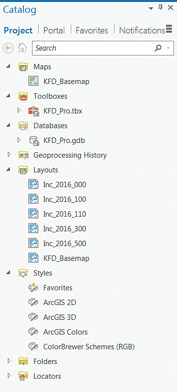
Its project-centric approach keeps all your maps, layouts, tools, geodatabases, and connections in one place. ArcGIS Pro automatically creates a default geodatabase, which you can change if desired.
Work on multiple projects simultaneously by opening and running multiple instances of ArcGIS Pro without closing the current project. You can work with a read-only project in the same manner as a writable project and use Save Project As to save it to a writable location. Continue to work in ArcGIS Pro while packaging operations complete in the background.
Use Project Favorites to save time if you often use the same folder, database, and server connections for many of your projects. Makes these items favorites and they will be available on the Favorites tab in the Catalog pane (previously known as the Project pane) and in Catalog view.
ArcGIS Pro lets you have many project templates that you can preconfigure for specific tasks such as editing or analysis. Project templates create preconfigured projects by saving interface modifications, toolboxes, and the connections needed for a specific task.
Take Advantage of Innovations and Integration
ArcGIS Pro features innovations that cannot be found in any other desktop GIS. New geoprocessing tools are available only in ArcGIS Pro. Work with views of 2D maps, 3D scenes, and tables at the same time and sync them so changes in one are reflected in the others.
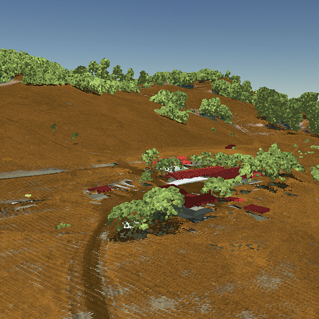
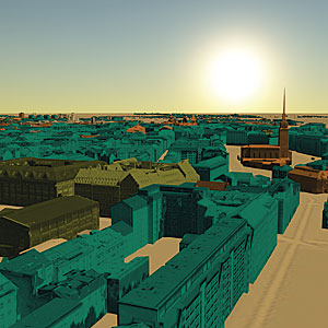
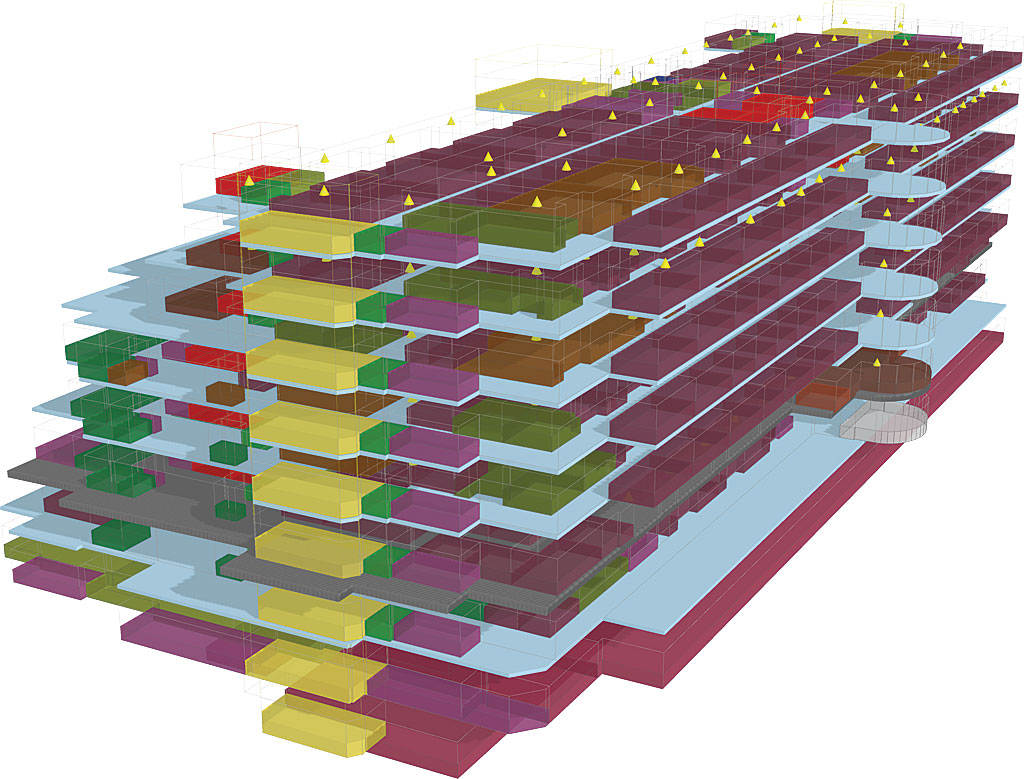
3D is the common visual and analytical experience for tomorrow’s GIS that is fully supported by ArcGIS Pro. With 3D streaming for global and local scenes; spatial analysis for advanced 3D workflows; lidar classification, feature extraction, and editing; and support for the Industry Foundation Classes (IFC) data model and BIM (Building Information Modeling), ArcGIS Pro is the authoring tool for urban design.
ArcGIS Pro is the primary tool for authoring large web scenes and editing in 3D. It now supports storytelling in 3D with animation that can use range and time information. Improvements to 3D drawing include feature drawing by camera distance and enhanced lighting of 3D objects. Explore 3D landscapes using new navigation controls. Layouts are more useful and powerful with embeddable, interactive, customized charts. Visualizing data in charts helps uncover patterns, trends, relationships, and structure in data.
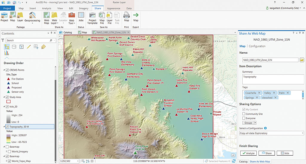
ArcGIS Pro is tightly integrated with ArcGIS Enterprise, ArcGIS Online, and the rest of the ArcGIS platform, making cross-platform workflows more powerful and providing easy access resources from ArcGIS Online or your portal.
Share your work as an item on ArcGIS Online or your portal or as a file. Sharing is built into the interface and available through the Sharing tab. Create a web map, publish a web layer, or share a project template directly from ArcGIS Pro and have it automatically added as an item in ArcGIS Online. Export maps to PDF and many other formats directly from ArcGIS Pro.
Migrate Your Work
Take existing maps directly into ArcGIS Pro. There is no need to re-create maps and layouts—simply import your map documents (.mxd), scenes (.sxd), and globes (.3DD) into ArcGIS Pro and save them as projects (.aprx). They will look just as they did in ArcMap with the same layouts and symbology. Actually, maps created in ArcMap may look even better after being imported because ArcGIS Pro uses anti-aliasing so lines and text are more crisp and clean. ArcGIS Pro uses the Maplex label engine for optimal placement, so if you did not use Maplex for the original map, labels may shift a bit.
ArcGIS can use the styles or style files you have already developed in ArcMap. By default, styles are not installed, but you can retrieve them from your ArcMap installation or get them from ArcGIS Online. Measured Grids (the lines, ticks, and labels used as a reference for projected coordinates on a map) can now be imported into ArcGIS Pro from a map document or inserted from a style.
ArcMap users have long requested multiple layout functionality, and ArcGIS Pro delivers this. Read “Managing Multiple Layouts in ArcGIS Pro” in the Spring 2017 issue of ArcUser to learn more about using multiple layouts.
ArcGIS Pro evaluates imported map documents and will tell you if any issues arise, so if you have created scripts or ModelBuilder models, it will check to see if they will work as originally written or if they need to be slightly modified. Minor syntax adjustments may be needed because ArcMap uses Python 2.7, while ArcGIS Pro uses Python 3.5.
Work Entirely in ArcGIS Pro
You can now perform more complete workflows, such as map creation and data management, entirely in ArcGIS Pro. You can modify topology properties directly in ArcGIS Pro. The enhanced traverse tool improves COGO workflows. In answer to user requests, the context menu options for importing and exporting data are included in the Catalog pane.
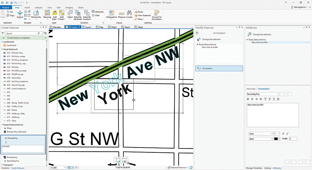
At 2.0, ArcGIS Pro gives you full control over annotation. You can create annotation feature classes, convert labels to annotation using a geoprocessing tool, and edit annotation features. Annotation is supported in core geoprocessing tools such as Copy Features, Append, and Feature Class to Feature Class.
Most of the geoprocessing tools and ArcGIS extensions will just work in ArcGIS Pro. Many of the time-saving features you used in ArcMap, such as Bookmarks, are in ArcGIS Pro but some may have a different name. For example, Data Driven Pages are now known as map series.
A New Generation of Desktop GIS
ArcGIS Pro, the new connected desktop, advances desktop GIS by providing a modern 2D/3D user experience not only for performing powerful analysis but also for creating beautiful maps. ArcGIS Pro is a premier client of the ArcGIS platform and an essential companion to ArcGIS Enterprise and ArcGIS Online. It is fully integrated into the Web GIS pattern of working with web layers, web maps, and web scenes.
Tasks previously executed in ArcMap can be automated in ArcGIS Pro simply by using Tasks or through the use of Python scripting. Extend ArcGIS Pro functionality by developing add-ins using the ArcGIS Pro SDK for the Microsoft .NET Framework.
Esri is working on new innovations in ArcGIS Pro that are only possible in the connected desktop and the services architecture. Each release of ArcGIS Pro incorporates the features and capabilities that you have requested. Take advantage of these capabilities by moving to ArcGIS Pro now.

