The term spatial computing dates from the 1980s. Its modern definition entered the lexicon in 2003. In his master’s thesis for the Massachusetts Institute of Technology’s (MIT) program in media arts and sciences, Simon Greenwold described spatial computing as “human interaction with a machine in which the machine retains and manipulates referents to real objects and spaces.”
But spatial computing extends back even further. It has been the cornerstone of GIS technology since it debuted in the late 1960s. Indeed, the theoretical foundation of GIS is that it’s not only possible but inherently useful to retain and manipulate real objects within some form of virtual space.
In the first GIS programs, virtual space was synonymous with cartographic space. Spatial computing meant using maps to organize large amounts of data in a visually intuitive manner.
GIS and the Roots of Spatial Computing
Early geospatial technology pioneers applied the concepts of theorists such as Ian McHarg, who described the world as a series of layers of information that exist and interact in the same physical spaces. Analyzing any spot on Earth yields information on elevation, soil type, hydrology, biology, and land use.
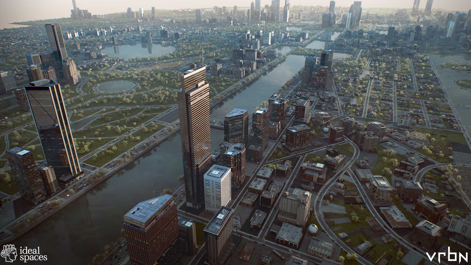
GIS brought this idea to life. The technology allows us to visualize and analyze layers of data on a map. GIS has become a key integrator of information about our world for uses that range from scientific research to engineering to commercial operations. Through innovation, GIS has grown beyond the bounds of mere 2D map layers to generate maps that are, in effect, 1:1-scale 3D models called geospatial digital twins.
The ability to provide maximum context is the major benefit of geospatial digital twins. This is especially useful for smart planning of our urban environments. For example, architects can use a digital twin to test how their proposals will fare under situations like flooding and extreme heat brought about by climate change. City planners can understand the effects of large-scale shifts in the urban environment with interventions focused on enhancing livability. The combination of visualization and hard data allows them to predict impacts and modify plans before making expensive changes to the physical world.
Spatial Computing and Digital Twins
Each advance in GIS technology has improved our ability to visualize, link, and manipulate real objects and spaces in a digital realm. GIS has evolved to offer truly immersive experiences. In particular, the combination of GIS and game engines, such as Unreal and Unity, has transformed the process of large-scale infrastructure projects.
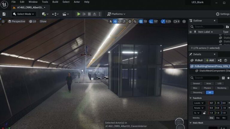
In Brisbane, Australia, for example, a digital twin of the ongoing subway construction has been used to display progress. People can walk virtually through planned subway tunnels and stations. This contextual experience helps project leads show residents how the work is shaping up.
The experience also allows planners, architects, engineers, and construction workers to make decisions with more information than could be provided by a paper map or even a traditional digital twin. They can stand on a platform and see how the design elements of a station will look to people moving through it.
The overall effect is a “visual narrative of space,” as Unity VP Matt Collins told Geo Week News, an online publication that covers the built world and 3D and geospatial technologies. And not just a narrative, Collins added, but one that can “faithfully abide the laws of physics within the systems.”
Spatial Computing to Visualize What Could Be
Digital twins can be crystal balls. The virtual spaces can be reconfigured to model different versions of an environment. In practical terms, digital twins allow various stakeholders to have the same vision. This is especially useful in the age of climate change.
Planners and architects can test different versions of a project. If they are designing a subdivision in a coastal community, they can calculate the flooding and storm surge that will likely occur from storms of different magnitudes. Just as importantly, they can visualize this data, inhabit it, and study it with maximum context.
Fundamentally, they are investigating spatial relations against a realistic backdrop of the world. For the subdivision, these objects include homes, streets, streetlights, and parks, and what matters is their existence in relation to water under multiple scenarios.
This is spatial computing: manipulating referents to real objects in a virtual world that, unlike the real one, can be changed at will.
Spatial Computing to Visualize Hidden Real Spaces
Immersive environments also offer the promise of displaying a world that is real and already exists yet remains largely invisible. As spatial computing hits consumer devices, some of its most useful applications are enabled by GIS.
Public utilities and other companies involved with underground infrastructure have been some of the most enthusiastic adopters of digital twins because the experience can reveal critical connections buried beneath the earth—made visible without the need to dig.
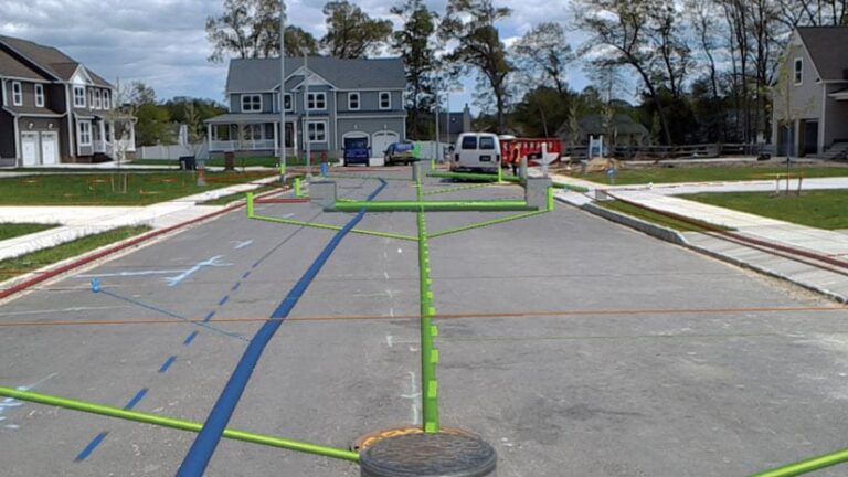
In 2017, the Toms River Municipal Utilities Authority (TRMUA) in Toms River, New Jersey, began using mixed reality (MR) headsets to help crews find underground utility assets for electric, gas, water, telecommunications, and sewer services.
GIS stores the location of these assets, and MR displays the underground infrastructure. Traditionally, utilities display this detail on a 2D map. What MR provides is maximum context. Workers in the field can visualize exactly what’s under their feet—and see how it’s related spatially to what is all around them.
TRMUA credits MR with saving time and lowering the chances of breaking connections in the networks residents rely on for modern living—with savings in the tens of thousands of dollars every day.
Many utilities have followed TRMUA’s lead. MR setups serve multiple purposes that include training new employees and sharing information between teams in the field and staff in the office.
One utility industry publication recently noted that what these systems ultimately provide is the elimination of guesswork. The ability to know exactly where an asset is located—and to understand how changes will affect the area around it—leads to increased efficiency and customer satisfaction.
The World in Sharper Focus
Apple’s Vision Pro headset is not the only recent example of XR rebranded as spatial computing. Meta and Microsoft have also marketed their XR headsets—Quest 3 and HoloLens, respectively—as spatial computers.
Spatial computing will continue into the mainstream of computing. Eventually, it will likely be the norm. As XR hardware increases in number and power, more organizations will look to unlock the value of all the spatial data recorded in GIS. Being able to experience data will add further value to the systems and workflows that create it.
GIS pioneers began exploring the outer limits of spatial computing a half-century ago. More recently, innovators have realized its potential for smarter urban planning, climate risk mitigation, management of operations across industries, and virtual exploration of real-world systems or scenarios via geospatial digital twins. Someday soon, those limits will be reachable by anyone.
As GIS users have learned through the decades, when we get a better sense of where we are in relation to things we care about, we can create the world we want
to see.

