The city of Fate, Texas, is a growing community on the eastern edge of the Dallas-Fort Worth metroplex. Like many suburban communities, its growth has been driven by several large residential planned developments. Also, like many suburban towns, these developments were changing Fate into a bedroom community—a community in which people lived but traveled outside town to work and shop.

Ryan Wells, director of planning and development at the city, recognized the long-term problem this created. “That really sets up a condition where a city has a hard time being fiscally sustainable or fiscally resilient. Single-family detached neighborhoods, while an important ingredient in any community, don’t really pay the bills when it comes to the cost of serving those communities.”
In the mid-2010s, city leadership became aware of this dangerous financial condition and decided to act to protect the future of the city of Fate. That decision included diversifying the way that the city develops. Part of this process included measuring the fiscal impact of every new development that was proposed in the city.
“This feeds into a citywide understanding of what development patterns tend to be more fiscally productive and which of those require more fiscal resources to support,” said Wells.
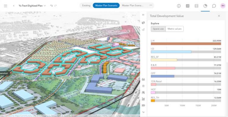
The city has recently acquired a 267-acre tract and is using ArcGIS Urban to carry out both the scenario planning and fiscal analysis to determine the best path forward for the city. This has put GIS technology in the hands of non-GIS staff so that the planning director, city leadership, stakeholders, and the public can view and analyze multiple scenarios. With everyone in agreement, it will be easier to establish buy-in across the city.
To learn more about how that project in the city of Fate has developed, listen to episode 3 of the Reinventing Planning podcast, Performing Fiscal Impact Analysis with GIS. The podcast is available on Spotify and wherever you download podcasts.


