In July 2014, Esri released the next generation hillshade, the Multi-Directional Hillshade image service. This hillshade was inspired by the work of the legendary Swiss artist and cartographer Eduard Imhof. The Multi-Directional Hillshade provides an excellent representation of the world’s topography and the perfect relief backdrop to support your work.
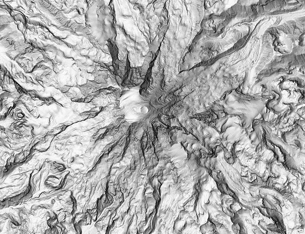
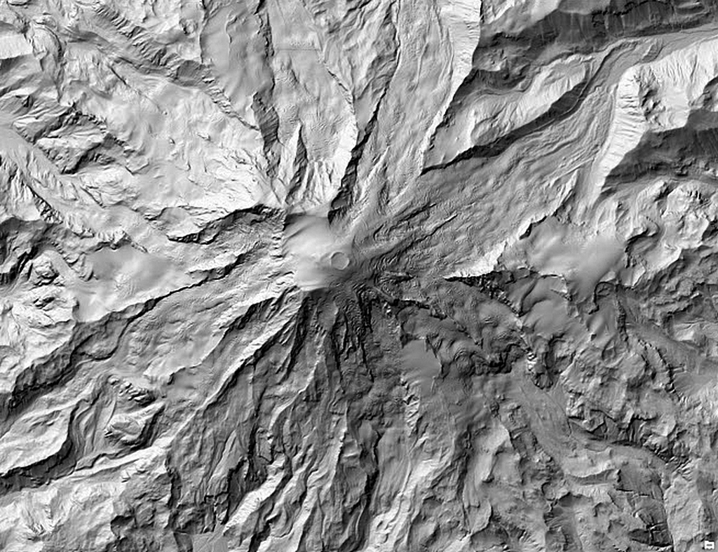
Unlike a default hillshade (i.e., light source with an azimuth angle of 315 degrees and an altitude angle above the horizon of 45 degrees), the Multi-Directional Hillshade presents an unparalleled view of the world’s mountains, plateaus, valleys, and canyons by using an algorithm that computes hillshade from six different directions as opposed to the single direction used in a default hillshade. The result is a stunning visualization in both high slope and expressionless areas.
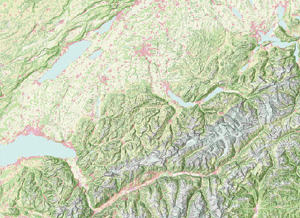
The Multi-Directional Hillshade, available on ArcGIS Online, can be easily added to maps created with ArcGIS for Desktop or web apps. It is currently implemented as a custom raster function on the World Elevation Service and requires an ArcGIS Online organizational account to access. This live service renders results dynamically on the fly for every pan/zoom request. Because the Multi-Directional Hillshade is a dynamic service, Esri can quickly update it as additional high-resolution datasets become available.
Traditional hillshades are created by illuminating light from the northwest direction. This often produces results in which the illuminated sides are overexposed and terrain details on nonilluminated sides are obscured. This problem is more pronounced in hillshades that have areas of medium to high slopes. However, by varying the direction of the light from six different sources, terrain depicted by the Multi-Directional Hillshade is more realistically represented, and overexposed and nonilluminated areas of the map are balanced.
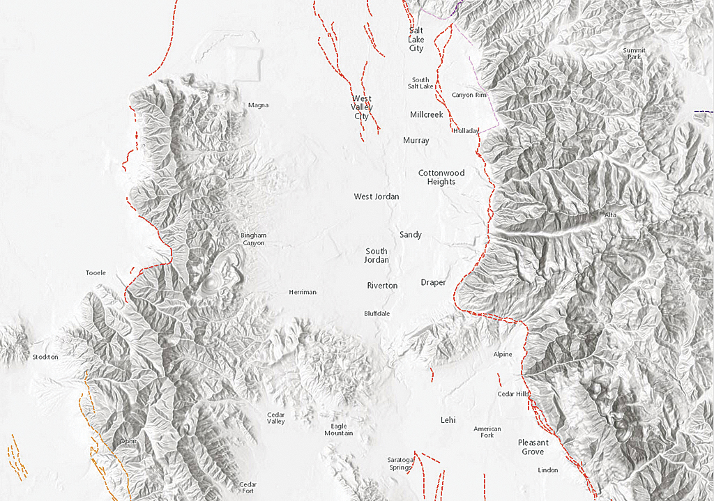
The Multi-Directional Hillshade provides a perfect backdrop for topographical, soil, water resources, or outdoor recreational maps. This service includes global elevation data from multiple sources and resolutions ranging from 230 meters (m) globally to 3 m partially covering the United States obtained from US Geological Survey (USGS) National Elevation Dataset (NED); Federal Emergency Management Agency (FEMA); and community contributed content from Denmark, Finland, and the United Kingdom. The ongoing data contributions by the ArcGIS user community continually improve the resolution, coverage, and quality of the data available. For more details and a list of current data sources, refer to the Item Description for the Terrain layer, available from ArcGIS Online.

