In 2021, Esri partner Dewberry was asked to identify temporary housing locations for disaster survivors displaced from their homes in Louisiana following Hurricane Ida. Locations close to the original communities were preferred because that would support faster revitalization of the affected region’s economy.
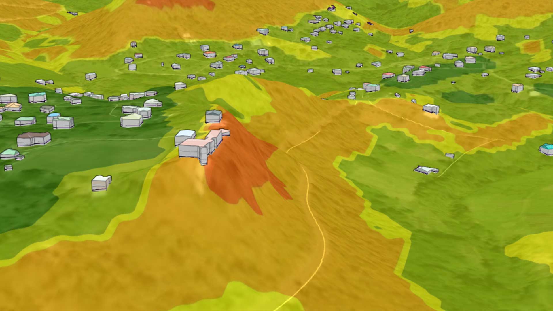
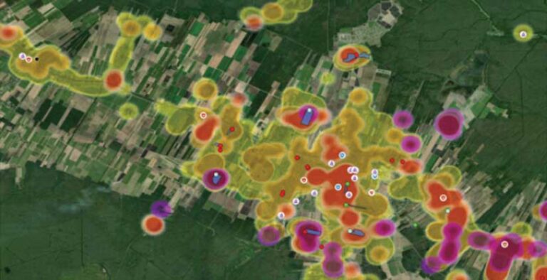
Dewberry, an architectural and engineering firm, combined its damage assessments with tools provided in the ArcGIS Network Analyst extension for ArcGIS Pro and added in parcel data and damage assessment information to display hot spots where damage occurred. The analysis also identified unaffected large parcels of land where temporary housing sites could be placed.
Hurricanes, tropical storms, and other natural disasters can cause structural devastation. For affected communities, it is vital to quickly determine the impacts on building structures to keep residents safe. Assessments of structural damage provide important information needed by federal, state, and local emergency responders to make critical decisions regarding resource allocation during recovery and rebuilding efforts.
Dewberry performs geospatial damage assessments for government clients following natural disasters. Advancements in the field of machine learning (ML) are playing an increasingly important role in performing damage assessments because these capabilities are also being used for proactive disaster response.
How ML Supports Geospatial Damage Assessments
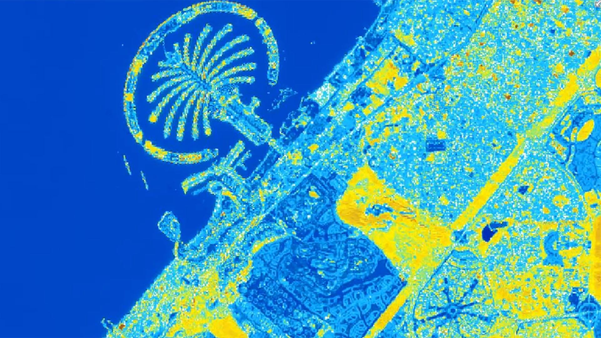
The predictive benefits of ML begin with data collection. Dewberry collects post-event imagery in areas that have sustained damage from hurricanes and other natural disasters. The company obtains this data from providers such as the National Oceanic and Atmospheric Administration (NOAA), Civil Air Patrol, and the National Insurance Crime Bureau. After the data is uploaded to ArcGIS Image Server, Esri’s imagery data management system, it is added to a compilation of imagery from previous natural disasters and then uploaded into a repository of data across various geographies.
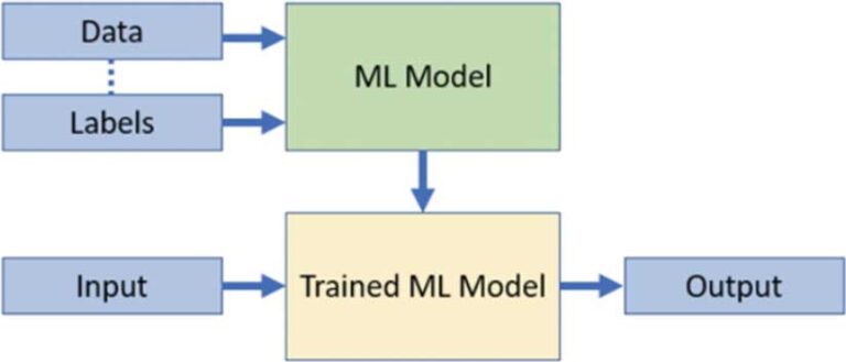
ArcGIS provides end-to-end deep learning capabilities, enabling users to label features, train models, and perform feature extraction on imagery. Using ArcGIS Image Analyst extension for ArcGIS Pro, deep learning models are trained to detect specific (and relevant) features within the imagery. The training data feeds the ML model, which learns to identify patterns of disaster damage to help predict which structures will be affected by future disasters.
Training Deep Learning Models
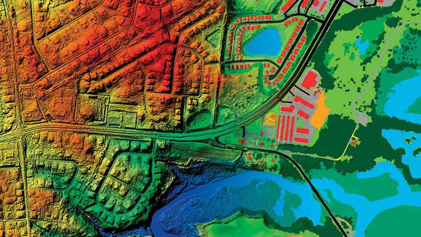
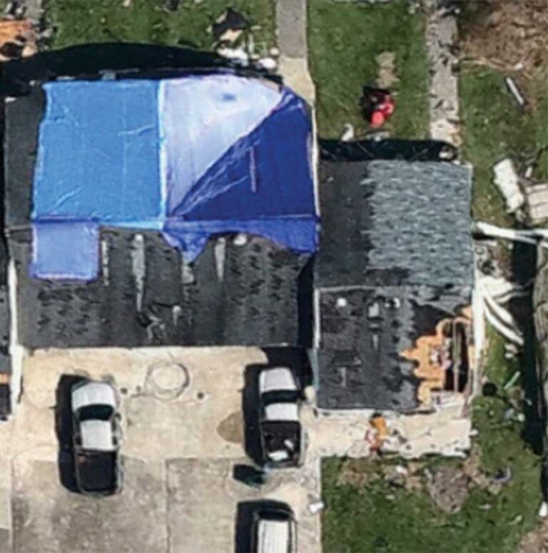
Prior to training a deep learning model, training samples using high-resolution imagery must be created to represent features of interest. Using the labeling capabilities in ArcGIS Pro, features of interest, such as downed trees, building classifications (damaged and undamaged), and tarps covering holes in roofs are digitized and labeled. Those labeled features are added to a feature class so they can be referenced in training the model.
Once training samples are collected, models are trained relevant to the problem set using the Train Deep Learning Model geoprocessing tool in the Image Analyst toolset for ArcGIS Pro. Key models Dewberry has trained include:
- An object detection model to identify damaged tree stumps.
- An object detection model to identify blue tarps.
- An object classification model to classify structures according to the severity of the damage sustained.
- The ground truth labels are compared to the model classification results to get a quick qualitative idea of how well the model performed.
Performing Damage Assessments
Before Esri’s ML technology was available, a Dewberry analyst visually interpreted postevent imagery, performing an average of 100 damage assessments per hour. Using trained deep learning models, Dewberry can now complete 410,000 automated assessments per hour. This significant improvement confirms that ML is beneficial for both interpreting data with greater efficiency and increasing the ability to extract a variety of data points.
Using the trained models with the inferencing tools in ArcGIS Pro, Dewberry identifies damaged property structures and classifies the severity of the damage. This information is communicated to the Federal Emergency Management Agency (FEMA) for downstream analytical applications. Once feature extraction with damage classification is complete, the results are reported to FEMA. Subsequently, FEMA shares the results through operational dashboards to provide actionable insights that enable multiple stakeholders to make timely and informed decisions.
Users of these dashboards can assess the damage and proactively dispatch necessary aid. ArcGIS goes beyond just extracting features using artificial intelligence (AI). It enables users to leverage the power of a complete suite of geospatial tools and applications to perform further downstream analysis.
The damage classification of disaster sites performed by Dewberry is paving the path for additional analyses. For example, after a tornado outbreak struck Kentucky in 2021, Dewberry reviewed information generated from damage assessments and input it into a debris estimation model. The model enabled analysts to determine approximately how much debris was generated from the damaged structures. Using ModelBuilder and Summarize tools in ArcGIS Pro, the data was aggregated and provided to the county to aid in allocating resources for debris removal.
Summary
Dewberry is leveraging powerful geospatial tools and ML capabilities to facilitate efficient response and recovery in times of critical need. Using ML-powered geospatial damage assessments, it is developing and implementing action plans to help communities better equip themselves to respond to future natural disasters. With upcoming enhancements, such as the ability to identify damaged power lines, roads, and bridges, and support for other types of disaster events, Dewberry is maximizing the potential of ML.
Dewberry staff members Catherine Bohn, Paul Dean, and Siddharth Pandey are subject matter experts who contributed to this article.
About the authors

Akshaya Suresh