Focus
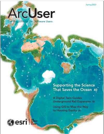
A Digital Twin Guides Underground Rail Expansion
Brisbane, the most rapidly growing city in Australia, is using a digital twin and a virtual reality program to guide the design and construction of an underground railway.
New Map Style Helps See the Future of Housing in Utah
The GIS team in the Utah office of Colliers International created a map style that more effectively communicates data on housing growth while saving the team map production time.
A research lab at the American University of Beirut created a database of rental information contributed by tenants and shared it with home seekers, tenants, researchers, and housing advocates through an ArcGIS Experience Builder web app.
Using GIS to Promote Appraisal Transparency and Efficiency
Chatham County, North Carolina, created an all-in-one solution for its tax department’s recent real property tax reappraisal process using GIS.
Letter from Editor
Special Section
Supporting the Science that Saves the Ocean
Esri is supporting programs of the United Nations Decade of Ocean Science for Sustainable Development (Ocean Decade), which are dedicated to better understanding and preserving the ocean and reversing biodiversity.
Science Applied to Real-World Challenges
GIS for Science is a three-volume series published by Esri Press and written for professional scientists, citizen scientists, and anyone who is interested in science, geography, and conservation.
End Notes
A Nature-Based Solution to Human-Elephant Conflict
Save the Elephants uses GIS to apply the elephant’s aversion to bees to discourage elephants from invading farmer’s fields in Kenya.
Departments
Software and Data
A Foundation for Digital Twins: ArcGIS Reality
ArcGISReality, a new suite of photogrammetry software products released by Esri, helps create the foundation for digital twins on scales ranging from local to global.
Manager’s Corner
Las Cruces Uses the Power of Visualizing Its Data
City of Las Cruces, New Mexico is partnering with Esri to deploy an adoption strategy helped build consensus for Enterprise GIS
Using GIS to Map the Way to Housing Equity
Solving the affordable housing crisis and #homelessness will require #zoning reform and GIS-based analysis to understand the impacts of land planning measures.
Five Reasons to Use ArcGIS Monitor
Move from reactive to proactive when managing ArcGIS Enterprise with ArcGIS Monitor, a tool that provides insight through reporting, visualization, and alerts and optimize performance.
Developer’s Section
Use Calcite to Easily Create Beautiful User Experiences
Esri’s Calcite Design System lets developers create beautiful, user-friendly, and consistent experiences across applications with minimal effort.
Using ArcGIS Maps SDK for JavaScript in Virtualized Environments
Learn how to tune your Virtual Desktop Infrastructure (VDI) when using ArcGIS Maps SDK for JavaScript to run web mapping applications in virtualized environments.
Hands On
High-Quality Field Descriptions Make Mapping Easier
Fields descriptions for your feature layers in ArcGIS Online let analysts understand and intelligently use the quantitative data in ArcGIS Living Atlas of the World.
Build maps using the ArcGIS Online item ID instead of the REST service URL and retain custom cartography, configured pop-ups, better metadata, raster functions, and views.
Bookshelf
Managing Our World: GIS for Natural Resources
A collection of real-life stories about natural resource organizations successfully using GIS to increase efficiency and sustainability using the geographic approach.
Moving Forward: GIS for Transportation
GIS and location intelligence are helping transportation organizations strengthen their ability to maintain roads and highways, railway systems, and other vital infrastructures.
Designing Map Interfaces: Patterns for Building Effective Map Apps
The essential guide to creating geospatial app interfaces that are usable, efficient, and stunning.
Faces of GIS
Be Your Own Leader and Own Your Career
Sid Pandey, chairperson of the URISA Vanguard Cabinet and #GIS senior consultant at Deloitte, shares tips for growing a GIS career.
Education
University Professor Blends GIS and Conservation Medicine
Carolyn Talmadge, Data Lab services manager and Tufts University and course director for the Cummings School of Veterinary Medicine teaches a GIS course required for the Master of Science in #Conservation Medicine (MCM) program.
ArcGIS Labs, self-paced learning modules that emphasize hands-on practice through step-by-step exercises, have been added to the Esri Academy catalog.
A Roadmap to Success for Students
The San Bernardino County Superintendent of Schools (SBCSS) office worked with the Southern California county’s school districts to create a website that uses a GIS portal to provide comprehensive information and helps better prepare students for college and the workplace.

