Things often shift and change when a new year rolls around, and ArcUser is no exception. The magazine’s founding editor, Monica Pratt, retired at the start of 2025, but ArcUser continues to highlight the vital work that GIS professionals do and the resources they use to address the world’s most difficult challenges.
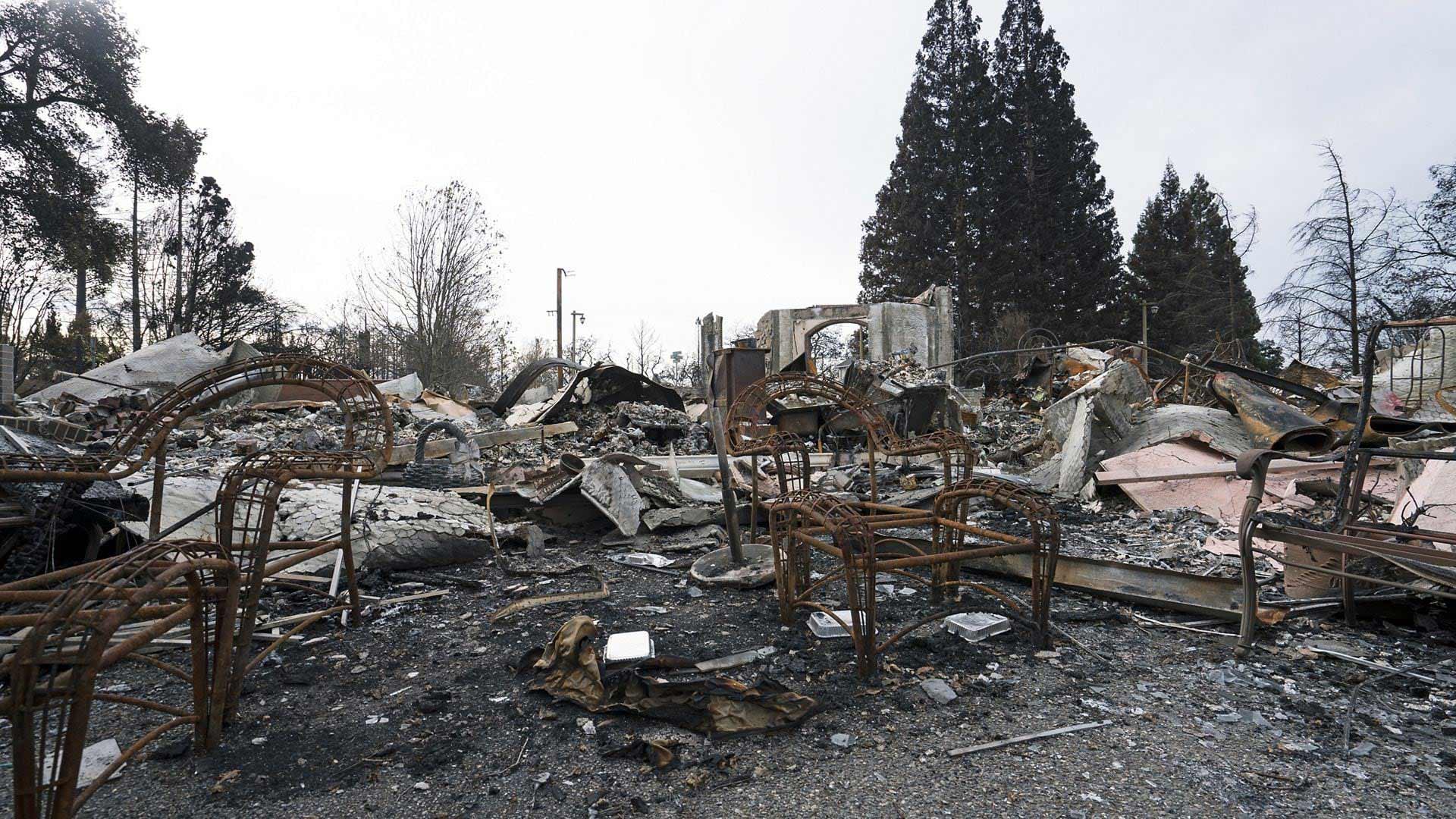
But for all the changes swept in by the new year, not all the challenges we face are new. Changing climate conditions, for instance, remain an ever-growing threat. In 2024 alone, the United States sustained 24 separate weather- or climate-related disasters with losses exceeding $1 billion, according to the National Oceanic and Atmospheric Administration (NOAA). These include hurricanes Helene and Milton, winter storms in the Pacific Northwest, wildfire in New Mexico, and catastrophic tornadoes in the Midwest. Already, 2025 has seen devastating fires tear across Los Angeles County, decimating homes and businesses. The frequency and severity of these events show no sign of slowing. Which is not to mention the more gradual—but still consequential—effects of climate change such as rising sea levels and ever-more frequent droughts. The problem is now familiar, but it is no less existential.
As articles in this issue demonstrate, GIS is one of the most effective tools we have to address challenges like these.
Staff at the Oregon Department of Emergency Management are using ArcGIS Instant Apps to ensure that information about deadly wildfire is more accurate and accessible. On Turkey’s Aegean Coast, GIS provides a clear picture of how progressively hotter and drier growing seasons impact olive production. In Point Hope, Alaska, drone imagery and GIS technology help local communities find a way to combat erosion and rising sea levels.
“Make plans ahead of time,” urges Sunny Fleming in an article that showcases the myriad ways GIS departments prepare for and respond to climate-related threats. “Embrace GIS technology to collaborate and communicate. Leverage the technological resources that you already have. Use them to their full potential.”
GIS plays a key role in allowing us to gather more data, plan more effectively, and respond more efficiently to the world’s challenges. This idea is the lynchpin of every story in this issue, whether it is about using geospatial AI to respond to disasters, developing web apps with less code and less effort, or using ArcGIS Indoors to help students find their way around a community college campus. No matter the scale of the problem, GIS is and will continue to be instrumental in finding the way forward.