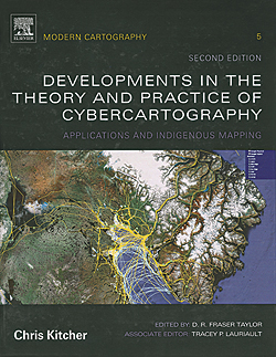
Developments in the Theory and Practice of Cybercartography, Volume 5, Second Edition: Applications and Indigenous Mapping (Modern Cartography Series)
Edited by D. R. Fraser Taylor and Tracey P. Lauriault
D. R. Fraser Taylor coined the term cybercartography and defined it as “The organization, presentation, analysis, and communication of spatially referenced information on a wide variety of topics of interest to society in an interactive, dynamic, multisensory format with the use of multimedia and multimodal interfaces.” The fifth volume in this Modern Cartography series from Elsevier Science explores the practice of partnering with indigenous people to map traditional knowledge and present these maps as cybercartographic atlases. This second edition reflects the many changes that have occurred in this area of cartography since the publication of the first edition in 2005. Ninety percent of this edition is either new or has been revised and includes several new cybercartographic atlases that have been created in cooperation with Inuit and First Nations groups. It also features an interactive companion website that supplies links to related websites, additional illustrations, and information on the dynamic and interactive elements of cybercartography.
Taylor is a distinguished research professor and director of the Geomatics and Cartographic Research Centre at Carleton University, Ottawa, Canada. Recognized as one of the world’s leading cartographers, he served as the president of the International Cartographic Association from 1987 to 1995. He pioneered the use of computers for cartography and introduced two of the first computer atlases in 1970. Lauriault is a postdoctoral researcher at the National Institute for Regional and Spatial Analysis at National University of Ireland, Maynooth, Ireland. Elsevier Science, 2014, 390 pp., ISBN-13: 978-0444627131

Python for Data Analysis: Data Wrangling with Pandas, NumPy, and IPython
By Wes McKinney
Because SciPy was integrated with ArcGIS in November 2014, Python for Data Analysis will be of special interest to users of ArcGIS. It contains sections devoted to SciPy and NumPy, a package that has been integrated with ArcGIS for several releases, as well as sections on pandas, matplotlib, and IPython. This is a practical book that provides information for working on data-intensive applications using Python. It also serves as a hands-on introduction to the analytical methods of scientific computing using Python. Its intended audience is analysts who are new to Python and Python programmers who are new to scientific computing. The book’s author, Wes McKinney, is the main author of the pandas library. O’Reilly Media, 2012, 466 pp., ISBN-13: 978-1449319793

