Michele Heilman is an ambitious senior at the University of Southern California (USC) who is majoring in geodesign and has a minor in sociology. She incorporates GIS, spatial sciences, architecture, urban planning, and social equity into her geodesign studies. During a gap year spent in Brazil, she learned about the country’s rich biodiversity. This sojourn inspired her to pursue a career path that promotes conservation. In this interview, Heilman shared her GIS journey.
Q: How did you get your start in GIS?
A: In high school, I applied and was accepted into USC with a major that wasn’t related to GIS. However, before starting at USC, I took part in a gap-year program in Brazil from August 2019 to March 2020.
After I returned home, my parents encouraged me to decide on a field of study when we heard all classes were going to be online. During my search, I discovered geodesign and GIS, which were completely new to me. Throughout high school, I had always been interested in environmental science, and my time in Florianópolis, Brazil, exposed me to various conservation efforts. I realized that geodesign combines elements of environmental science with the necessary technology to protect the environment. It was a fortunate coincidence that I stumbled upon geodesign, and I ended up pursuing it for all four years of college.
Q: How have you used GIS in your geodesign projects at school?
A: My first project during my freshman year was on food deserts in Washington, DC. We mapped out different demographic factors like age, socioeconomic status, closest transit stops for train or bus, and then figured out what community is most in need of a grocery store. Doing this project at USC after coming from DC was special for me, as it taught me how the skills I was learning could be applied to my community and my home city.
Another time, I participated in a lab where we did modeling of hillshade analysis of wineries in Temecula[, California,] to grow different grapes to find the optimal location for a new winery.
Right now, I am working on a project for LA [Los Angeles] County for [its] 2045 climate action plan to spatialize some of [its] goals. Everyone in the class is focused on a different action plan, and my group is focused on the transportation-related aspects of the action plan. We are currently conducting an analysis to find where optimal transit-oriented development projects could be proposed in LA County, or potentially propose new car-free or zero-emission zones.
[Since this interview, Heilman worked with her Geodesign Capstone group at USC to spatialize transportation solutions to meet LA County’s 2024 Climate Action Plan goals.]
I’m also in a geospatial modeling class. We did one assignment that modeled different zombie apocalypse scenarios with agent-based modeling. This class introduced us to modeling for video game technologies. I find it very interesting—you can do modeling that is oriented for video games, environmental science, or urban planning.
Overall, these projects have taught me that spatial analysis and modeling can be essential tools across many diverse industries, while helping me learn how to effectively use the software.
Q: Did you do any internships while in college?
A: I had the opportunity to participate in an internship with the World Wildlife Fund [WWF] during the summer after my freshman year. When I came across the job description, I felt like it was tailor-made for me. I couldn’t imagine anyone else with Spanish and Portuguese language skills and GIS experience being a better fit for this role. My position was Amazon rainforest assistant research intern, and I worked under the forest team at WWF.
One of the key requirements was the ability to translate documents from Spanish and Portuguese to English. The internship involved a combination of research and translation work, including analyzing various documents and assessing road and infrastructure developments in the Amazon region.
I also contributed to mapping the WWF focal landscapes, which are WWF’s priority conservation areas in the Amazon [region]. Throughout the internship, I collaborated with individuals from different parts of South America, and I often encountered GIS data in multiple languages with limited context. Therefore, a significant aspect of my role involved cleaning, organizing, and interpreting data with minimal information.
This role prepared me for my second internship, with the US Chamber of Commerce. My language skills were handy once again as I conducted economic and policy research in South America. Although I didn’t need my GIS skills as the Brazil-US Business Council intern, it was a full-circle moment to realize how useful my gap year abroad, internship with the WWF, and the broader geodesign framework for research helped me work towards that internship opportunity. After one internship in the nonprofit sphere, doing an internship in the private sector introduced me to new concepts and new perspectives.
Q: What was valuable about your internships?
A: One of the advantages of interning at WWF was the opportunity to develop both my soft skills and technical skills. I had the chance to collaborate with individuals from different teams within the organization, gaining real-world insights and guidance from industry professionals. This experience helped me navigate my career path and make informed decisions about my future. This internship made me realize it was possible to combine my passions of geodesign, language learning, and cross-cultural understanding in my professional career. Going forward, I am able to make intentional choices about where I want to work and the type of work I want to be doing, which is a privilege.
While enhancing my soft skills was a significant benefit, the internship also provided valuable exposure to real-world GIS. Prior to my sophomore year, I had only taken two GIS classes at USC, one of which was heavily focused on lab work and had an instructor readily available for assistance. However, during my WWF internship, I quickly realized the importance of troubleshooting issues independently, as there was no instructor to rely on. Like I mentioned before, data isn’t always organized in the best way. You have to be really intentional about the way you organize your data so others are able to interpret and interact with it with limited context. Despite the challenges, I successfully created several maps using WWF’s data, which includes the Amazon regional climate change index, integrated risk index, and ecological risk index, and these maps proved to be a valuable tool for visualizing and sharing this data with others.
Q: What’s your best advice to other young professionals?
A: I feel really lucky that I pursued geodesign going into college and attended a school like USC, because [its] Spatial Science Institute is huge and there are lots of free resources at my fingertips and [USC provides] access to Esri software for us students.
With that said, find out if your university provides free access to Esri software. It’s more than likely [it does]. Then, soak in all the resources you can get and just fully take advantage of accessing the technology.
Next, search for internships that match your interests and career goals while also being open to trying new industries.
Finally, put yourself out there and talk to people. I’m sure people are tired of hearing this, but it’s the truth! Try going to events like on-campus events or conferences. Also, just go up and talk to your professor! If you know a professor doing interesting research, reach out to them, saying “Hi, I’d love to find time to learn more about your research and ask you a few questions.” The point is to learn more about what people are doing and what they did to get there.
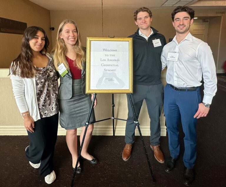
For example, I made time to go to the LA Geospatial Summit, which was happening on campus for one day only. That day I had a class and I had to work after class, but I made time to pop into the event during the networking portion. That is where I met people from Esri and Esri Young Professionals Network [YPN] that led to publishing this article.
Overall, just try to show up to any opportunity, and don’t think to yourself, “Should I go?” Because the answer is yes, you should!
Q: What are your career plans after you graduate?
A: I have such a diverse range of interests, and I’ve been exploring different career paths to determine my next steps. One aspect of GIS that particularly appeals to me is its widespread application across various industries, including architectural design, public policy, urban planning, international development, and environmental conservation. These fields intersect with GIS in many ways, and ideally, I would like to work in a role that incorporates all of these aspects or join an organization that is involved in these areas.
My language skills, passion for exploring the world, and interest in learning about different cultures make me particularly drawn to the intersection of international development and conservation. Given the versatility of GIS and its relevance to multiple industries I’m interested in, I am open to a wide range of possibilities. To further explore these industries and expand my professional network, I try to attend a variety of conferences such as the Urban Land Institute’s fall meeting and Esri’s Geodesign Summit and events to connect with new individuals, learn about new technology, and gain insights from industry experts.
About the authors

Rosemary Boone