Geospatial Data Included in Autodesk Forma
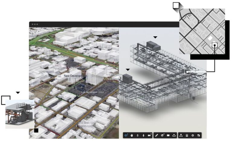
In a deepening of their partnership, Esri and Autodesk agreed to integrate Esri’s authoritative geospatial reference data into Autodesk Forma, cloud-based software that offers easy-to-use AI-powered tools to architecture, engineering, and construction (AEC) professionals for concept and schematic design.
Historically, AEC professionals have used multiple tools during the planning phase, often leading to inefficiencies and data loss. The integration of ArcGIS data into Autodesk Forma addresses these challenges by providing cohesive, consistent spatial data and analytics from the outset.
The inclusion of ArcGIS data—including basemaps and ArcGIS Living Atlas of the World data layers—in Autodesk Forma means that architects and planners can begin their designs with immediate access to comprehensive and cohesive geographic context. The combined strengths of GIS and building information modeling (BIM) technologies during early design and planning empower teams with enhanced mapping capabilities and improved collaboration, which can help reduce project costs and timelines.
“By partnering with Esri, we have committed to providing our customers with the unmatched geographic perspective that ArcGIS brings to the [AEC] project workflow,” said Eric DesRoche, director of infrastructure business strategy at Autodesk. “With Esri’s contextual data at their fingertips, architects and planners can use Autodesk Forma to design with location and sustainability in mind, leading to more resilient projects that can better support local communities.”

New American Community Survey Data Available in ArcGIS Living Atlas of the World
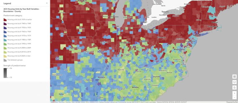
The 2019–2023 American Community Survey (ACS) five-year estimates are now available within ArcGIS Living Atlas of the World. These ready-to-use layers empower people to instantly begin to explore, map, and analyze the data. The multiscale layers have data for state, county, and tract levels. Having free access to these layers in ArcGIS Living Atlas significantly reduces the time GIS users spend on downloading and processing data.
In addition, this year’s update includes the ability to access vintage ACS data in ArcGIS Living Atlas with the pop-up function. The collection of 2010–2014 historical layers now has vintage information in pop-ups as well.
Census ACS data enables local officials, businesses, and researchers to understand what is taking place in their communities and helps community programs allocate resources. Access to the latest ACS data is crucial because many federal agencies are mandated to use it, and numerous nonprofits rely on it for grant applications, operations, and decision-making.


