Accurate landownership records and cadastral management are foundational to a country’s information infrastructure and underpin the wealth of its citizens. Geospatial technologies—especially GIS—are critical to rapidly documenting and formalizing land rights.
Millions of people move to cities to seek better livelihoods, education, and health to improve their quality of life. This rapid population growth within cities is posing challenges for governments worldwide.
For example, the African nation of Angola has an urbanization rate of 68 percent, according to the World Bank. Its capital city, Luanda, has experienced population growth of 3.8 percent from 2022 to 2023. Struggling to keep up with this growth, the country’s real estate sector is facing issues such as illegal land occupations and informal, unregulated land transactions.
Many buildings are constructed without proper registration or documentation of land and property ownership. Most of the citizens in urban areas lack official ownership documentation and security of tenure. The high demand and tenancy turnover have also created problems for public institutions that must collect the appropriate fees and taxes for property sales. This has led to a lack of necessary revenue for basic infrastructure such as water, electricity, roads, and education for municipalities.
Land management in Angola is also complex and involves many stakeholders and entities. The country’s two main land management entities are the property registry offices Conservatória do Registo Predial (CRP), under the Ministry of Justice (MINJUS), and the national mapping and cadastre agency Instituto de Geodesía e Cartografia de Angola (IGCA). IGCA works under the Ministry of Planning, Urbanism, and Construction (MINOPUH), which is responsible for mapping Angola’s terrain and infrastructure and managing the national cadastre—a comprehensive land registry that records property boundaries, land values, and land concession details.
The government of Angola realized that its goals of providing affordable housing, improving the real estate market, and collecting land-based taxes were impeded by the lack of accurate parcel boundaries and legal documentation of ownership. The government contacted the Mitrelli Group, an international group of companies that promotes and executes sustainable large-scale social and economic growth projects in the developing world. It has been working in Africa for more than two decades.
Angola worked with Mitrelli Group and Geo Data, an Esri partner that specializes in advanced land management GIS and mapping solutions for national entities. Geo Data implemented a solution to modernize and streamline the country’s land administration process.
Helping Make Growth Possible with GIS
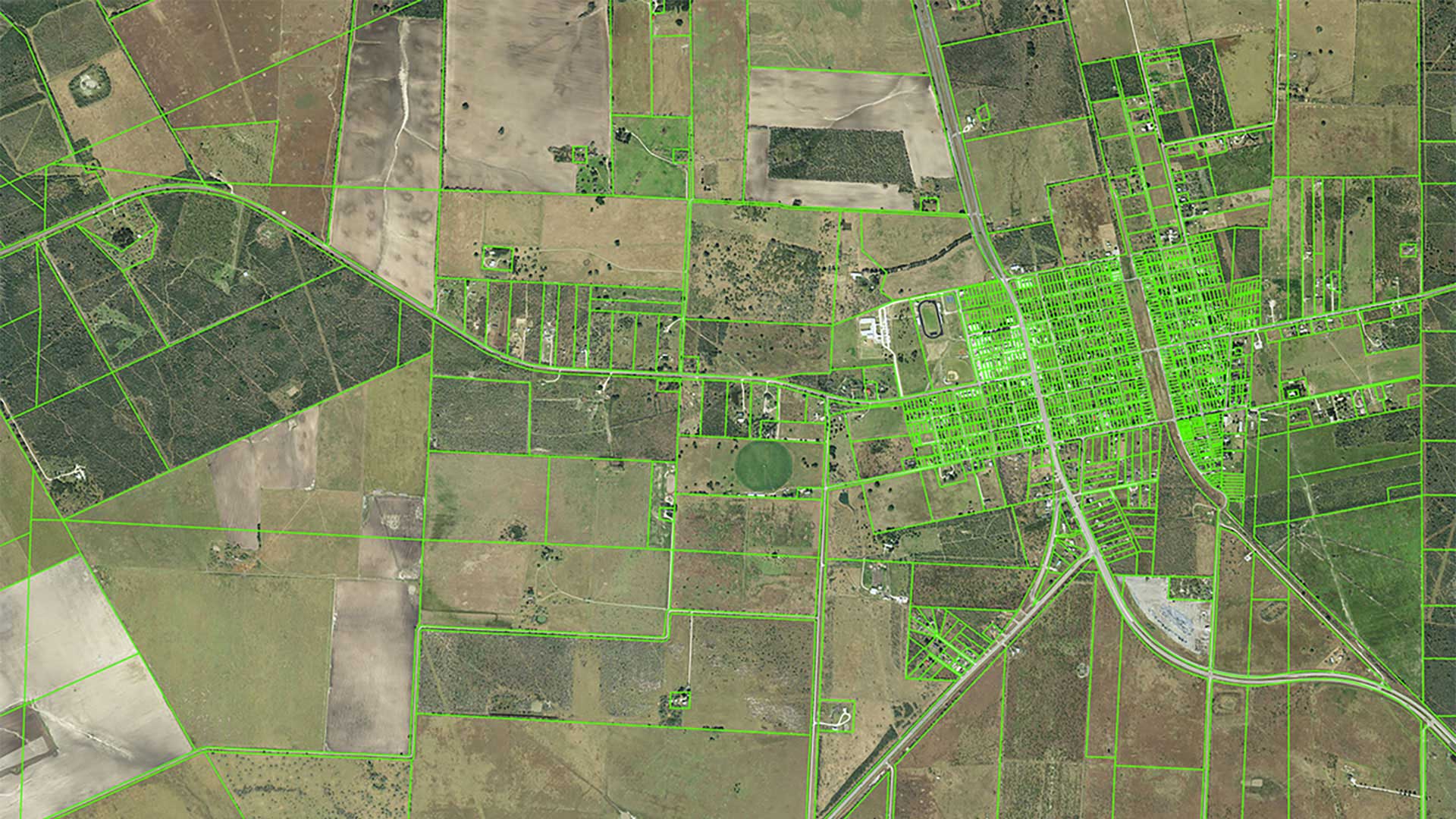
One specific focus of Angola’s government has been to improve land cadastre accuracy and consistency. Cadastre plays a critical role in preventing land disputes and provides essential details such as ownership, boundaries, and the value of real property.
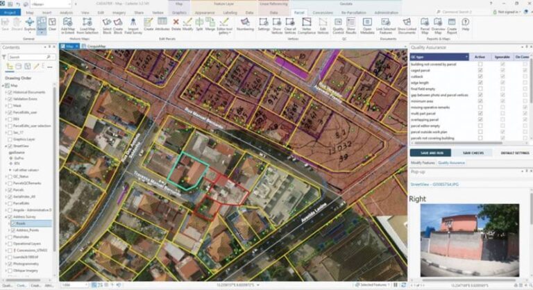
The Angolan government faced the challenge of mapping hundreds of thousands of parcels in a cost-effective way in just a few years and registering properties on a massive scale. To address these challenges, Geo Data purchased a software agreement with Esri to implement the Land Administration Modernization Program (LAMP). LAMP provides access to ArcGIS software for developing countries to enable land agencies to undertake needed modernization initiatives. Utilizing the LAMP program, Geo Data was able to develop a distributed cadastre system employing professional workflows using ArcGIS Pro, coupled with ArcGIS Enterprise for distributing, viewing, querying, and managing data by authorized stakeholders.
Geo Data leveraged drone-acquired imagery with photogrammetric mapping techniques using ArcGIS Drone2Map and geospatial artificial intelligence (GeoAI) to automate feature extraction and analysis. Geo Data helped IGCA save time and dramatically improve data quality by creating orthophotographs with centimeter-level accuracy and performing 3D mapping. Address surveys using the mobile app ArcGIS Collector updated and improved the address database by including street names with all historical name versions and house numbers.
Geo Data combined imagery, 3D mapping, and an address database with existing historical data, maps, and other documentation to create 450,000 accurate urban parcel boundaries. These were implemented into the cadastre system. The entire process was completed in less than three years.
The company also developed a system for the registration process at the CRP offices to support and automate the legal mass registration of 100,000 properties as part of an affordable housing project managed by the state. Geo Data implemented the registration system in all 22 registry offices in all 18 provinces of Angola.
The new cadastre system was distributed throughout all 18 province offices of IGCA with comprehensive training, technical support, and knowledge transfer. The two systems are connected via a bidirectional interface, which enables the registry office to view related properties on a map.
Implementation of a cadastre system based on geospatial technology and integration with the land registry achieved several objectives. These efforts increased security and legal certainty for registrants regarding ownership of the property as well as fostering public land tenure by providing accurate boundaries of the property parcels. The reliable property information obtained through these efforts has improved land management and tax collection and support urban planning.
Enabling Future Growth
The government of Angola has an ambitious goal to provide affordable housing to millions of people and increase the number of registrations to more than a million properties by 2027. Esri’s LAMP has provided critical technology that is helping realize that goal. The new interconnectivity of the cadastre system with the registration system now enables the generation of a deed or legal document and displays an accurate map of each property. Since Angola’s General Tax Administration will interface with this system regularly, property-related taxes and fees collected are expected to increase significantly.
As the national economy grows and the number of individuals looking for housing increases, the Angolan government expects to see a marked expansion of new home construction. Having accurate land parcel boundaries and efficient digital land registration processes will assist the government in its goal of building one million new homes on vacant parcels with appropriate right-of-use and ownership documentation.