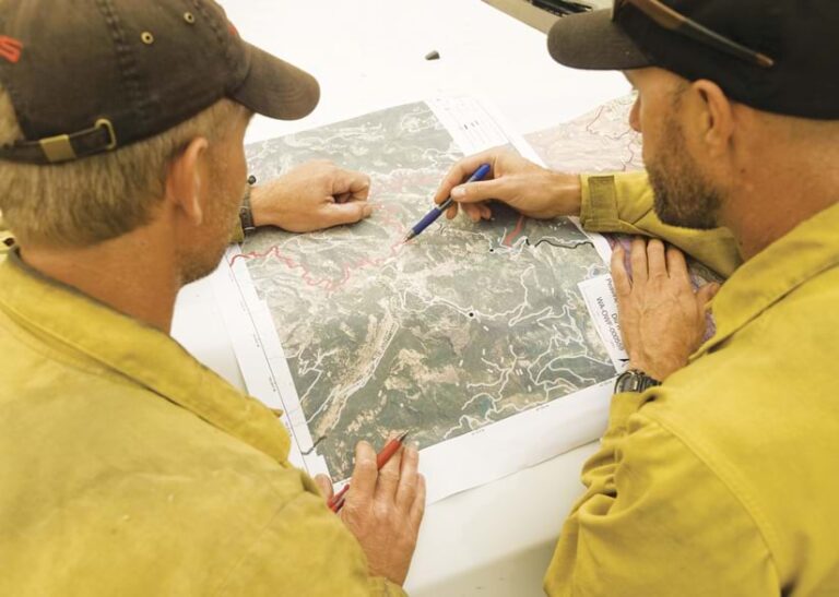
Each year as the days turn warmer and drier, a breed of GIS specialists across the United States begins to stir: the thousands of geospatial technology professionals who help protect land and lives from catastrophic wildfires.
When it comes to public awareness of the people who battle wildland fires, the firefighters who go toe-to-toe with flames are the most readily seen—and for good reason, since they directly square off with the threat. But there’s more behind wildfire response than meets the eye.

Geospatial tools and data sharing are paramount to planning and managing wildfire response, helping reduce devastation while saving lives and livelihoods. GIS specialists protect, update, and disperse this data. And thanks to the National Interagency Fire Center (NIFC), these professionals—who hail from all over the country—now have a central place to go to get answers to GIS-related questions, troubleshoot issues, find new geospatial solutions, and get relevant training updates: the Wildfire Response GIS user group on Esri Community.
An Expansive Collaboration
NIFC has an office in Boise, Idaho, where eight of the nation’s biggest wildland firefighting federal and state agencies—including the United States Forest Service, the Bureau of Land Management, and the National Park Service—send staff members to work together on large wildfire response efforts. With coordination aided by their representatives at NIFC, these agencies tend nearly 700 million acres of federal public land on which fire can, and does, spread.
Many of the nation’s GIS specialists who focus on wildland fire are distributed among those agencies, and they use their skills to update and maintain interagency geospatial content that’s available on an expansive instance of ArcGIS Online called NIFC Org. This content—which includes data, maps, and dashboards—serves numerous wildfire response needs, from collecting data in the field and tracking wildfire perimeters to showing the results of fire suppression efforts and providing information to the public.
Katie Hansen and Walker Henry are two of four ArcGIS Online administrators at NIFC who position themselves within quick reach of these GIS specialists. Hansen, Henry, and their team members ensure that the specialists are equipped with both the training and the resources they need to wield ArcGIS technology on behalf of the federal and state agencies they work for while managing active wildfires.
Assisting a group of specialists as large as the one that Hansen, Henry, and their colleagues do is no easy task—not only because of the sheer amount of information the GIS specialists need but also because everyone is scattered across the country. It is imperative that NIFC communicate effectively, in a way that holds up in a variety of contexts.
A Solution Close at Hand
For years, the team at NIFC communicated with its ArcGIS Online users via email, which had its shortcomings. The challenges only grew when NIFC began scaling up its work in 2016.
“Since our users are so diverse in their GIS skills, the information that we needed to relay to them required customized messages and multiple distribution lists,” Hansen recalled.
The team faced the typical pitfalls of emailing such a large group at once, including invalid email addresses, overzealous spam folders, and people missing important communication when they were out of the office. GIS specialists also often sent individual emails to the NIFC team to ask the same questions, which meant Hansen, Henry, and their colleagues relayed the same responses over and over.
“We needed to reach a larger audience with answers to the same questions,” said Hansen.

What the NIFC team wanted was a platform where important communication could be shared with the whole ArcGIS Online organization at once and where users could see and search for information at any time, regardless of when the communication went out.
The solution was much closer than anyone on the team realized.
In 2019, when NIFC hosted its official wildfire incident management course for GIS specialists in Sacramento, California, it had to combine two classes.
“There were over 60 students and 15 instructors conducting the scenario-based training,” said Henry. “Communication and organization were at the forefront of everyone’s mind.”
Sean Triplett, the tools and technology lead for the US Forest Service, was in Sacramento to assist with the training, and he had recently heard about Esri Community, Esri’s free online platform where GIS professionals and enthusiasts from around the world connect to share ideas, collaborate, and find solutions to problems. He had learned about the resource through a family member who was serving as a community manager in Esri Community. During one of the training breaks, Triplett, the NIFC team, and others got on a call with Triplett’s family member to learn about what the platform could do for NIFC.
The team was impressed. Within weeks, Hansen, Henry, and their colleagues had set up a user group and began adding users.
“The information sharing then just came naturally,” Henry remembered.
A Growing Community
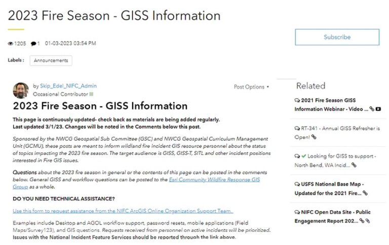
In just four years, NIFC’s Wildfire Response GIS user group on Esri Community has grown to nearly 1,500 users, with more joining all the time. The group is private, which gives the NIFC team control over who can access it. Any professionals who are involved in wildland fire response can ask to join the group, but all requests undergo an approval process. This is one of several key features that the NIFC team uses to protect the conversations and ensure membership relevance.
Another invaluable tool within Esri Community is the ability for administrators to label posts, according to Henry.
“The group serves as our official notification and information system,” he said. “Users are required to follow an Announcements label so that they receive immediate notifications for critical information and updates.”
Group members don’t just go to Esri Community to receive information from the NIFC team, however. They also log in to ask questions and crowdsource answers from other community users, such as how to install software on incident computers that organizations often rent during response operations.
Hansen, Henry, and the other group owners receive notifications when new messages are posted to the group and are ready to assist when needed. But as can happen when a large community of peers works together in a common digital space, other members often jump on requests for help before the NIFC team can get there.
“It is always refreshing to us as [administrators] to see our users engage with each other [and] feel comfortable enough to ask questions and search for answers from us and from their peers,” said Hansen.
Each spring, the Wildfire Response GIS user group on Esri Community receives a wave of new members who are fresh from their NIFC trainings. With this, Hansen, Henry, and their teammates hope that people not only know summertime for its formidable wildfires but also increasingly recognize the impressive teamwork that the GIS community engages in to face them.

