With more than eight million users and one million public layers, ArcGIS Online is the world’s largest mapping and data-sharing ecosystem. Its users create valuable maps and apps that millions of people concurrently view and interact with to understand their world.
To support the important work that users do every day, Esri continually updates ArcGIS Online to improve and expand its functionality and reliability. For the March update, the team added new 3D capabilities, a refreshed user profile page, additional editing permissions, and much more.
New 3D Capabilities
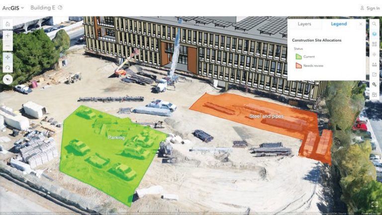
Drape-to-mesh, a new functionality in Scene Viewer, enables users to drape features above and below integrated mesh scenes, making those features easier to see. This is especially helpful for planning special events. Say, for example, that before an event, a public safety agency uses ArcGIS Drone2Map to capture an area of interest as an integrated mesh scene layer. Event planning staff can then sketch planning features—such as the locations of guards, perimeters, and assets—using a 2D web app and then contextualize and communicate those plans in a 3D app.

Users can also now maintain their scene layer’s item ID and URL by replacing the contents of a scene layer published from a scene layer package rather than having to republish the layer altogether. The scenes and apps that contain the scene layer will then have the updated contents. This improved workflow saves users time and provides a convenient way for them to assess the quality of their content before bringing it into a production web scene.
Transition to HTTPS Only
Esri is committed to providing strong security for the ArcGIS platform by using the latest industry standards and best practices for security protocols. That’s why ArcGIS Online will begin to enforce the use of all encrypted communication (HTTPS). To help organizations using ArcGIS Online transition to all HTTPS, users will be notified when they add an item that uses HTTP. Additionally, the ArcGIS Online Security Advisor tool in the ArcGIS Trust Center instantly identifies HTTP links. Starting December 8, 2020, ArcGIS Online will no longer support communication over HTTP, so users must update all their items to HTTPS before then.
The User Profile Page Gets a Refresh
The My profile page has been refreshed to make it easy for users to view and access their items and settings. When signed in, users can quickly identify items they shared with their organization and with the public. Two tabs, Public items and Organization items, display the user’s top 12 items—based on views, quality, and authoritative status—in each category.
The refreshed profile page also allows users to showcase their public items and profile. When a user’s profile visibility is set to Everyone (public), the public portion of the profile page serves as a live portfolio that can be shared on professional networks and social media. The user’s top public items are displayed in an easy-to-navigate gallery. Groups that the user is a member of and which are set to Everyone (public) are also shown on the profile page, along with the user’s image and bio.
And now, the new My settings page organizes users’ personal settings into four tabs. The General tab includes each user’s profile information and linked ArcGIS Online accounts. The Security tab has each user’s password and security question. The Licenses tab includes the person’s user type; role; licensed products; and, if licensed, the option to download ArcGIS Pro. And the Credits tab provides an overview of the user’s credit quantity (if the organization administrator has turned on credit budgeting).
Additional Editing Permissions
ArcGIS Online provides many fine-grained editing permissions. With the latest update, hosted feature layer owners and organization administrators can configure layers to allow editors to update attributes only. With this setting, feature geometries and locations are maintained even when feature attributes are changed.
Beta Products Accessible Through ArcGIS Online
ArcGIS Online users have access to many innovative beta products that invite experimentation and allow users to provide feedback to Esri to guide product development. The following beta products either are new or have received notable updates.
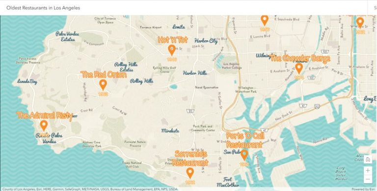
Map Viewer Beta has received several enhancements since the last ArcGIS Online update. One key improvement is label authoring. Now, longer labels automatically wrap into multiple lines, and users can tailor their labels by
- Specifying when they appear based on zoom level.
- Rotating and repositioning them.
- Using new fonts.
- Incorporating ArcGIS Arcade expressions.

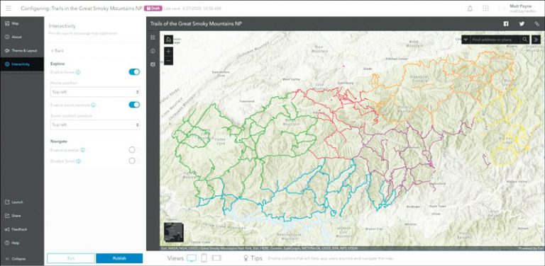
The Minimalist beta configurable app allows users to showcase the maps they author in Map Viewer Beta. The new configuration experience in Minimalist includes express setup and provides instant visual updates to streamline app creation. The draft mode enables users to view the mobile experience while building the app.

ArcGIS Notebooks beta integrates Jupyter notebooks directly within ArcGIS Online. Users can combine code, on-the-fly visualizations, analysis tools, and maps in the notebook environment. Notebooks can also be used to automate administrative tasks, such as managing users and content. (See “Spatial Analysis Meets Data Science with ArcGIS Notebooks” for more information.)

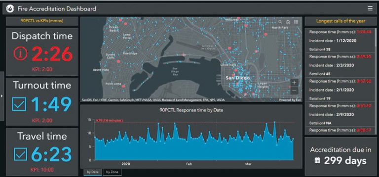
ArcGIS Dashboards beta has improved usability, including summary statistics for percentile and count, the capability to draw more features on the map, and better overall map performance. Dashboards beta also allows users to compose ArcGIS Arcade expressions directly in both list and indicator elements for conditional formatting, value conversions, and more.

Brief Mentions
A new feature layer template is now available for collecting tabular data, such as sales data. And when purchasing a new ArcGIS Online organizational subscription, customers can choose the region—the United States or Europe—where their geospatial data will be stored.
To learn more about these updates, read the blog articles from the ArcGIS Online product team.

