An innovative program that lets Virginia high school students earn university credit for geospatial classes has been expanded to include a broader range of students.
The Geospatial Semester (GSS) is an innovative dual enrollment program between high schools in Virginia and the Integrated Science and Technology department at James Madison University (JMU) that started 13 years ago. Juniors and seniors are dual enrollment students who take GIS classes at their high school and earn credit from the university.
Students learn how to find data, create maps, and apply mapping analysis tools to solve real-world problems. The Geospatial Semester in Virginia is financially self-supporting (and has been for more than a decade).
Students from Loudoun County Public Schools (LCPS) participate in GSS. Loudoun County, located in the Commonwealth of Virginia, is part of the Washington (DC) metropolitan area. LCPS obtained an education license for Esri software more than 15 years ago. Today there are geospatial science classes taught in 11 of the county’s 17 high schools.
Michael Wagner is the lead GIS teacher in the LCPS Science Office. “I developed the original GIS course with my colleague at Heritage High School, Jon Pruess,” said Wagner. “We ran a pilot course for three years and then started to roll it out to the other schools in the county.” In addition to teaching earth and geospatial science classes, Wagner oversees all geospatial science classes in the county and manages the district’s relationship with JMU and GSS.

At the beginning of the 2019–2020 school year, Taryn Langmead, earth science and geospatial science teacher at Loudoun Valley High School, teamed up with Dan Loper, special education teacher at the school, to teach a GIS class that combined exceptional learners with the dual enrollment students.
“Basically, we decided to introduce geospatial science in the Basic Skills class for our exceptional learners that range from grade nine to returning graduates,” said Langmead. The class was developed as a cooperative effort between the principal at Loudoun Valley High, the special education department chair, Loper, and Langmead. Support for class instruction was provided by teaching assistants, Edwina Payne and Carrie Crum, as well as student helper Elsa Higbie.
“Foremost in our minds is how our exceptional learners have just as much right to knowledge as their typically developing peers,” said Loper. “Next, we considered differentiation. Our exceptional learners have diverse needs as individuals, sometimes changing on a day-to-day basis. We introduced the GIS concepts with those considerations in mind. These experiences may open doors for our students that might not have otherwise been available to them. In addition, the content may become an inspirational platform for our students to develop a love of the field and eventually find GIS employment.”
“Dan had previously used GIS, so we were well equipped to scaffold GIS concepts to help the exceptional learners understand the expected outcomes for the class,” said Langmead.
To make the course accessible to all students, the use of descriptive teaching and learning techniques were adopted. Flash cards were used with some of the students to help them better understand GIS concepts and terminology. In addition, the course was referred to as Geography Science rather than Geospatial Science, and data was called number knowledge.
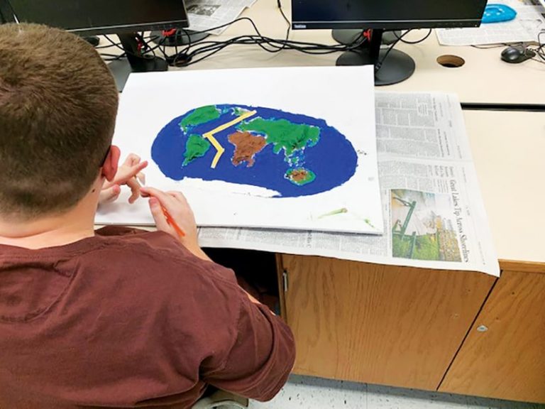
Lessons combine different approaches to learning content. For example, some lessons are computer based. Students use ArcGIS Online to complete them. In other lessons, students make models of the landforms they are studying.
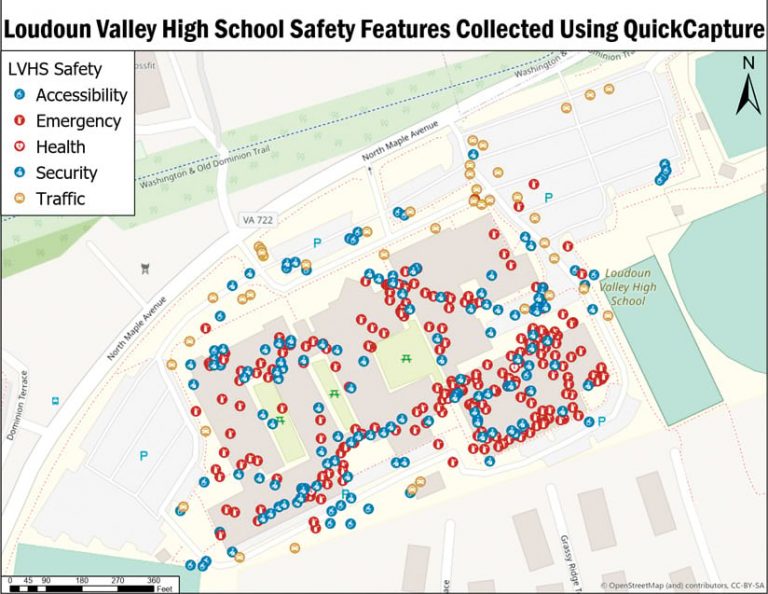
Participation in projects varies to accommodate authentic inclusion and provide as much lesson detail and curriculum as possible. Projects can have many levels. For some projects, dual enrollment students create maps and surveys using ArcGIS QuickCapture. Then these students work collaboratively with exceptional learners to gather data around the school campus. Exceptional learners loved it when the dual enrollment students worked with them on different projects.

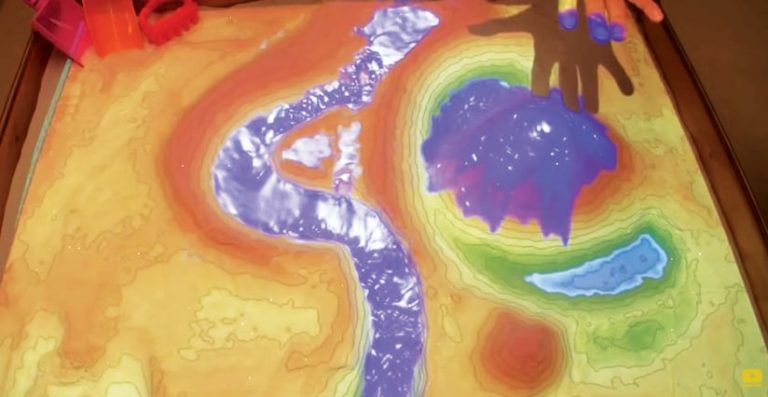
Langmead built an augmented reality sandbox using information from the University of California, Davis (UC Davis). An augmented reality sandbox combines sand with 3D visualization applications that were created through National Science Foundation-funded research at UC Davis. Molding the sand manually brings a simulated landscape to life. The visual perception of the sand is augmented in real time with a colored elevation map that has topographic contour lines and simulated water.
Loper and Langmead tried to place towns in the augmented reality sandbox as part of classroom lessons. Unfortunately, the COVID-19 pandemic curtailed their sandbox modeling activities, but the two teachers were able to continue using ArcGIS Online for data and visualization.
Exceptional learners provided perspectives that Loper and Langmead hadn’t previously considered. They also had the opportunity to give the dual enrollment students feedback on their midterm projects, which those students appreciated.
The teachers generally felt that taking the class helped the exceptional learners improve their communication skills because they could better explain how they perceive the world. At the beginning of the school year, some exceptional learners were asked to provide details about a particular map feature, such as a mountain or a beach. Initially, students didn’t know how to describe those features. As the school year progressed, however, these same students were making observations and analyzing what they were seeing on the map and connecting that with other experiences or information they had learned.

“The students were enthusiastically engaged and often stepped up to challenges that were outside of their comfort zones. Some students would do really well with one task and then help out their classmates with the same task. Other times they would struggle, but there was always perseverance and encouragement fostered between all of the students,” said Langmead.
“I think that the cognitive abilities among the students have most certainly improved at varying levels,” said Loper. “This is evidenced by the demeanor in which they approach the class, the looks on their faces as they are getting to know various GIS concepts and tools, and the utter exuberance of some students as they embark on their GIS learning.”
Wagner believes the spatial thinking skills they develop will benefit these students long after high school and might help them in getting a job that uses GIS.
“I would love to figure out a way that ArcGIS Online and some of the tools that come with it could be available to these students after high school,” said Wagner. “I have worked with some of our job coaches on integrating the ArcGIS Workforce app for students who are involved in community-based instruction. Though we are in the early stages of this project, I believe it is a tool that can allow students to be more independent as they navigate daily tasks.”

