Pima County’s Green Building Manager Shares Advantages of Using Navigator for ArcGIS
Every morning in Pima County, Arizona, six inspectors from the building and site development division leave their homes to visit 5 to 16 houses or buildings to make sure construction is up to code. The agency is committed to helping property owners and professionals complete projects economically, safely, and sustainably.
The inspectors’ coverage zone includes all of Pima County, an area that encompasses more than 9,000 square miles and is home to about 1 million people. A little more than half of Pima County residents live in the city of Tucson, while the rest are spread out across rural stretches of the Sonoran Desert and nearby mountain ranges.

That means county inspectors have to do quite a bit of driving. But before they start their day, each inspector downloads a route that has been strategically designed to account for the time it will take to drive to each site and perform an inspection.
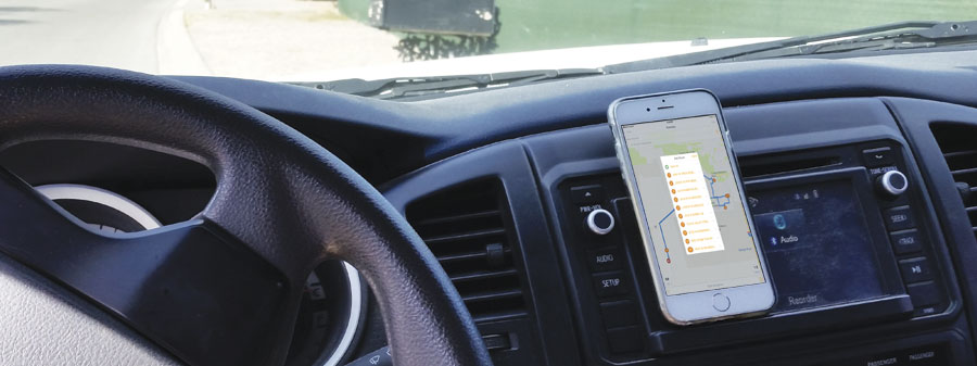
That route is made using Navigator for ArcGIS, a new mobile app from Esri that is part of ArcGIS Online. The app is designed to get fieldworkers where they need to be in the most efficient and reliable way possible. It can read Esri data or custom data, and it allows field crew members to search for and navigate directly to the organization’s assets—even if those assets are located off commercial street networks.
Like many other Esri apps, Navigator is fully integrated with the ArcGIS platform. It works offline and has seamless interactions with Collector for ArcGIS, an app designed to help crews collect information and images in the field and sync them with the office. Navigator can also receive stop assignments directly from other apps, and its travel modes calculate the most efficient routes possible based on the type of vehicle being used.
Pima County’s green building manager, Rich Franz-Ünder, recently shared some details about his experience with Navigator. This is an edited account of his interview.
Q: How does being able to use custom data in your navigation app help you out?
A: There are two different fundamental problems with other mapping software products. First, they are not current. Our inspectors work in brand-new housing divisions. Without our custom map layers, we can’t route inspectors to those areas. Second, sometimes mapping software has an address that is different from the official address, and the program may send us to the wrong place. The county has the official address data we use for our records.
The Navigator app works with our custom data. Before, we would have to convert addresses to latitude and longitude and then upload multiple stops. That takes up a lot of time every morning. With Navigator, it’s one click and they’re ready to go.
Q: What back-office analysis have you been able to integrate into the app?
A: We analyzed how much time our staff spends performing inspections so we can determine their estimated times of arrival for clients. We used to spend about four staff hours every day answering the question, when is my inspector going to be here? Soon, homeowners will receive an email the afternoon prior to the inspection that contains the inspector’s estimated time of arrival. Homeowners will be able to manage their time better because they will have better information.
We use our analysis to create routes that better balance workloads, and we push out those routes to the Navigator app. Now inspectors are traveling an average of 34 percent fewer miles each day and saving 18 percent of drive time. And we are saving $197,000 per year on mileage and inspectors’ time.
Q: How does the ability to work offline change things for you and for the inspectors?
A: That is key. Pima County is a big, rural county, and there are areas without cell phone service. Inspectors need to be able to receive routing and directions in these areas. Staff also use a tool in the permitting system that has to work offline. When the inspectors get back online, the app has to be able to adjust to what happened, to sync with other systems. That is huge for us.
Learn more about Navigator for ArcGIS.

