Basemaps are more than technical tools. They are hidden infrastructure that support and advance development around the world. Basemaps are foundational data that governments, businesses, and communities need to make informed decisions, create strategic plans, and respond effectively to challenges.
Esri provides a large collection of 2D and 3D basemaps built with data from both Esri and OpenStreetMap (OSM)—and soon, users will be able to access basemaps built with additional data from the Overture Maps Foundation, a collaboration that Esri joined last year. All these basemaps, which cover the globe, employ open data from many sources. They are comprehensive and highly detailed, thanks to the cutting-edge technology and many human hands that contribute to and edit them.
“What’s nice about this kind of open data is you can have incredible detail for some types of features,” said Deane Kensok, Esri’s chief technology officer for ArcGIS content. “And the maps get better and better over time as the open data community improves the data.”
Basemaps are better in some areas of the world than others, however. So as Esri continually works to improve the open data-based basemaps available in ArcGIS, staff are also coming up with new ways to help national mapping agencies in underrepresented parts of the world build up their basemaps.
“National basemaps are indispensable for a country’s development,” said Sohail Elabd, Esri’s director of international strategies. “Investing in building basemaps would be transformative for many countries.”
Developing Comprehensive 3D Basemaps with Overture
For the past few years, Esri has been using OSM’s Daylight Map Distribution to support the basemaps it develops and hosts. At the end of 2024, however, Daylight Map Distribution is moving into mature support. So Esri is transitioning to Overture Maps and releasing a new version of the Open Basemap with that data.
Overture Maps includes a curated and integrated collection of open data from OSM and many other sources. Esri’s new Open Basemap will be designed and delivered as a vector tile basemap available in multiple map styles, which can be easily customized into many other styles. Overture data will also be used to update parts of Esri vector basemaps.
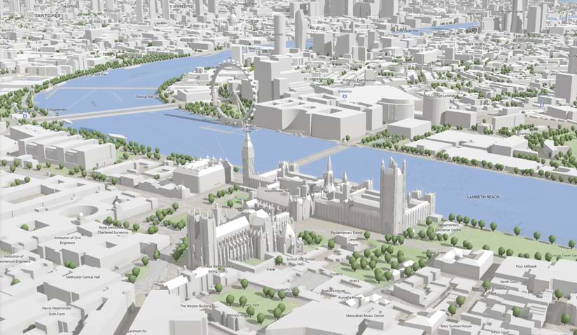
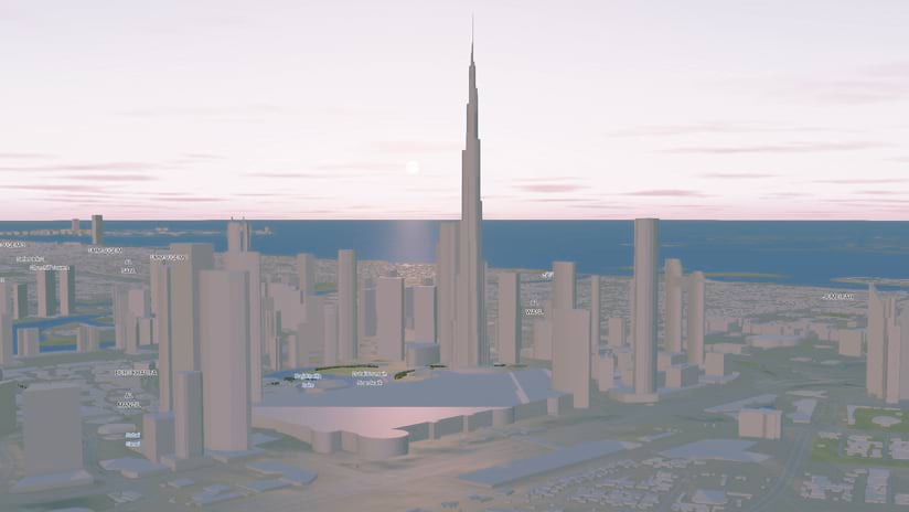
Esri has been working with other Overture Maps members to include more buildings with 3D attributes—such as building heights from lidar and data from contributors to Esri’s Community Maps Program—in Overture data. Expanding on the new 3D basemaps that Esri released last year, Esri will offer new 3D scene layers for buildings, trees, and place labels that are created with Overture Maps data.
In addition, Esri will use Overture data to update large parts of the new Esri 3D Buildings scene layer, which is currently in beta. The 3D Buildings layer is produced with data from commercial, community, and open data sources. Esri will use Overture buildings data to add coverage where commercial or community data is not available.
“Overture Maps provides the most comprehensive buildings layer that exists,” said Kensok. “It has over 2.3 billion buildings in it already and combines data from multiple sources, including OSM, Esri, Microsoft, and Google.”
In some areas of the world, the buildings data is so detailed that it includes columns, patio coverings, and solar panels. Just like with Esri’s basemap data, these details are largely generated by humans, rather than machines, who hand-draw or edit the data.
“The Esri Community Maps datasets are coming from GIS professionals, cities, counties, and national mapping agencies, so they tend to be high quality,” said Kensok. “They nicely complement the great work of the OSM community to build and maintain open data around the world.”
Other Overture Maps members are also enhancing the 3D buildings data that is available. Meta, for example, has taken elevation values from US Geological Survey lidar data and appended estimated heights to buildings. This can be used to extrude the buildings from the footprints and show them in 3D.
“Overture members and OSM mappers have added heights to millions of buildings in the past couple years, so we have an emerging 3D landscape that didn’t exist before and that we can continue to scale internationally,” said Kensok.
Just like it did with OSM’s Daylight Map Distribution, Esri will update its maps and layers with Overture data monthly, ensuring that any data added by Overture members and the OSM community is quickly reflected in Esri’s basemaps.
Making Basemaps More Widely Available Around the World
Having a reliable and detailed map-based view of a country’s landscape—from mountains and rivers to roads, buildings, and farmland—is pivotal for stimulating economic growth, attracting investment, and enhancing public services. That’s why, in addition to contributing to OSM and Overture and including authoritative data from Esri users in its basemaps, Esri is committed to ensuring that comprehensive geospatial data and detailed basemaps are available for every region in the world.
In 2019, Esri launched the Africa GeoPortal, which brings together geospatial data, tools, and learning for free for anyone working in Africa or on geospatial projects based in Africa. It is also a place for user communities to share their geospatial data and open it up for use by others.
The Africa GeoPortal, which is powered by Esri technology, comes with content from ArcGIS Living Atlas of the World that’s specially curated so that it relates directly to Africa. Users also get access to ArcGIS Online, apps and analytical tools, and a large selection of Esri’s e-Learning materials. But the unparalleled value of the Africa GeoPortal comes in the form of community-contributed data.
“People bring in data they might collect at a local or national or continental level, especially if they need a place to store it,” said Matthew Pennells, Esri’s director for global community engagement. “We also have governments adding data, [along with] broader partners in the geospatial industry, such as […] Digital Earth Africa.”
The Africa GeoPortal is intended to be a model for other areas of the world that lack extensive geospatial data, including the Caribbean and Latin America, which have their own geoportals as well.
Many national mapping agencies, though, still lack the capacity to build the authoritative basemaps their countries need to plan urban development and infrastructure projects, prepare for natural hazards, augment climate resilience, optimize agricultural practices, ensure food security, protect the environment, and manage natural resources. So Esri is continuing to expand its efforts to contribute to open data, whether by ensuring that its geospatial data can be downloaded or used as a service and is interoperable with other systems, or by helping users in emerging markets gain the technological capacity to conduct advanced GIS work.
“The evolution of basemaps—particularly the advancement into 3D representations—is revolutionizing how people perceive and interact with geospatial data,” noted Elabd. “We hope the solutions we develop can be a model that many national governments, regional organizations, businesses, and aid organizations can repeat going forward.”
As Esri continues to champion open data initiatives, contribute to collaborative projects like Overture Maps, and empower national mapping agencies, the future of basemaps looks promising. The accessibility and comprehensiveness of these foundational datasets will play a pivotal role in driving sustainable development, making informed decisions, and responding effectively to global challenges.
“The call to action is clear,” said Elabd. “The geospatial community needs to invest in national basemaps, embrace the power of 3D geospatial technology, and collaborate to build a more connected and informed world.”


