Esri’s gift of free GIS software for all K–12 schools in the United States opens up new horizons for teaching not only geography but also history to American students.
Geographers and national leaders have long been concerned that geography is not being taught enough or very well in K–12 classrooms, as I outlined in my winter 2011/2012 column for ArcNews. Over the past few decades, changes in school curricula have often substituted a mushy blend of “social studies” for rigorous, stand-alone courses in geography and history, as well as other core subjects. These blended social studies classes are often taught by teachers who have some undergraduate background in history but who frequently have little knowledge of geography or GIS.
Esri’s ConnectED donation of ArcGIS Online to all US classrooms is now turning out to be a boon for history teachers as well. Most of them can benefit by integrating GIS into both their history classes and the geography components of their social studies courses.
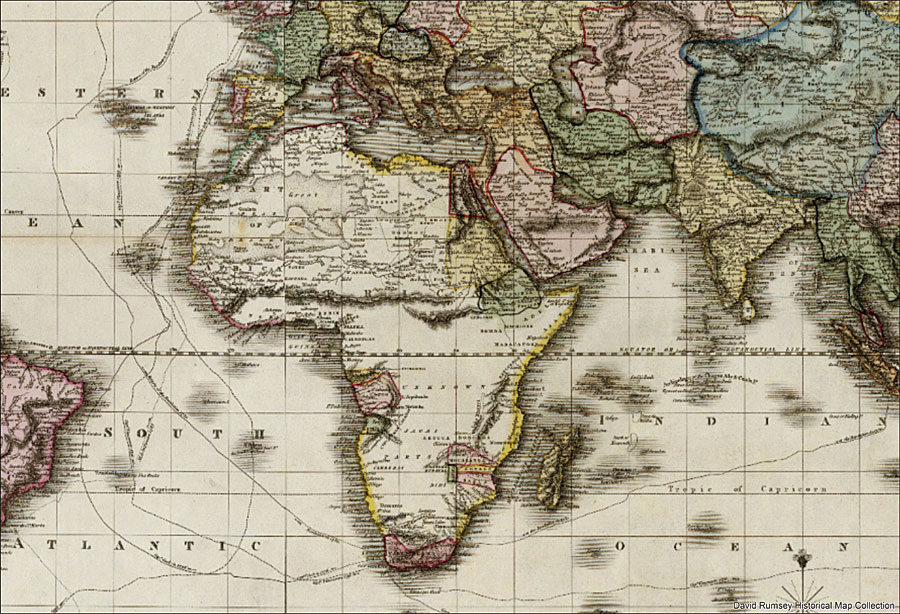
This synergistic development should come as no surprise, as geography has traditionally had its longest and deepest interactions with history. Geographers have practiced historical geography with distinction for centuries, as illustrated by D. W. Meinig in his book, The Shaping of America: A Geographical Perspective on 500 Years of History, to name just one example. And many historians, such as Fernand Braudel, have contributed geographically grounded historical accounts that have become classics in the study of geography.

During the past few years, significant new forms of interaction between geographers and historians have also begun to emerge. In higher education, geographers and historians are integrating historical and geographic research agendas using spatial analysis and new geographic technologies—and the potentially transformative implications of this work for both history and geography are clear and exciting. These areas of intellectual, educational, and technological collaboration—often referred to in shorthand as historical GIS—are now sparking fundamental reevaluations of historical research methods and interpretation. They are also revealing new possibilities for education and a better understanding of our world in both history and geography.
Historians and history teachers are starting to understand key aspects of GIS, such as its ability to integrate, analyze, and visualize large amounts of spatial and temporal data from multiple disciplines and sources. They are also beginning to comprehend the technology’s ability to move across multiple scales, both spatially and temporally, or geographically and historically. This capacity to combine space and time in one integrated system has profound implications for research and education in history and geography.
Many history teachers are beginning to grasp the significance of incorporating a spatial dimension across multiple scales into historical research and education, despite the barriers of vested interests and outmoded curricula in many of their schools. Daniel J. Bodenhamer, a prominent historian, has argued, for example, that “of all modern information technologies, GIS may have the most potential for breaching the wall of tradition in history,” noting that “its ability to integrate disparate information drawn from the same place at the same time allows scholars to simulate the complexity of history.”
Just as the microscope and DNA sequencing, for example, have revolutionized research and education in biology, making the work of Carl Linnaeus and Charles Darwin ever more important to modern biology and medical applications, so too do new geographic technologies, such as GIS and real-time interactive GPS/GIS technology, have the potential to extend rather than displace traditional research and teaching in geography and history.
Recent advances in GIS can help historians tackle the issue of explaining the historical construction of space, says Stanford University historian Richard White in the forward for Placing History: How Maps, Spatial Data, and GIS Are Changing Historical Scholarship.
“GIS creates the possibility of extending spatial analysis beyond the local scale,” writes White. “We can tell more complex stories more clearly and coherently.”
He also points out that spatial history not only fosters collaboration within the discipline but essentially requires it. Thus, the number of major international historical GIS projects—often coupled with traditional methods of historical and geographic analysis—continues to expand. Examples of such projects include the China Historical GIS, the Great Britain Historical GIS, the Tibetan and Himalayan digital libraries, the Hawai’i Island Digital Collaboratory for Humanities and Science, the US National Historical Geographic Information System, and the Holocaust Historical GIS Project, among many others. (These historical GIS projects are discussed in more detail in my article “Geohistories” in the book GeoHumanities [Routledge, 2011], from which portions of this column were adapted.)
Begin Using GIS for Education
Any school in the United States can sign up for a free ArcGIS organizational account by visiting Esri’s ConnectED home page. Scroll down, click “Request a free school account,” and complete a brief online form to get started.
The AAG-Esri GeoMentors program can help with technical support and educational resources as well. Sign up online to seek GeoMentor assistance (or to serve as a GeoMentor), and then program staff will provide information on how to integrate GIS into the classroom or extra-curricular student activities. The GeoMentors website also has details about available training and curriculum materials, as well as information on how to connect with GeoMentors, teachers, and school collaborators. Additionally, join and follow several GeoMentors online communities, including those on social media, to get program announcements, discover helpful new resources, and meet fellow members of the GeoMentors community.
Among the many educational materials available to K–12 history and geography teachers are the Esri GeoInquiries for US History. They are designed to be fast and easy-to-use instructional resources that incorporate advanced web mapping technology. With no installation, fees, or logins necessary, instructors present the 15-minute activities in each collection from a single computer or projector. The Esri GeoInquiries collection includes a range of subjects, such as history, geography, and earth science, and is meant to supplement the lessons and topics already being covered in the classroom. Each GeoInquiry even describes the specific textbooks and chapters with which it aligns so the activities adhere to current curricula.
Many other educational resources for teaching and learning GIS are also available. The My Community, Our Earth: Geographic Learning for Sustainable Development (MyCOE) program, for example, works with students in the United States and around the world on GIS and geography projects within their own communities, and some assignments include historical GIS components. Access the program, which is supported by a number of US federal agencies and international organizations, or contact Candice Luebbering for more information.
Synergistic Opportunities
Historical GIS is destined to be common ground for the disciplines of geography and history for decades to come. We now have new synergistic opportunities for history and geography teachers to collaborate to benefit our K–12 students, thanks to Esri’s remarkable gift of GIS software to these schools.
At the Association of American Geographers, we seek creative and productive new ways to enable interaction between geography and history, these two old friends that have coexisted and been in conversation for millennia. As we embark on revitalizing and reenergizing American educational agendas, these time-honored disciplines of study and research are fresh with promise and laden with enormous new potential for understanding not only our past but also each other.
Contact Doug Richardson at drichardson@aag.org.
Read other articles in the “Crossing Borders” series.


