Famous for historical landmarks and museums, Houston, Texas, draws more than seven million visitors per year. Leading-edge medical and research facilities, the National Aeronautics and Space Administration’s (NASA) Johnson Space Center, and flourishing port and railroad industries have also attracted over two million residents, making Houston the most populous city in Texas.
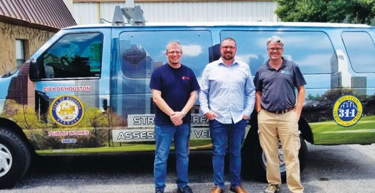
With a bustling economy and robust tourism, quality roadways are a must. To collect data on current road conditions and maintenance requirements for its 15,000 miles of heavily used roads, the City of Houston was already using street surface assessment vehicles (SSAVs). The SSAVs performed mobile inspections and gathered pavement imagery, which helped Houston prioritize planned road improvement projects to make the best use of available funds.
Although the SSAVs were effective, after several years of use, there was room for improvement. City officials needed more specific data regarding the actual surface area of roads so they could improve road quality ratings and provide accurate information to contractors. They also needed a more effective way to analyze the data generated by the SSAVs. Esri startup partner Argis Solutions, Inc., had the answer.
Focusing Improvement Efforts Where It Really Counts
Argis, a Colorado-based company founded in 2016, specializes in technology that combines ArcGIS geospatial data with augmented reality (AR) and machine learning. Members of the Argis development team had helped build and maintain the original SSAVs as part of Idea Integration (the company originally tasked with the SSAV project), and they understood exactly what the City of Houston needed to do next.

“They were looking to fix the roads that impact the largest number of people in order to achieve the best overall improvement in ride quality across the city of Houston,” said Argis founder Brady Hustad. “They also wanted to improve the overall efficiency of the funds spent on road improvements.”
The startup was subcontracted alongside the International Cybernetics Corporation (providers of the SSAV hardware) by Indigo Beam Consulting, the company managing the project on behalf of the City of Houston. Their task was to convert one SSAV into a ride quality measurement vehicle (RQMV) and make it into a more focused vehicle to enhance road monitoring and maintenance.
Now, once the regular SSAVs have conducted road inspections and collected pavement imagery, the new RQMV gets sent out to evaluate project sites and potential issues both before and after repairs and maintenance work are done. The combined SSAV survey data and RQMV assessments produce an abundance of ArcGIS data, so in addition to needing training on how to use the new van, the city also needed a way to compile and interpret all that data.
A New Approach to Using Data
As the SSAVs and RQMV collect information, the city receives it as a mix of video, images, text-based data, and GPS coordinates. To ingest these inputs and turn them into feature layers in ArcGIS Enterprise, the Argis team designed and created a migration tool, the SSAV web viewer. Each layer focuses on a different aspect of road quality, such as ride quality, pavement assessment, and road width and length. These layers are organized and moved into the city’s data servers so city staff can use this information to make road maintenance plans.
“We used Esri tools to provide the advanced analysis and the spatial optimization tools to help the city make better decisions,” said Hustad.
The SSAV web viewer that Argis built can analyze the condition of individual streets and also rate the overall condition of whole neighborhoods. This way, instead of focusing solely on repairing the worst individual roads, the city can ensure that entire areas receive maintenance at the same time. In turn, this fosters efficiency and generates greater resident satisfaction.
Increased Accuracy and Reduced Labor Costs
The migration tool produced by Argis reduces the number of staff hours needed to analyze the vast amounts of data collected by the SSAVs and the RQMV, saving the City of Houston on labor costs and reducing the potential for human error. Additionally, by applying machine learning, the system will continue to improve as it captures and processes more data. As the RQMV gathers new information, Houston’s system enhances the accuracy of its digital model of the roads. This will lead to better road assessments, improved city planning, more accurate repair cost analysis, and a greater return on investment.
Argis’s cutting-edge data analysis solution enabled the City of Houston to streamline its processes for evaluating road conditions. With the new RQMV functionality, the city has access to current, intelligent data on ride quality and street maintenance needs. Having the data layers created by the SSAV web viewer solution easily accessible within the city’s own GIS helps city leaders make the best decisions on how to spend budgeted funds and support the implementation of further analysis, resulting in better roads for everyone.
“The City of Houston deserves a lot of credit for its willingness to try something different in order to do a better job,” said Hustad.

