Consider this scenario—a GIS specialist needs to present the results of a critical geospatial analysis to an important audience. The audience members are unfamiliar with geospatial technology, and their meeting time is limited. To make things even trickier, the presentation will take place with limited internet access.
Kevin Haynes routinely faces these situations as the environmental GIS manager for the South Carolina National Guard. Integrating complex quantitative analysis in the military decision-making process is a large part of his job. Although ArcGIS StoryMaps has enabled Haynes to create captivating multimedia narratives about his GIS work, obstacles such as time sensitivity and the need for offline access remained—until he used briefings in ArcGIS StoryMaps.
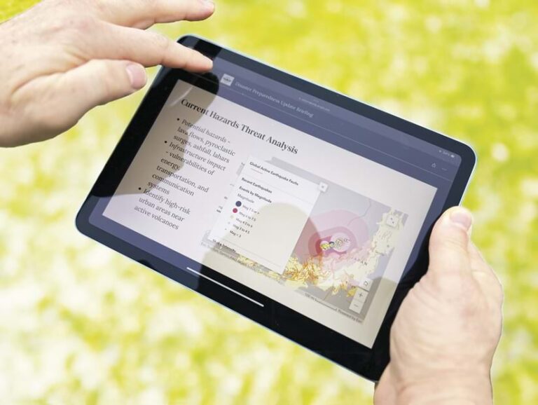
A new output type, briefings, was released in ArcGIS StoryMaps in ArcGIS Online in February, with planned availability in ArcGIS Enterprise 11.3. With briefings, ArcGIS StoryMaps now provides a slide-based presentation-style format to share dynamic geospatial work using popular ArcGIS StoryMaps blocks. Authors control colors and fonts, enabling the creation of a briefing that meets brand guidelines and accessibility requirements. The briefings builder is easy to learn, intuitive to use, and requires no knowledge of digital design or web development.
Benefits of Briefings
Briefings became available at a crucial time for Haynes, as senior leadership was preparing a presentation for other military leaders about cybersecurity. Using briefings, Haynes transformed a verbose report into a briefing that made an impression. The presentation was a success, and Haynes was officially recognized by the state adjutant general for his storytelling efforts.

“This experience solidified my belief in the power of ArcGIS tools to evolve and cater to the dynamic requirements of military and strategic communication,” he said.
Two briefings qualities have particular impact for Haynes:
- A slide-based presentation format—Prior to briefings, Haynes said, integrating interactive content such as web maps; 3D scenes; and apps such as ArcGIS Dashboards into presentations was a cumbersome process. With briefings, users can include dynamic or interactive items from their ArcGIS ecosystem and embed most other outside content.
- Offline accessibility—With the ArcGIS StoryMaps briefings app, available on iOS and Android tablets and Windows computers and tablets, customers can present a briefing without an internet connection. Authors can also specify how ArcGIS web maps and 3D scenes appear in offline situations. For example, a mobile map package or mobile scene package can be preconfigured to include additional interactivity in the offline version of the briefing.
One Builder, Many Uses
There are many other situations where briefings can be an ideal solution:
- Updating a recurring report—A briefing can be duplicated so that the same presentation can be used with updated content. Authors can empower additional stakeholders to edit a briefing by configuring permissions for shared update groups in their ArcGIS organization.
- Simplifying a complex topic—A slide-based format presents key takeaways in a timely manner. Each briefing has a built-in table of contents, making it easy to navigate. Briefings can also be packaged together in a collection in ArcGIS StoryMaps if they need to appear together, like chapters in a book.

