Trachoma is the leading infectious cause of vision loss and blindness in the world, according to the World Health Organization. In Kenya, the disease is highly prevalent due to inadequate water access, poor sanitation, and limited health care, especially in the country’s rural and remote areas. An additional challenge is the difficulty of tracking seminomadic tribes such as the Maasai.
Though it’s easily preventable and treatable in its early stages, trachoma is considered a major health risk in Kenya and about 40 other countries where an estimated 115 million people are at risk of vision loss due to trachoma. The disease is spread by infected flies or from contact with an infected person. When left untreated, trachoma causes scarring and inward-growing eyelashes, which scrape a person’s eyeballs and can eventually lead to blindness.

To address this devastating disease, the World Health Organization recommends a strategy of surgery, antibiotics, face cleanliness, and environmental improvements. The organization aims to eliminate trachoma as a public health problem by 2030.
Sightsavers is a nongovernmental organization and Esri Nonprofit Program participant that was founded in 1950. Sightsavers partners with government agencies and other nongovernmental organizations in developing countries to treat and prevent avoidable blindness. As part of this effort, Sightsavers is using ArcGIS Pro, ArcGIS Online, ArcGIS Field Maps, ArcGIS QuickCapture, and ArcGIS Dashboards to help Kenya’s Ministry of Health identify gaps in the distribution of antibiotics that prevent trachoma transmission in Kenya.
Sharing GIS Data to Prevent Vision Loss
Sightsavers began working in Kenya in 1952. Although the country’s government has committed to universal health care, many people in Kenya—especially in remote areas—struggle to access health-care services and water for sanitation. As a result, an estimated 7 million people in Kenya are at risk of trachoma.
“Our participation in the Esri Nonprofit Program, as well as other relationships that we have developed, has helped us expand our services to those in need through the exchange of data,” said Alexandre Chailloux, senior research associate for spatial analysis at Sightsavers.
Many nongovernmental organizations work on different projects in the same geographic areas where the availability of population records and administrative data is poor, Chailloux said. “Capitalizing on the opportunity to share GIS data between the different organizations improves the efficiency, accuracy, and outcomes of their activities—ultimately improving the life opportunities of many more individuals,” he added.

The Ministry of Health has performed annual mass drug administration campaigns in those areas of rural Kenya where trachoma has been prevalent for many years, Chailloux said. “However, significant reinfection was common only a few years after treatment. A primary reason for the limited success was because we weren’t entirely sure of the locations of all community groups living in rural areas,” he explained. “Additionally, there’s a corridor that runs through Tanzania and Kenya used by the Maasai, a seminomadic community, and knowing where they are located at the moment of the drug distribution is challenging.”
A New GIS Methodology
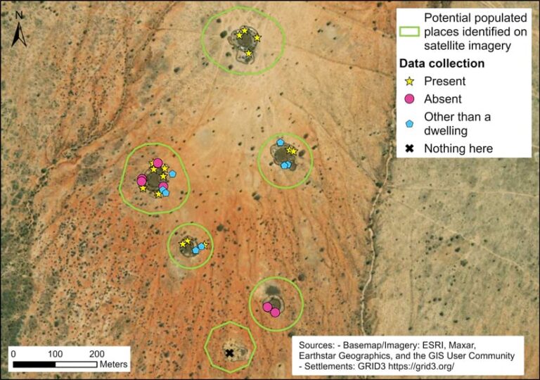
In 2022, Sightsavers provided support to the Ministry of Health by introducing a new GIS-based mass drug administration system. First, satellite imagery is used to identify all of Kenya’s potentially inhabited rural areas. Those areas are then georeferenced along with the rural communities that local community drug distributors currently visit. This allows Sightsavers and the Ministry of Health to identify gaps in the distribution of trachoma drugs.
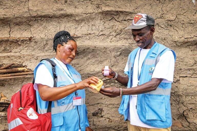
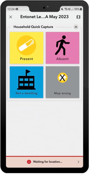
Sightsavers and the Ministry of Health employ ArcGIS technology throughout the process. Sightsavers’ GIS analysts use online population and settlement data along with satellite imagery to identify dwellings in ArcGIS Pro, which is also used for geoprocessing and spatial analysis. The analysts develop interactive maps and apps in ArcGIS Online. Community drug distributors use Field Maps to find settlements and dwellings and to georeference their locations while employing QuickCapture for data collection. Supervisors use Dashboards to monitor progress.

To evaluate the effectiveness of the GIS-based system, Sightsavers implemented real-time mass drug administration monitoring in three wards of Kajiado County. This is an area where trachoma is endemic, Chailloux said, noting that QuickCapture is easy for community drug distributors to use for data collection and that it doesn’t add too much work. “Information collected included the number of household members at home; the number of household members that were treated with trachoma drugs; and the identification of buildings, such as communal structures and animal shelters, where no treatment was necessary,” Chailloux explained.
The ArcGIS technology-based process proved to be very successful, significantly increasing mass drug administration coverage and community drug distributor resource planning while allowing trachoma treatment to be expanded.
Scaling Up GIS and Cross-Border Coordination
Looking forward, Chailloux would like to better understand the factors that lead to severe reinfection events, despite good mass drug administration coverage. “We’d also like to expand our cross-border coordination of trachoma treatments to ensure that those living in remote border areas are included,” he said. “This will help countries to meet the World Health Organization’s goal of eliminating trachoma by 2030.”
Sightsavers also wants to scale up its use of GIS, including mapping nomadic communities’ migratory patterns so that these can be linked with the dates of mass drug administration campaigns. “Lastly, we want to develop new geospatial tools to enhance the supervision and timely oversight of our trachoma elimination campaigns,” Chailloux said. This will result in quicker decision-making that is based on data analysis and will ultimately help the Ministry of Health improve mass drug administration coverage.

