Established in 1984, the city of Rochester Hills, Michigan, is a suburban community located north of Detroit. The Rochester Hills Fire Department supplies fire, search and rescue, and emergency medical services. The department’s Community Risk Reduction Division provides critical fire safety education to the community.
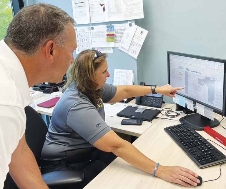
Jenn Whitbeck, the department’s fire and life safety educator, manages the department’s community education by visiting schools, senior care facilities, and homes. She also installs safety aids such as free smoke alarms, carbon monoxide alarms, and bed-shakers (designed for hearing-impaired individuals) provided via a state-run program. Details of these installations and any on-site visits, such as geographic location and device information, are recorded and reported to local leadership and state officials.

Streamlining Processes with ArcGIS Survey123
To capture these details and track her visits, Whitbeck used to record data with spreadsheets—a time-consuming and inefficient process. She collaborated with Rochester Hills GIS manager Doreen Groth to transform this workflow with ArcGIS Survey123.
“The paperwork took away from all the time that I could have been spending in the community or with our seniors or with our school-age kids,” Whitbeck said.
Groth selected Survey123 because it enables users to create, share, and analyze smart forms and surveys. She used a variety of resources when preparing for the project, such as online videos, Esri tutorials, Esri User Conference sessions, and Esri’s ArcGIS Survey123 Community. She also learned about fire department operations and community risk reduction.
Centralizing Operations with ArcGIS Dashboards
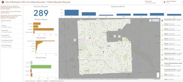
To facilitate this transition, Groth determined the data structure, the workflow, and what data to capture. She then created a form for a one-way point of entry to collect information, accessible via mobile devices. Using ArcGIS Dashboards, she created a dashboard to help the Community Risk Reduction Division solicit requests from the public, manage appointments, and monitor program administration. Now, residents can make a call, send an email, or fill out a third-party form on the website to set up appointments for educational presentations or alarm installations.

By using Survey123, the new process streamlined data recording, saved time during visits, reduced errors, and allowed Whitbeck to serve the community while efficiently measuring advances in risk reduction.
Whitbeck also uses Survey123 forms to track smoke and carbon monoxide alarm installations and conduct comprehensive fire and life safety surveys. With Survey123, residents can also easily sign waivers required for home visits. Once on-site visits are completed, the report is automatically created, the dashboard is updated, and both are ready for Whitbeck to review.
“The process with this is much more streamlined and straightforward,” Groth said. “Your information gets updated in the dashboard. Everybody sees it right away.”
Data Access Improves Efficiency
The division’s team has been using Survey123 for its new workflow since 2021. According to Whitbeck, the time it takes to enter data has declined from 30 percent of her total weekly work time to less than 10 percent. Whitbeck can now see the locations she has visited, which helps her determine where she still needs to go. She then compares this information to the department’s community data and incident maps to understand where incidents occur and how to better target outreach efforts.
As a result, according to Nathan Mueller, the city’s senior adviser for strategy and communications, “I think in Michigan we’re either second or third in terms of the number of smoke alarms that we give away for free in the state.”
Using dashboards has also enabled leadership to easily view related data. When the Rochester Hills fire chief needs to know how many events Whitbeck attended or how many people came to an event, he can access the data quickly and share it with stakeholders. This data can also help the fire department when asking for additional funding, personnel, or crew training. Reporting is also much easier with revamped digital workflows. Submitting state-required reports is now done with the click of a mouse, and stored electronic data makes producing reports much faster.
On-site visits are also more efficient with Survey123. Whitbeck can record details on her iPad during a visit and later send a follow-up email survey to the resident for feedback. Easier recording during the visit means less time spent on recordkeeping in the office. The digital survey has also increased participation, with an estimated 85 percent of residents returning post-visit forms.
Groth said the department has received positive feedback from Rochester Hills residents about the new digital process, and other fire departments have expressed interest in similarly transforming their workflows. In partnership with the state, Whitbeck and Groth have exchanged ideas, best practices, and lessons learned that will help other fire departments share data and report more efficiently to the state in the future. The ability to better track outreach efforts has helped the Community Risk Reduction division better provide education and fire safety tools to the community.
“With this system, it gives me my time back, plus it’s giving me actual accurate data,” said Whitbeck. “And it makes me feel so good that I’m actually spending time out in the community.”

