Online Exclusive

Storm water runoff from Washington, DC, carries contaminants such as tar, mercury, and herbicides downstream to nearby Chesapeake Bay, the nation’s largest estuary. Area residents can take an active role in protecting the bay’s health, and lower their utility bills, by using a new interactive web mapping application, Green Up DC, provided by the District Department of the Environment (DDOE).
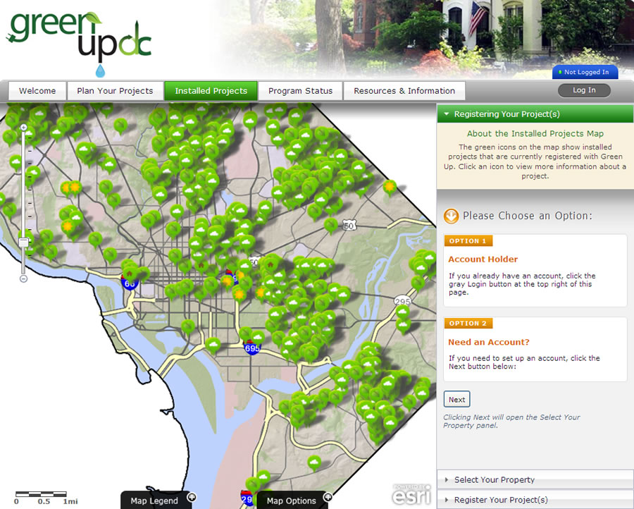
Green Up DC offers Washington, D.C. residents tools to plan new improvement projects for their homes and businesses, such as green roofs, pervious pavement, and rain barrels. They also can access information about financial subsidies and rebates, register installed projects, and view maps of other property owners’ projects.
“Many storm water problems are the result of excessive runoff from hard, impervious surfaces such as roofs, sidewalks, and driveways,” said Jenny Guillaume, an environmental protection specialist with DDOE’s watershed protection division. “Anyone can visit the Green Up DC site to look at their own property and find out how to reduce storm water.”

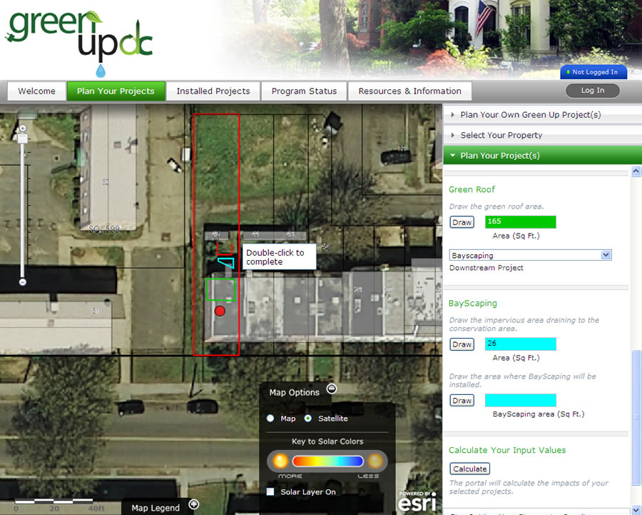
Green Up DC features an intuitive mapcentric interface in an application that was created with Esri ArcGIS API for JavaScript and runs on the web via Esri’s ArcGIS technology. Users can choose from 14 project types. The site also offers energy conservation projects including solar electricity and hot water, air sealing and insulation, hot water conservation, and duct sealing repair. The application is fast and simple to use. A homeowner can simply type in an address, zoom to the property, and draw the location of energy conservation or storm water projects, using an aerial photo background as a guide.
The Green Up DC application calculates project costs and benefits and provides a list of experienced local vendors who can complete the project or quote a price. Registered users of Green Up DC can save planned projects or register projects that they have already installed. “As with many other urbanized areas, the district has significant storm water management challenges, including flooding and water quality issues from sediments and other contaminants,” said Bruce Taylor, a project manager with Esri partner Critigen, LLC. “The Green Up application makes it easier for homeowners to take an active role in reducing storm water runoff.”
Critigen, a technology consulting and IT outsourcing company, uses location data, business intelligence tools, and cloud computing in its work with public and private clients. Taylor and his team worked with DDOE to design Green Up DC, which is based partly on eco-portals built for other clients. With its partner CH2M HILL, Critigen adapted a storm water runoff model developed by the Center for Watershed Protection so it could be easily used by people who have no technical background. Critigen used land-base data, aerial photographs, and impervious surface information from the district’s ArcGIS for Server map services to display property characteristics and provide input data for the calculators.

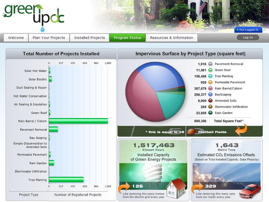
Green Up DC maps both planned and registered projects and provides a program status dashboard and reports that can be used to monitor the progress of the program. Homeowners and business owners can access the status dashboard to see the anticipated impact of a particular project. DDOE officials will be able to verify how many projects are completed and add the data to reports for the city as well as the Environmental Protection Agency. The reports include summaries listed by specific watershed, sewer shed, or political jurisdiction.
“We hope to see more people implementing projects and sharing projects,” Guillaume said. “Green Up DC’s link to Facebook helps us tap into social media to spread the word. We would love this tool to help homeowners plan and complete their projects.”
For more information, contact Jenny Guillaume, environmental protection specialist, district department of environment.

