Symington Family Estates has been producing wine in Portugal’s famed Douro region for five generations. The family business—which specializes in port but also produces other highly regarded wines—owns 26 quintas, or estates, that total nearly 2,300 hectares (5,500 acres) of land. More than 1,000 hectares (2,500 acres) of that is vineyards.

In 2010, Symington sought to improve its technical capabilities for land-use and crop management to make them more efficient. At the time, many of the company’s records and procedures were still documented on paper and stored in filing cabinets. Digital records resided on individual computers or in siloed servers. But the company’s viticultural, enological, and IT teams were familiar with the capabilities of GIS, so they contacted Esri Portugal for a consultation. Symington ended up implementing a comprehensive ArcGIS Enterprise solution that continues to underpin its cultivation and wine-making processes today.
“This was the foundation for the digital transformation of operations at Symington Family Estates,” said Rui Roda, business manager at Esri partner whereness, a spin-off of Esri Portugal that took the project over in 2018. “From the beginning, there was a strong perception that a GIS-based solution could facilitate everyday field operations and that centralized, shared information would make a major contribution to the farm managers’ knowledge and their ability to exchange ideas with one another.”
To fulfill known and anticipated needs over the years, staff at Symington have regularly proposed and requested new GIS apps. For example, when the enology department, which oversees wine making, needed a way to register and monitor wine production processes, staff members adopted ArcGIS Survey123. The form-based app made it easy for them to record structured data about all the events that occur during and after the fermentation process.

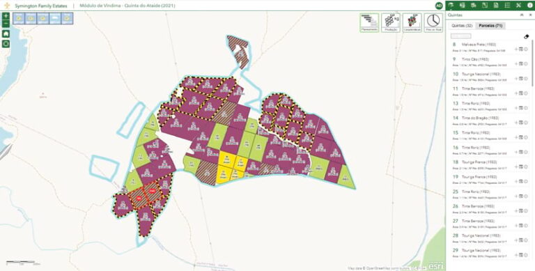
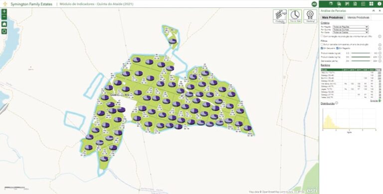
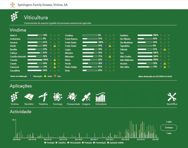
The company also uses imagery to monitor things like soil moisture in its vineyards. To make all relevant imagery accessible to people in various departments, whereness developed a single point of access for Symington in ArcGIS Enterprise. This comprehensive solution is composed of several apps and modules, including ones for land and crop management, keeping track of seasonal activity, monitoring plant conditions, and recording Normalized Difference Vegetation Index (NDVI) measurements.
“The system has secure access—named users—and the applications are accessed through a single sign-on,” said Roda. “ArcGIS Enterprise aggregates all the web applications—for land use, harvesting, phenology [the study of cyclical biological events in relation to the climate], activities, etc.—that were created with ArcGIS Web AppBuilder templates and customized with JavaScript widgets.”
Staff members at Symington also use Survey123 for mobile data collection out in the vineyards. The app’s ability to maintain data integrity when recovering from data connection failures is critical. Many of the farms in Douro are in deep valleys at river level, so 3G and 4G mobile network signals are not always stable enough for data transmission.
The GIS workflow at Symington parallels that of the annual cultivation and production of wine. It begins with the new season in December or January of each year. Initially, parcel geometry and grape varieties are confirmed and updated in the GIS if necessary. All field activities, from pruning to fertilization, are recorded.
From March through June, the condition of the vines is carefully evaluated and documented three separate times. By the end of July, managers submit their crop plans and production estimates—both of which are based on GIS analyses of previous crops. These reports go to the head of viticulture and the production director, as well as the heads of port wine enology and Douro DOC (Denominação de Origem Controlada, or controlled denomination of origin, which guarantees the quality of wines from this region).

Production data is submitted to the system when harvesting begins, typically in the first week of September. Harvesting continues for two months, during which the production status of each parcel is individually monitored and recorded.
By the end of October, the harvest is complete, and all the final production reports are generated in ArcGIS Enterprise to give to management.
“Anyone looking at our GIS system would not imagine that there are 12 years of hard work in its development, because everything seems so simple and logical,” said Pedro Leal da Costa, head of viticulture at Symington Family Estates. “It takes a few seconds to obtain a planning map for a particular vintage or a production map for all farms. It’s easy to understand from images what we have harvested and still need to harvest. And the system is intuitive when recording events inside a cellar—for example, recommending the necessary follow-up to monitor port wine fermentation.”
The next steps for Symington include looking into adding a hydric soils report to the data stack and evaluating the benefits of viticultural zoning. The winemakers are also interested in integrating ArcGIS Enterprise with other systems, such as enterprise resource planning platform SAP S/4HANA Cloud.

